
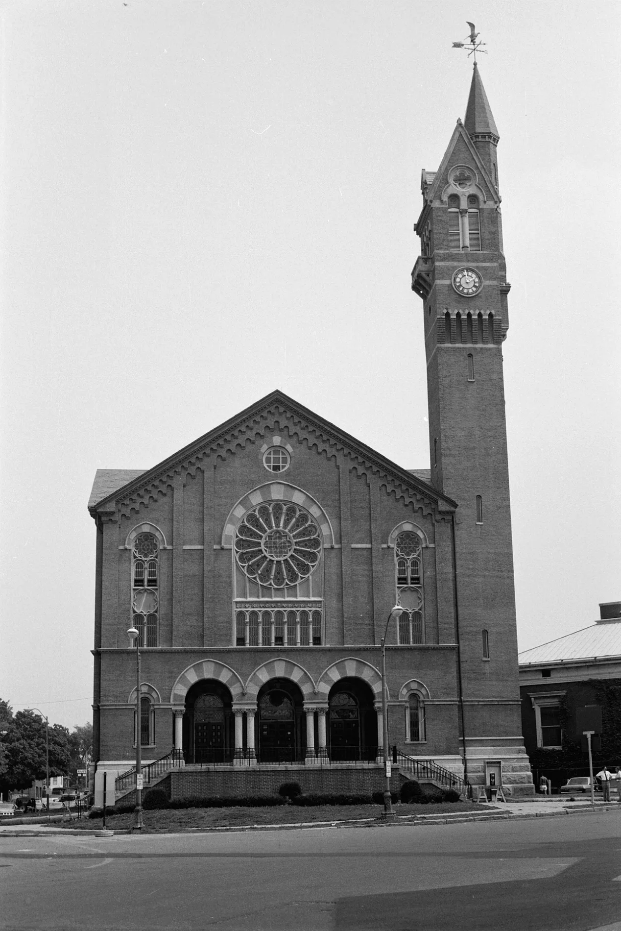
Chicopee City Hall in Chicopee, Massachusetts
Chicopee City Hall in Chicopee is a historic building, Springfield Street 17. Chicopee City Hall is built in the Romanesque Revival architecture style. Ⓦ.
- House Number
- 17
- Street
- Springfield Street
- Building Type
- public building
Image
Cafes
Doctor's offices
Post offices
Convenience stores
Libraries
Bus stops
Restaurants
Town halls
Video game stores
Fire stations
Fast food restaurants
Places of worship
Streets nearby
Springfield StreetAlumnae Library, Springfield Street Historic District, SPRINGFIELD / ATWATER, SPRINGFIELD / CASINO, SPRINGFIELD / CHAPIN, SPRINGFIELD / DAVENPORT, SPRINGFIELD / FRANKLIN, SPRINGFIELD / GAYLORD, SPRINGFIELD / HENRY HARRIS, SPRINGFIELD / HOWARD, SPRINGFIELD / LEMUEL, SPRINGFIELD / MARION, SPRINGFIELD / MELLEN, SPRINGFIELD / PEARL, SPRINGFIELD / SOUTH, SPRINGFIELD / STEARNS, Munich Haus, Center St. and Exchange
150 ft
Chicopee Canal Walk250 ft
Exchange StreetChicopee Junction
300 ft
Front StreetAditus Inc, FRONT / ACADEMY, FRONT / CYMAN, FRONT / ELLERTON, FRONT / GRAPE, FRONT / GROVE, FRONT / ORCHARD, FRONT / QUARRY, Front/Academy(opposite), Front/Cyman, Front/Ellerton(opposite), Front/Orchard(opposite), Front/Wheatland(opposite), Chicopee Public Library, Corner Store, Brad's Service Center, Chicopee City Hall, Chicopee, Front/Springfield
400 ft
Miller Street500 ft
Cabot StreetChicopee Center, Chicopee Center Post Office, CABOT / PARK
0.1 mi
Canal Street0.1 mi
Davitt Bridge0.1 mi
Spring StreetKava Press
0.1 mi
Wedges Court0.1 mi
School StreetChicopee Center
0.1 mi
Chapman Street0.1 mi
Center StreetCENTER / SCHOOL, Subway, Video Game Giants, Center/Hampden, CENTER / PLAINFIELD, Center St. (opposite 628), Center/Health clinic, Center/Plainfield(opposite), Center/Rt 91, Center/Rt. 91, CENTER / SOUTH
0.1 mi
Parshley AvenueChicopee Center Chiropractic
0.1 mi
Pearl Street0.1 mi
Lower Grape Street0.2 mi
Granby RoadGRANBY / STANLEY
0.2 mi
Howard Street0.2 mi
Dwight StreetChicopee Fire Department
0.2 mi
Gilmore Street0.2 mi
Grape StreetPetros
0.2 mi
Chase Place0.2 mi
Pleasant Street0.2 mi
Wintworth Street0.2 mi
Elm StreetHoly Mother of the Rosary Church
0.2 mi
Park Street0.3 mi
Nonotuck Avenue0.3 mi
Clinton Street0.3 mi
South Street0.3 mi
Union Street0.3 mi
Myrtle Street0.3 mi
Auburn Street0.3 mi
Ash StreetCenter/Union
0.3 mi
Leclair Terrace0.3 mi
Chapin Street0.3 mi
Captain Mac Street0.4 mi
Buildings nearby
The Apartments at Ames Privilege250 ft
Cabotville Mill Building0.1 mi
Living-Learning, Community and Cultural Center (LLCCC)0.3 mi
Canals nearby
Dwight Manufacturing Company Canal450 ft
Industrial areas nearby
Cabotville Industrial Park0.2 mi
Opticians nearby
Chicopee Eyecare0.2 mi
Parks nearby
Bullens Park0.2 mi
Places of worship nearby
Christ's Community Church0.1 mi
Assumption Church0.1 mi
Movimiento Iglesia Christiana Church0.2 mi
Grace Episcopal Church0.2 mi
Holy Name of Jesus (closed)0.3 mi
Public buildings nearby
City Hall Annex200 ft
| Year built | 1871 |
|---|---|
| Architectural style | Romanesque Revival architecture |
| Heritage designation | National Register of Historic Places listed place |
| Located in | Chicopee |
| Country | United States |
 Public transit map Chicopee Legend
| Railway | |
| Bus | |
| Streetcar |
 Bicycle map Chicopee Legend
| Bike path | |
| Bike lane on roadway | |
| Cycling allowed on bus lane | |
| Bicycle street | |
| Open to cyclists | |
| Open to cyclists, good path | |
| Cycling prohibited | |
| Cobblestone |
| Long-distance bike route | (depending on scale) | |
| Long-distance bike route |
 Pedestrian map Chicopee Legend
| Path |
| Long-distance hiking trail | (depending on scale) | |
| Long-distance hiking trail | ||
| Pedestrians prohibited |