
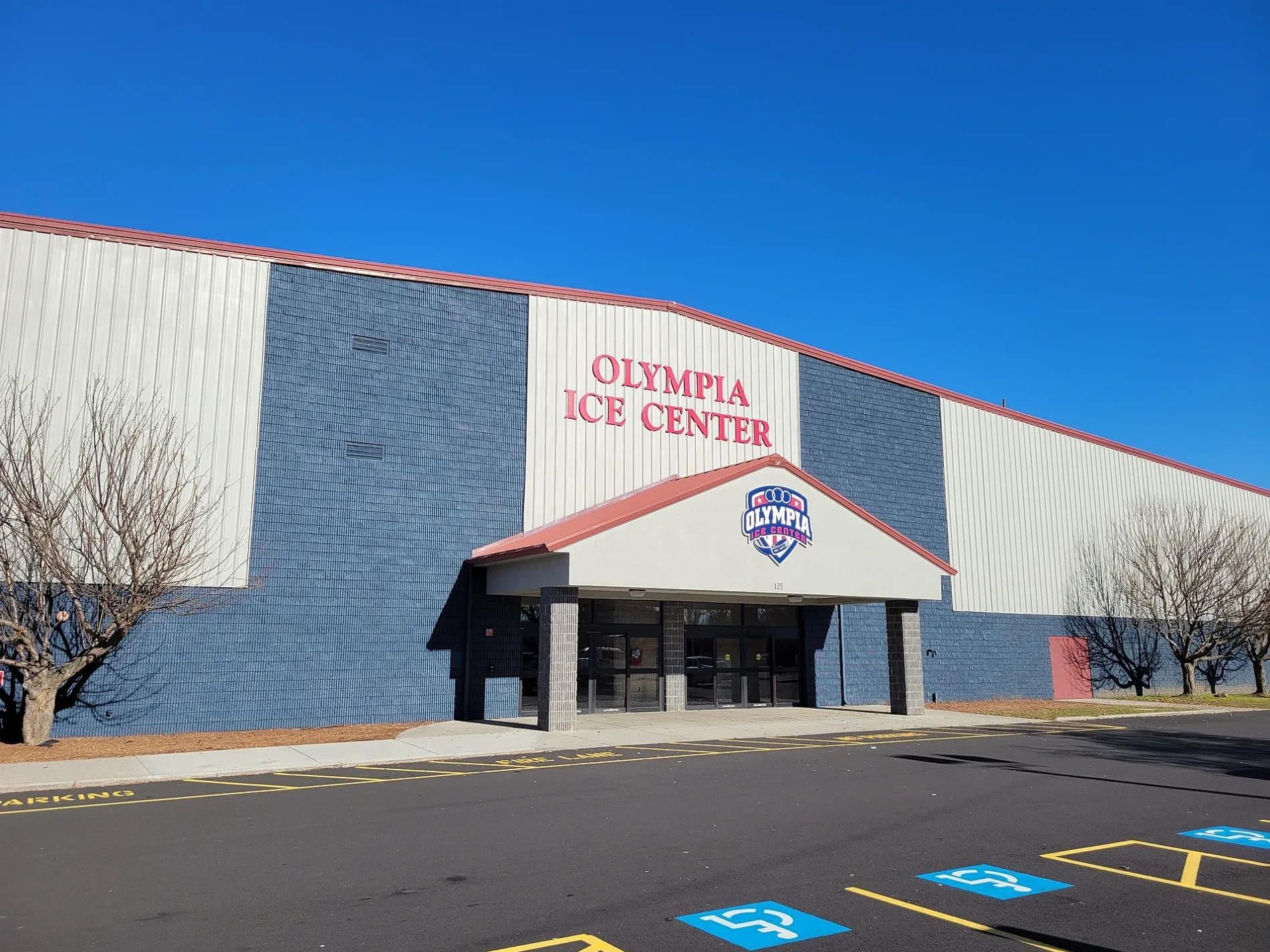
Olympia Ice Center in West Springfield, Massachusetts
Olympia Ice Center in West Springfield is a sports center (Ice skating;ice hockey), Capital Drive 125 (01089). Ⓦ.
- House Number
- 125
- Postal Code
- 01089
- Street
- Capital Drive
- Building Type
- building
- Leisure
- sports center
Image
Gas stations
Liquor stores
Convenience stores
Cannabis dispensaries
Banks
Restaurants
Tile stores
Car rentals
Bus stops
Car dealerships
Hotels
Cell phone stores
Cafes
Charging stations
Streets nearby
Capital Drive550 ft
Ashley Avenue0.2 mi
Ferry Avenue0.3 mi
Riverdale StreetRIVERDALE / ASHLEY, RIVERDALE / US HWY 5, Pride, Starbucks, Chili's, Ninety Nine Restaurant, RIVERDALE / MARION, Shell, RIVERDALE / ALTHEA, RIVERDALE / HAYES, RIVERDALE / LABELLE, Bedding Barn, RIVERDALE / WAYSIDE, Piccadilly Restaurant and Pub, Red's Auto Repair & Towing, Hooters, Merrick, RIVERDALE / PARKING LOT, RIVERDALE / PIERCE, Brightside, Riverdale and Brightside Dr, Ashleyville, RIVERDALE / UNKNOWN, Pizza Hut, Westside Inn, Knights Inn, Springfield Inn, RIVERDALE / PVT, Cal's Wood Fired Grill & Bar, Quality Inn, Friendly's, Cannabis Connection Of West Springfield, T-Mobile, Nouria, Montessori Childrens School, Tokyo Asian Kitchen
0.3 mi
Wayside Avenue0.4 mi
West Springfield Connecticut River Walk and Bikeway0.4 mi
Border Way0.4 mi
Beston Street0.5 mi
Kimball Street0.5 mi
Burton Street0.5 mi
Hampden Avenue0.5 mi
Abbey Street0.5 mi
Tremont Street0.5 mi
Dublin Street0.5 mi
Daggett DriveKeyBank, Burger King
0.5 mi
Emerald Street0.5 mi
Exchange StreetChicopee Junction
0.5 mi
Railroad Row0.5 mi
West Street0.6 mi
Doty Circle0.6 mi
Leonard Street0.6 mi
Center StreetCENTER / SCHOOL, Subway, Video Game Giants, Center/Hampden, CENTER / PLAINFIELD, Center St. (opposite 628), Center/Health clinic, Center/Plainfield(opposite), Center/Rt 91, Center/Rt. 91, CENTER / SOUTH
0.6 mi
Dagget Drive0.6 mi
Exchange Street Branch0.6 mi
Whitney Road0.6 mi
Spruce Street0.6 mi
Bullens Street0.6 mi
Cooney PlaceThe Commons
0.6 mi
Park Street0.6 mi
Front StreetAditus Inc, FRONT / ACADEMY, FRONT / CYMAN, FRONT / ELLERTON, FRONT / GRAPE, FRONT / GROVE, FRONT / ORCHARD, FRONT / QUARRY, Front/Academy(opposite), Front/Cyman, Front/Ellerton(opposite), Front/Orchard(opposite), Front/Wheatland(opposite), Chicopee Public Library, Corner Store, Brad's Service Center, Chicopee City Hall, Chicopee, Front/Springfield
0.6 mi
Plainfield Street0.6 mi
Depot Street0.6 mi
Chestnut Street0.7 mi
Banks nearby
TD Bank0.6 mi
Brownfields nearby
Hampden Steam Plant Site0.6 mi
Buildings nearby
Chamberland Cedar Delivery0.5 mi
Mosher Co0.5 mi
American Leagion0.6 mi
Bay Oil0.6 mi
Am Litho0.7 mi
Cemeteries nearby
Ashley Cemetery0.4 mi
Hardware stores nearby
The Home Depot0.3 mi
Nature reserves nearby
Land Along Connecticut R.0.5 mi
Parks nearby
Wisniowski Park0.6 mi
Railways nearby
Connecticut River Main Line0.5 mi
Retail areas nearby
Riverdale Center0.3 mi
Riverdale Shops0.5 mi
Rivers nearby
Connecticut River0.4 mi
Wholesale stores nearby
Costco0.4 mi
| Year built | 1998 |
|---|---|
| Located in | Massachusetts |
| Country | United States |
 Public transit map West Springfield Legend
| Railway | |
| Bus | |
| Streetcar |
 Bicycle map West Springfield Legend
| Bike path | |
| Bike lane on roadway | |
| Cycling allowed on bus lane | |
| Bicycle street | |
| Open to cyclists | |
| Open to cyclists, good path | |
| Cycling prohibited | |
| Cobblestone |
| Long-distance bike route | (depending on scale) | |
| Long-distance bike route |
 Pedestrian map West Springfield Legend
| Path |
| Long-distance hiking trail | (depending on scale) | |
| Long-distance hiking trail | ||
| Pedestrians prohibited |