
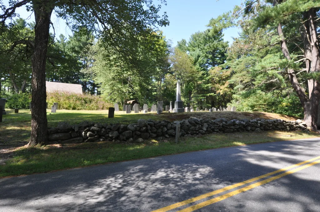
Forest Cemetery in Acton, Massachusetts
Forest Cemetery in Acton ist ein historisches Objekt. Forest Cemetery is also known as Old Burial Ground. Forest Cemetery is located near Carlisle Road. Ⓦ.
- Land Use
- cemetery
Image
Bus stops
Viewpoints
Places of worship
Tourist information centers
Trash bins
Antique stores
Streets nearby
Carlisle Road200 ft
Cross Street400 ft
North Street450 ft
South Street0.2 mi
Marshall Path0.2 mi
Blueberry Path0.2 mi
John Francis Lane0.3 mi
Acton Street0.3 mi
Preston Way0.3 mi
Hartland Way0.4 mi
Devon Drive0.4 mi
Lions Gate Road0.5 mi
Tinsdale Drive0.5 mi
Eastern Road0.5 mi
High Woods Lane0.5 mi
RedGuggins Brook, Location Map, Nahoba Brook/Spring Hill boundary, 6C, Old Stone Chamber, pond view
0.5 mi
Jack & Betty Valentine Trail0.5 mi
West Street0.6 mi
Bruce Freeman Rail TrailDunkin', Subway
0.7 mi
Main StreetNorth Acton, Acton Police Department, Acton Public Safety Building, Acton Ace Hardware, Dunkin', Benjarong, Subway, Jerry's Barbershop, Nail Studio, Village Pediatric Dental, King's Ink, Hosmer House Museum, Acton Post Office, Jo Karen, Enterprise Bank, Luxe Nails and Spa, Acton Cycle and Ski(?)
0.7 mi
Acton Road0.7 mi
Old Quarry Drive0.7 mi
Koning Farm Road0.8 mi
Shops nearby
Acton-Boxborough Dance Center0.5 mi
Rex Lumber0.6 mi
Abandoned railways nearby
Lowell & Framingham Branch0.6 mi
Auto repair shops nearby
Scott Motor Services Inc0.5 mi
Boulders nearby
Roof Slab Quarry Site0.5 mi
Buildings nearby
Acton's Main Street Mini-Storage0.2 mi
Acton Indoor Tennis Association0.3 mi
Club House0.4 mi
Golf courses nearby
Butter Brook Golf Club0.7 mi
Grasslands nearby
Dorethy's Field0.6 mi
Industrial buildings nearby
Trudeau Homes International0.6 mi
Concorp, Inc0.7 mi
Nature reserves nearby
Cr #430.5 mi
North Acton Community Gardens0.5 mi
Acton St. Realty0.5 mi
Office buildings nearby
Methods Machine Tools0.4 mi
Acorn Deck House Company0.5 mi
Recreation grounds nearby
Nashoba Sportsmen's Club0.5 mi
Residential areas nearby
Robbins Brook Senior Community0.5 mi
Rivers nearby
Nashoba Brook0.4 mi
Sports fields nearby
Trap Range0.4 mi
Rifle Ranges0.5 mi
Streams nearby
Butter Brook0.6 mi
Waters nearby
Fishing Pond0.3 mi
Robbins Mill Pond0.6 mi
Watershed protection areas nearby
Kennedy-Marshall Land0.5 mi
| Year built | 1750 |
|---|---|
| Area | 0.5 |
| Heritage designation | National Register of Historic Places listed place |
| Located in | Acton |
| Country | United States |
| Location | North Acton |
 Public transit map Acton Legend
 | Railway | |
| Bus | |
| Streetcar |
 Bicycle map Acton Legend
 | Bike path | |
| Bike lane on roadway | |
| Cycling allowed on bus lane | |
| Bicycle street | |
| Open to cyclists | |
| Open to cyclists, good path | |
| Cycling prohibited | |
| Cobblestone |
| Long-distance bike route | (depending on scale) | |
| Long-distance bike route |
 Pedestrian map Acton Legend
 | Path |
| Long-distance hiking trail | (depending on scale) | |
| Long-distance hiking trail | ||
| Pedestrians prohibited |