
First Church of Christ in Bedford, Massachusetts
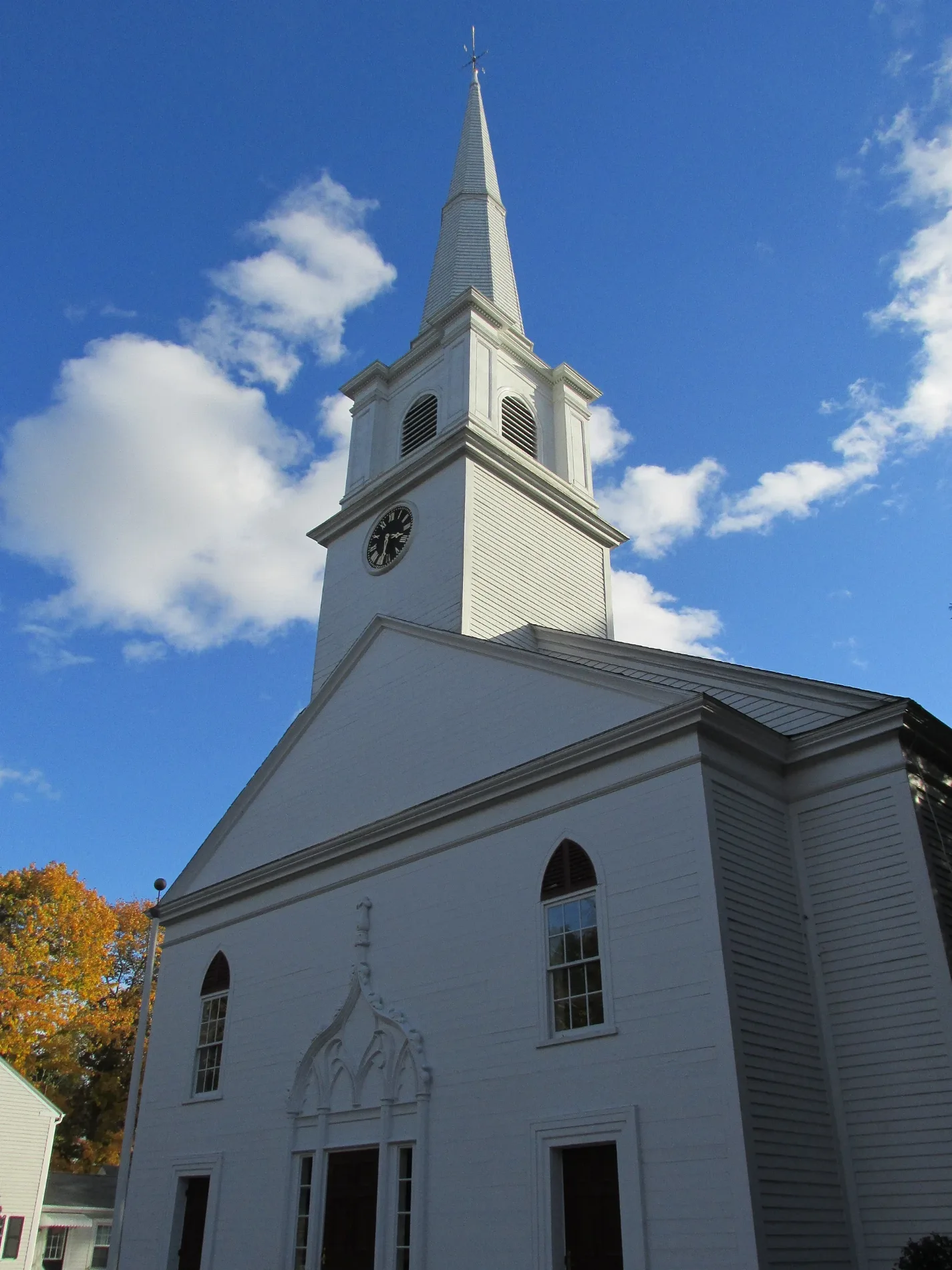
First Church of Christ in Bedford is a Church, The Great Road 25. It is built in the Greek Revival architecture style and was built in 1832. First Church of Christ also exists in Hampden County.
- House Number
- 25
- Street
- The Great Road
- Amenity
- place of worship
- Building Type
- church
Image
Restaurants
Interior decorators
Social facilities
Jewelry stores
Post offices
Beauty salons
Public bookcases
Pet stores
Tourist information centers
Pubs
Arts centers
Artworks
Charging stations
Community centers
Antique stores
Massage therapy clinics
Bus stops
Gas stations
Streets nearby
Ruben Duren Path300 ft
Resting PlaceRembering Center School, Kids Club, Free Little Art Gallery
450 ft
School AvenueColorworks
500 ft
Jenks Nature Trail0.1 mi
The Great RoadGreat Rd @ Masardis St, Great Rd @ Perham St - Lexington Line, Great Rd opp Masardis St, TD Bank, Simply Natural Nails, Wear Overs, Independent Gas, Family Laser Dentistry, Ginger, Ken's N.Y. Deli, KB Jewelers, Ken's Pub, Great Rd @ Roberts Dr, Great Rd opp Roberts Dr, Starbucks, Back On Track, Domino's, Middlesex Savings Bank, Supercuts, Verizon, Lapels, Energy Plus Nutrition, Bank of America, Brookline Bank, Five Guys, Poke Bros, Simply Nails and Spa, Learning Express Toys, US Post Office, Emerson Dental, Hand & Stone Spa, Fetch It, Corner Antiques, The Patriot, Great Rd @ Shawsheen Ave, Great Rd @ Shawsheen Rd, Great Rd opp Shawsheen Ave, Great Road @ Pine St, Virsa De Punjab, Top Cleaners, Shell, Great Rd @ Shopping Center, Karate Elite Freestyle, Blue Fuji, Flower Shop, Great Rd @ Perham St - Bedford Line, Great Rd @ Brooksbie Rd, Great Rd opp Brooksbie Rd
0.1 mi
School Way0.1 mi
North RoadNorthside Convenience, Holi, Bedford Orthodontics, Bedford Periodontal and Dental Implant Care
0.2 mi
Rodney Road0.2 mi
Benjamin Kidder Lane0.2 mi
Ruben Duren Way0.2 mi
Mudge WayBedford, Dance Rhythm, ChargePoint
0.2 mi
Secondary Trail (orange)0.2 mi
Liljegren Way0.2 mi
Paul Revere Road0.3 mi
Schoolyard Trail0.3 mi
Railroad Avenue0.3 mi
Carlisle RoadBedford Lock and Key, Dunkin', Salon Elegante, Wild & Scenic River Kiosk
0.3 mi
Pollard Inn LaneTL Nail Spa
0.3 mi
Avalon Drive0.4 mi
Abbott Lane0.4 mi
Concord Road0.4 mi
Bay Circle0.4 mi
Appliance stores nearby
Doyon's TV & Appliance Inc0.3 mi
Auto repair shops nearby
Sullivan Tire0.2 mi
Buildings nearby
Town Center350 ft
Fitch Tavern450 ft
The Red Barn0.2 mi
Elijah Bacon House0.2 mi
Sewer Pumping Station0.4 mi
Car dealerships nearby
Minuteman Volkswagen0.3 mi
Dentist's offices nearby
Oscar S. DePriest IV, DMD, PC0.1 mi
Fire stations nearby
Bedford Fire Department0.1 mi
Grasslands nearby
Athletic Fields0.2 mi
Ice cream shops nearby
Bedford Farms0.2 mi
Libraries nearby
Bedford Free Public Library550 ft
Parks nearby
Memorial Plaza550 ft
Willson Park0.1 mi
Places of worship nearby
Saint Michael Parish0.4 mi
Police stations nearby
Bedford Police Department200 ft
Residential areas nearby
Israel Putnam Village0.2 mi
Avalon at Bedford Center0.4 mi
Retail buildings nearby
Northside Convenience0.3 mi
Social facilities nearby
Right at Home0.1 mi
Sports fields nearby
B Field350 ft
F Field0.1 mi
Sabourin Field0.2 mi
A Field0.3 mi
practice field0.3 mi
Town halls nearby
Bedford Town Hall300 ft
| Year built | 1832 |
|---|---|
| Architectural style | Greek Revival architecture |
| Located in | Bedford |
| Country | United States |
 Public transit map Bedford Legend
| Railway | |
| Bus | |
| Streetcar |
 Bicycle map Bedford Legend
| Bike path | |
| Bike lane on roadway | |
| Cycling allowed on bus lane | |
| Bicycle street | |
| Open to cyclists | |
| Open to cyclists, good path | |
| Cycling prohibited | |
| Cobblestone |
| Long-distance bike route | (depending on scale) | |
| Long-distance bike route |
 Pedestrian map Bedford Legend
| Path |
| Long-distance hiking trail | (depending on scale) | |
| Long-distance hiking trail | ||
| Pedestrians prohibited |