
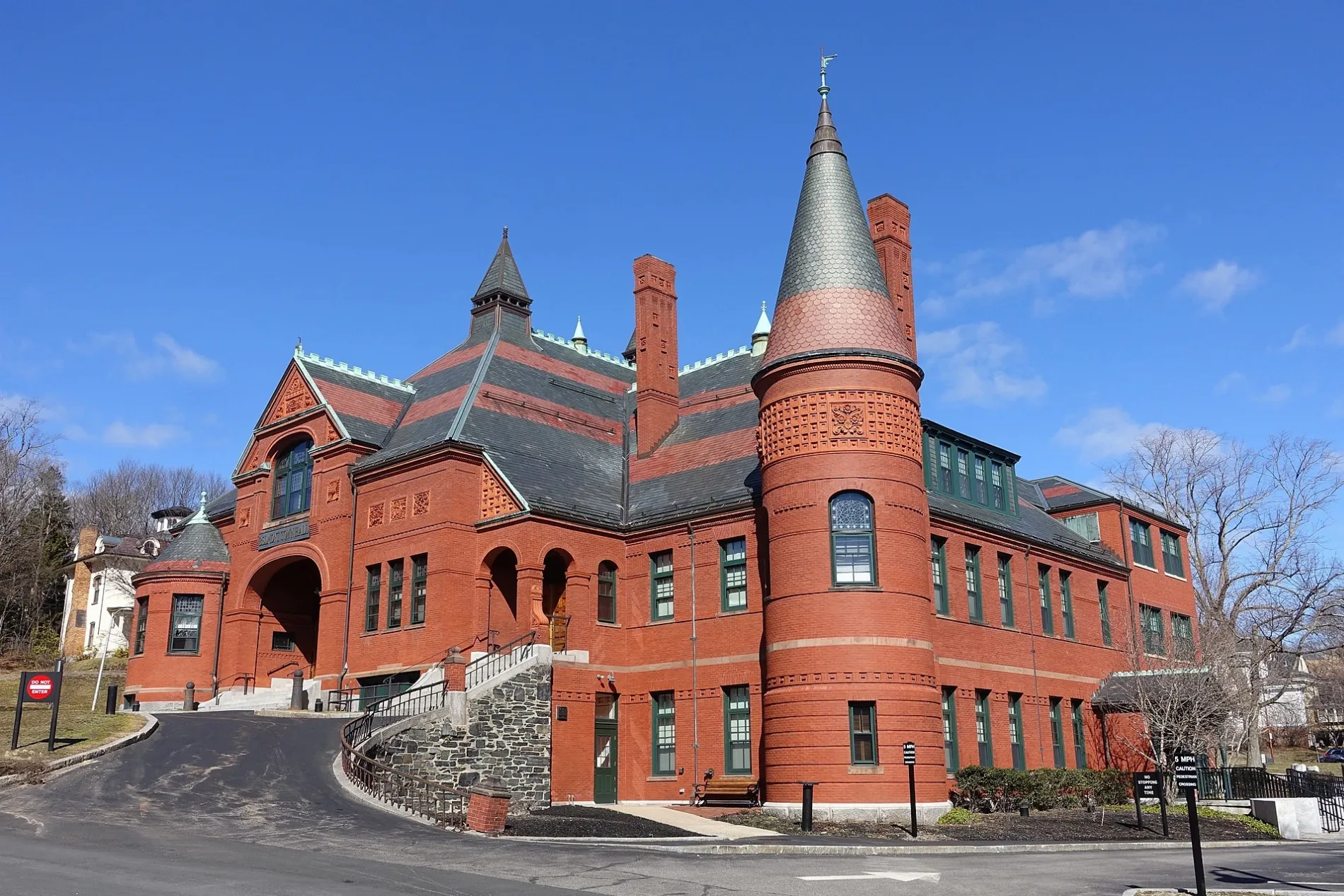
Belmont Town Hall in Belmont, Massachusetts
Belmont Town Hall in Belmont is a town hall, Concord Avenue 455 (02478). Belmont Town Hall is built in the Queen Anne style architecture in the United States style.
- House Number
- 455
- Postal Code
- 02478
- Street
- Concord Avenue
- Amenity
- town hall
- Building Type
- building
Image
Cafes
Platforms
Banks
Bakeries
Candy stores
Restaurants
Sporting goods stores
Toy stores
Bus stops
Clothing stores
Stops
Fast food restaurants
Hair salons
Housewares stores
Streets nearby
Moore Street400 ft
Common StreetBelmont, Savino's, The Spirited Gourmet, Bakehaus, Jerry's, Bank of America, Teddy's Kitchen
500 ft
Royal Road550 ft
Channing RoadNic'k's II, Cornerstone Baptist Church, Claflin Street Lot
0.1 mi
Sunnyside Place0.1 mi
Concord AvenueBelmont, Eastern Bank, Indigo Fire, Concord Ave @ Cottage St, Concord Ave @ Leonard St - Belmont Center Sta, Concord Ave @ Leonard St, Concord Ave opp Cottage St, Concord Ave @ Edgemoor Rd, Concord Ave @ Louise Rd, Concord Ave @ Orchard St, P & M Service Center, Concord Ave opp Edgemoor Rd, Concord Ave opp Louise Rd, Concord Ave opp Orchard St, Concord Ave @ Trowbridge St
0.1 mi
Leonard StreetLeonard St @ Moore St - Belmont Center Sta, Il Casale, Patou, A Chocolate Dream, Asai, The Wellington, Stone Hearth Pizza Company, Revolve, CambridgeWear, The Toy Shop of Belmont, Black Bear Café, Westcott Mercantile, Bellmont Caffe, Robert's Salon, El Centro, Leon and Company, Santander, Bruegger's Bagels, Butternut Bakehouse, Champions Sporting Goods, Local Root, Didriks, Belmont Books, CVS Pharmacy, Quebrada Baking Co.
0.1 mi
Centre Avenue0.1 mi
Wellington Lane0.1 mi
Alexander AvenueAlexander Ave @ Leonard St
0.2 mi
Dunbarton Road0.2 mi
Hay Road0.2 mi
Cross StreetCross St @ GilmoreRd, Cross St @ Staunton Rd
0.2 mi
Claflin Street0.2 mi
Clark Street Pedestrian & Bicycle Bridge0.2 mi
Sumner Lane0.2 mi
Somerset Street0.2 mi
Snake Hill Hay Road Cut Through0.2 mi
Clark Lane0.2 mi
Farm Road0.3 mi
Pleasant StreetBelmont, CitySide Subaru, Bob’s Automotive Services
0.3 mi
Howells Road0.3 mi
Weeks Meadow Trail0.3 mi
Locke Road0.3 mi
Shady Brook Lane0.3 mi
Farnham Street0.3 mi
Hickory Lane0.4 mi
Juniper Road0.4 mi
Fletcher Road0.5 mi
Garfield Road0.5 mi
Kenmore Road0.5 mi
Clifton Street0.5 mi
Banks nearby
M&T Bank350 ft
Bank of America0.1 mi
Buildings nearby
Belmont Women's Club250 ft
Wellington Station0.1 mi
Powers Music School0.2 mi
Piston / Nason House0.3 mi
Fire stations nearby
Belmont Center Fire House0.2 mi
Libraries nearby
Belmont Public Library0.3 mi
Parks nearby
Town Green450 ft
Belmont War Memorial0.1 mi
Common Street Grounds0.1 mi
Places of worship nearby
The First Church in Belmont Unitarian Universalist0.2 mi
Plymouth Congregational Church0.2 mi
First Armenian Church0.2 mi
Police stations nearby
Bemont Police Department300 ft
Railways nearby
Fitchburg Route Main Line400 ft
Streams nearby
Wellington Brook550 ft
| Year built | 1881 |
|---|---|
| Architectural style | Queen Anne style architecture in the United States |
| Located in | Belmont |
| Country | United States |
 Public transit map Belmont Legend
| Railway | |
| Bus | |
| Streetcar |
 Bicycle map Belmont Legend
| Bike path | |
| Bike lane on roadway | |
| Cycling allowed on bus lane | |
| Bicycle street | |
| Open to cyclists | |
| Open to cyclists, good path | |
| Cycling prohibited | |
| Cobblestone |
| Long-distance bike route | (depending on scale) | |
| Long-distance bike route |
 Pedestrian map Belmont Legend
| Path |
| Long-distance hiking trail | (depending on scale) | |
| Long-distance hiking trail | ||
| Pedestrians prohibited |