
Newton Highlands - Green Line (D) - Riverside in Newton, Massachusetts
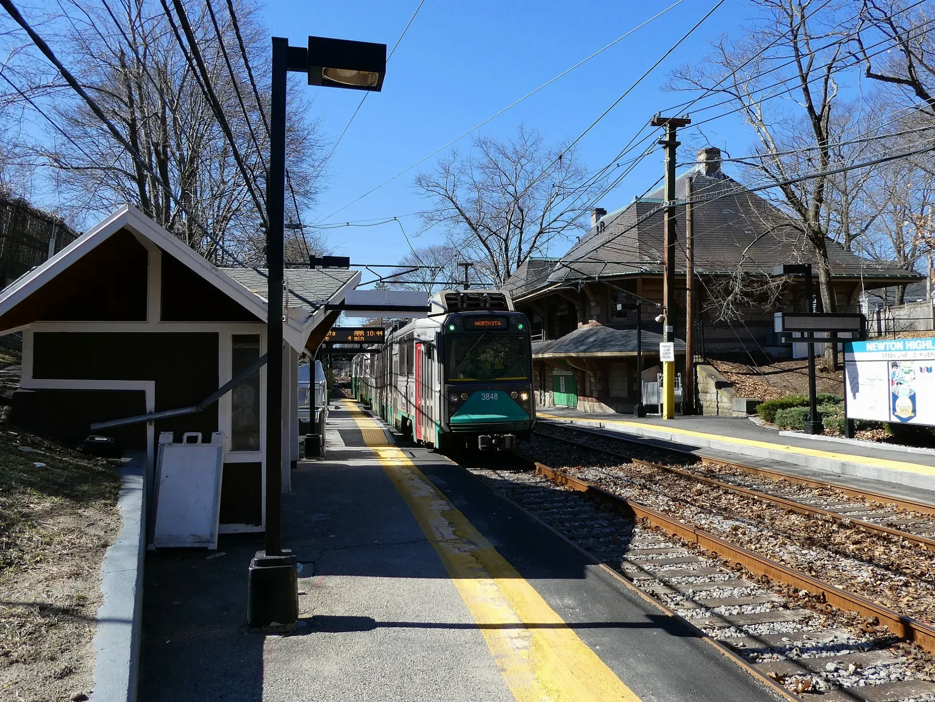
Newton Highlands - Green Line (D) - Riverside in Newton is a light rail stop (Massachusetts Bay Transportation Authority, MBTA, wheelchair accessible, no bench, lit). Newton Highlands - Green Line (D) - Riverside is located near Cushing Street. Newton Highlands - Green Line (D) - Riverside is built in the Richardsonian Romanesque style. Ⓦ.
- Operator
- Massachusetts Bay Transportation Authority
- Bicycle
- no
- Wheelchair Access
- yes
Image
Opticians
Cafes
Restaurants
Places of worship
Bus stops
Light rail stops
- light rail lines Green-D
Stops
- light rail lines Green-D
Bike rentals
Party supply stores
Candy stores
Post offices
Streets nearby
Lake Avenue200 ft
Floral Place350 ft
Station AvenueNewton Highlands, Bluebikes - Newton Highlands T
400 ft
Hyde Street0.1 mi
Floral Street0.1 mi
Forest Street0.1 mi
Allen Terrace0.1 mi
Norman Road0.2 mi
Cushing Street0.2 mi
Rogers Street0.2 mi
Woodcliff Road0.2 mi
Clark Street0.2 mi
Lakewood Road0.2 mi
Hartford StreetNewton Highland Congregational Church
0.2 mi
Rowena Road0.2 mi
Miller Road0.2 mi
Boylston Road0.2 mi
Rockledge Road0.2 mi
Aberdeen Street0.3 mi
Centre StreetShell, Centre St @ Clark St, Centre St @ Locksley Rd, Bertucci's, 400 Centre St - West, Centre St @ Bellevue St, Centre St @ Cabot St, Centre St @ George St, Centre St @ Hyde Ave, Centre St @ Lombard St, Centre St @ Newtonville Ave, Centre St @ Cushing St, Centre St @ Hyde St, Newton Centre, Newton, Rosenfeld's Bagels, Centre St @ Alderwood Rd, Centre St @ Cotton St, Centre St @ Mill St, Centre St @ Ward St, Centre St @ Commonwealth Ave, Bluebikes - Centre St at Commonwealth Ave, 785 Centre St, 790 Centre St, Centre St @ Sargent St, Centre St @ Church St, 400 Centre St - East, Centre St @ Jefferson St, Centre St @ Langley Rd, Subway, Little Big Diner, The Cork & Board, Tatte Bakery & Cafe, Jinny's Pizzeria, Centre St @ Bowen St, Centre St @ Gibbs St, Centre St @ Beacon St, Sichuan Gourmet House, Centre St @ Walnut St, Bluebikes - Centre St at Washington St
0.3 mi
Mullen Court0.3 mi
Walnut StreetWalnut St @ Mill St, Walnut St @ Prospect Ave, Walnut St @ Prospect St, Walnut St @ Washington Pk, Walnut St @ Duncklee St, Walnut St @ Dunklee St, Walnut St @ Brentwood Ave, 791 Walnut St, 796 Walnut St, Whole Foods Market, Walnut St @ Berwick Rd, Walnut St @ Fisher Ave, 940 Walnut St, Bluebikes - Beacon at Walnut, Walnut St @ Beacon St, Vinodivino, Walnut St @ Linwood Ave, Walnut St @ Page St, Walnut St @ Lincoln St, The Party Starts Here!, Newton Eye Care, Walnut St @ Lincoln St - Newton Highland Station, Walnut St @ Newtonville Ave, Walnut St @ Austin St, Citizens Bank, Walnut St @ Homer St, Walnut St @ Commonwealth Ave, Walnut St @ Watertown St, Walnut St opp Otis St, United Methodist Church, Newton Highlands, Walnut St @ Clyde St, Walnut St @ Washington St, Newtonville, Walnut St @ Otis St, Dumpling House, Domino's, Boston Shawarma, Aji, Fuji at Newton
0.3 mi
Old Rogers Road0.3 mi
Boylston-Centre Streets Service Road0.3 mi
Rotherwood Road0.3 mi
Boylston-Winchester Streets Service Road0.3 mi
Walnut Place0.3 mi
Wade Street0.3 mi
Locksley Road0.3 mi
Athelstane Road0.3 mi
Hereward Road0.3 mi
Allerton Road0.3 mi
Cloverdale Road0.3 mi
Boylston StreetJoseph A Russo, MD, Eliot, Chestnut Hill Shopping Ctr @ AMC Theaters, Blue Blottle, Warby Parker, Nike, Juice Press, Gorjana, The Sweetish Fish, alo, Visage Sculpture, 325 Boylston St, Sunoco, 280 Boylston St, Shake Shack, Lululemon, Bianca, Pottery Barn, Showcase SuperLux, BP, Chestnut Hill Shopping Ctr @ Macy's, Anthropologie, Miltons, Woodward St @ Boylston St
0.4 mi
Ashcroft Road0.4 mi
Oakdale Road0.4 mi
Payne Road0.4 mi
Solon Street0.4 mi
Cedric Road0.4 mi
Apartment buildings nearby
John W. Weeks House0.4 mi
Banks nearby
Brookline Bank550 ft
Beaches nearby
Crystal Lake Beach0.2 mi
Light rail lines nearby
Green Line (D)0.1 mi
Light rail stops nearby
Newton Highlands - Green Line (D) - Park St & North150 ft
Parks nearby
Crystal Lake Park0.2 mi
Places of worship nearby
The Episcopal Parish of Saint Paul0.2 mi
Playgrounds nearby
Weeks Playground0.4 mi
Recreation grounds nearby
Louise Levingston Cove0.3 mi
Restaurants nearby
Anna's Taqueria0.2 mi
| Year built | 1885 |
|---|---|
| Official opening | 1959 |
| Located in | Newton |
| Country | United States |
| Transport network | MBTA subway |
| Connecting line | Green Line |
| Connecting service | Green Line D branch |
Public transit map Newton Legend
| Railway | |
| Bus | |
| Streetcar |
Bicycle map Newton Legend
| Bike path | |
| Bike lane on roadway | |
| Cycling allowed on bus lane | |
| Bicycle street | |
| Open to cyclists | |
| Open to cyclists, good path | |
| Cycling prohibited | |
| Cobblestone |
| Long-distance bike route | (depending on scale) | |
| Long-distance bike route |
Pedestrian map Newton Legend
| Path |
| Long-distance hiking trail | (depending on scale) | |
| Long-distance hiking trail | ||
| Pedestrians prohibited |