
St. Mary Church in Waltham, Massachusetts
St. Mary Church in Waltham is a Church, School Street 133. It is also known as St. Mary's Roman Catholic Church Complex and is built in the Romanesque Revival architecture style. The Church was built in 1858 and is a protected historic site. Ⓦ.
- House Number
- 133
- Street
- School Street
- Amenity
- place of worship
- Building Type
- building
Image
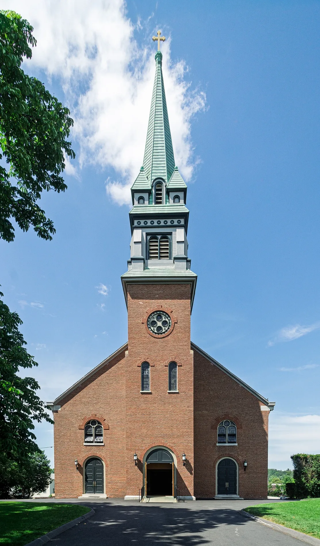
Beauty salons
Banks
Wine shops
Cafes
Driving schools
Hair salons
Bus stops
Fast food restaurants
Charging stations
Auto repair shops
Auto parts stores
Ice cream shops
Restaurants
Pubs
Streets nearby
Gormans Court350 ft
Macks Court350 ft
School StreetSchool St @ Lexington St, New York Taco Pizzeria
400 ft
Pond Street450 ft
Greeley's Court500 ft
Lexington StreetLexington St @ Lexington Terr, Lexington St @ Pond St, Lexington St opp Shopping Plaza, 130 Lexington St @ Shopping Plaza, Dunkin', Y.A.R.Z., Lexington St @ School St, Central Square, Opp 680 Lexington St, 617 Lexington St - Waltham HS, Burger King, Lexington St @ Curve St, Lexington St @ Lincoln St, Lexington St @ Stanley Rd, Lexington St opp Curve St, Lexington St opp Stanley Rd, Lexington St opp Lincoln St, First Baptist Church in Waltham, Opp 617 Lexington St - Waltham HS, 1042 Trapelo Rd, Subway, Supercuts, Crumbl Cookies, Lexington St @ College Farm Rd, Lexington St opp College Farm Rd, O'Reilly Auto Parts, Lexington St @ Brookway Rd, Lexington St opp Brookway Rd, TJ Maxx, Hair Crew, The Paper Store, Dion's, North Waltham Branch, American Automobile Association, Grassfield's, FedEx Ship Center, Gulf, East Cambridge Bank, Waltham Modern Dentistry, Glendale Bottled Liquors, Chipotle, Boston Market, Opp 976 Lexington St, 976 Lexington St
500 ft
Common StreetCommon St @ School St, Central Parking Lot Charging Station
550 ft
Lindy Lane550 ft
Exchange Street0.1 mi
Middle Street Court0.1 mi
Pond Street Court0.1 mi
Middle Street0.1 mi
Spring Street0.1 mi
Exchange Court0.2 mi
Castle Street0.2 mi
Summer Street0.2 mi
Waltham Wayside TrailLinden Station, AutoZone, Digital Federal Credit Union
0.2 mi
Lexington Terrace0.2 mi
Emerson Road0.2 mi
Grant Place0.2 mi
Athletic Field Road0.2 mi
Emery StreetUS Storage Centers
0.2 mi
Totten Court0.2 mi
Munster Terrace0.2 mi
Grant Street0.2 mi
Bacon StreetBacon St @ Athletic Field Rd, Bacon St @ Pond St, Bacon St @ School St, Bacon St @ Clark Ln, Bacon St @ Dale St, Bacon St @ Greenwood Ln, Bacon St @ Kendall Pk, Bacon St @ Varnum Pk, Bacon St opp Clark Ln, Bacon St opp Greenwood Ln
0.3 mi
Dale StreetDale St @ Bacon St, Dale St @ Lexington St, Opp 45 Dale St, 45 Dale St, Dale St @ Claremont St, Dale St opp Caughey St
0.3 mi
Fiske Street0.3 mi
Guinan Street0.3 mi
Taddeo Way0.3 mi
Plympton Avenue0.3 mi
Farnsworth Avenue0.4 mi
Hazel Street0.4 mi
Farnsworth Street0.4 mi
Varnum Park0.4 mi
Banks nearby
TD Bank0.2 mi
Buildings nearby
Waltham Pumping Station0.1 mi
Waltham Boys and Girls Club0.1 mi
Car washes nearby
Quick & Clean Car Wash0.3 mi
Convenience stores nearby
7-Eleven0.2 mi
Fire stations nearby
Waltham Fire Department0.3 mi
Libraries nearby
Waltham Public Library0.2 mi
Liquor stores nearby
Ryans Liquors0.3 mi
Parking lots nearby
Central Square Parking Deck0.2 mi
Parks nearby
Leary Field0.3 mi
Bradford Drake Playground0.3 mi
Police stations nearby
Waltham Police Department0.2 mi
Restaurants nearby
The Chateau500 ft
Boston Kebab0.2 mi
| Year built | 1858 |
|---|---|
| Architectural style | Romanesque Revival architecture |
| Heritage designation | National Register of Historic Places listed place |
| Located in | Waltham |
| Country | United States |
 Public transit map Waltham Legend
| Railway | |
| Bus | |
| Streetcar |
 Bicycle map Waltham Legend
| Bike path | |
| Bike lane on roadway | |
| Cycling allowed on bus lane | |
| Bicycle street | |
| Open to cyclists | |
| Open to cyclists, good path | |
| Cycling prohibited | |
| Cobblestone |
| Long-distance bike route | (depending on scale) | |
| Long-distance bike route |
 Pedestrian map Waltham Legend
| Path |
| Long-distance hiking trail | (depending on scale) | |
| Long-distance hiking trail | ||
| Pedestrians prohibited |