
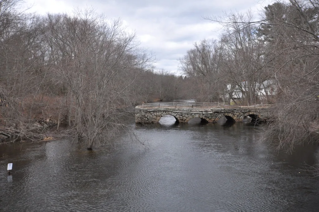
Stone's Bridge in Wayland, Massachusetts
Stone's Bridge in Wayland is a track. It runs in a northeast-southwest direction starting from Old Stonebridge Road. Ⓦ.
- Road Type
- track
- Route
- northeast-southwest
Image
Banks
Places of worship
Massage therapy clinics
Cell phone stores
Bed stores
Restaurants
Car dealerships
Convenience stores
Post offices
Bus stops
Cafes
Fast food restaurants
Vacation apartments
Fire stations
Garden centers
Beauty salons
Clothing stores
Pharmacies
Streets nearby
Old Stonebridge Road150 ft
Potter Road200 ft
Stonebridge Road250 ft
Shore Drive300 ft
Lowry Road0.1 mi
Overlook Road0.1 mi
Weston Aqueduct Trail (Open but Unmarked)0.2 mi
Coe Road0.2 mi
River View Avenue0.2 mi
River View Circle0.2 mi
Larnis Road0.2 mi
Upton Road0.2 mi
Weston Aqueduct Trail0.3 mi
Little Farms Road0.3 mi
Driscoll Drive0.3 mi
Eddy Street0.3 mi
Carol J. Getchell Nature Trail0.3 mi
Meadow View Road0.3 mi
Oak Hill Road0.3 mi
Brookdale Lane0.4 mi
Brookdale Road0.4 mi
Russet Lane0.4 mi
Kay Street0.4 mi
Elmfield Road0.5 mi
Elm Street0.5 mi
Overlook Drive East0.5 mi
Temi Road0.5 mi
Brooks Road0.5 mi
Old Orchard Road0.5 mi
Christopher Lane0.5 mi
Michael Road0.6 mi
Meadow Street Extension0.6 mi
Lynne Road0.6 mi
Stock Farm Road0.6 mi
Elmwood Road0.6 mi
Green Lane0.6 mi
Riverpath Drive0.6 mi
Deer Path Lane0.6 mi
Landham RoadSaint Ansels Church
0.6 mi
Strauss Lane0.6 mi
Oxbow RoadMontage at Danforth Green
0.6 mi
Shadow Oak Drive0.8 mi
Buildings nearby
Avalon Framingham Garages0.6 mi
Avalon Framingham Maintenance0.6 mi
Avalon Framingham0.6 mi
Dog parks nearby
Avalon Framingham Dog Park0.6 mi
Parks nearby
Eric Schwartz Ballfield0.2 mi
Recreation grounds nearby
Wayland Rod & Gun Club0.2 mi
Rivers nearby
Sudbury River0.2 mi
| Year built | 1857 |
|---|---|
| Heritage designation | National Register of Historic Places listed place |
| Located in | Framingham, Wayland |
| Country | United States |
| Crosses | Sudbury River |
| Website | http://focus.nps.gov/AssetDetail/NRIS/100000527 |
 Public transit map Wayland Legend
| Railway | |
| Bus | |
| Streetcar |
 Bicycle map Wayland Legend
| Bike path | |
| Bike lane on roadway | |
| Cycling allowed on bus lane | |
| Bicycle street | |
| Open to cyclists | |
| Open to cyclists, good path | |
| Cycling prohibited | |
| Cobblestone |
| Long-distance bike route | (depending on scale) | |
| Long-distance bike route |
 Pedestrian map Wayland Legend
| Path |
| Long-distance hiking trail | (depending on scale) | |
| Long-distance hiking trail | ||
| Pedestrians prohibited |