
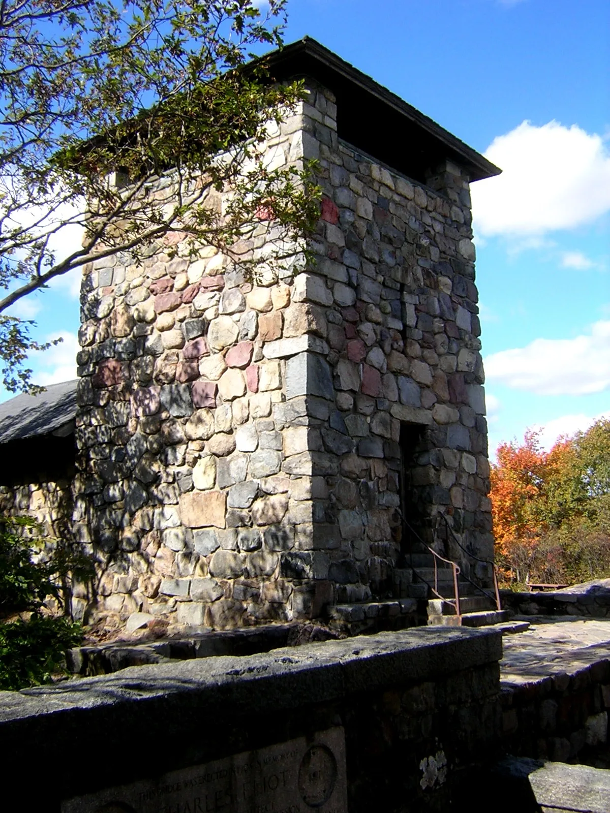
Eliot Tower in Milton, Massachusetts
Eliot Tower in Milton is a viewpoint (wheelchair accessible). Eliot Tower is located near Summit Road. Ⓦ.
- Building Type
- building
- Tourism
- viewpoint
- Wheelchair Access
- yes
Image
Libraries
Bus stops
Streets nearby
North Skyline TrailPath Continues
500 ft
Summit Road550 ft
Coon Hollow Path0.1 mi
South Skyline Trail0.1 mi
Eliot Circle0.1 mi
Brookwood Trail0.2 mi
Patriots Path0.2 mi
Sonya0.3 mi
Skyline Trail0.3 mi
Puddle Path0.3 mi
Beginner Area Return0.4 mi
Wildcat Notch Trail0.4 mi
Accord Path0.4 mi
Wolcott PathBlue Hills Reservation Map
0.4 mi
Blue Hill River Road0.4 mi
Half Way Path0.4 mi
Carberry Path0.5 mi
Canton Avenue1904 Canton Ave @ Trailside Museum, Opp 1904 Canton Ave @ Trailside Museum
0.5 mi
Hillside Street0.5 mi
Washington StreetTama. Japanese Ramen & Bar, Dunkin', Saint Gerard Majella Church, Washington Street at Osco Drug, Cobb Corner Plaza Sign (Washington St.), Dunkin' Donuts, Ponkapoag, Eliot School, The Commons at Washington Street, SPICE ART - The Taste of India, MrG Barbershop, Domino's, Thyme, Rosetta's Italian Restaurant, Nisa's Thai, D & E Pizza & Subs, Playa Bowls, Boston Beauty Ink, Ambience Restaurant & Bar, Canton, Canton Center, Washington St opp Canton Center Station, Washington St @ Canton Center Station, Shell, Canton Historical Society Library
0.5 mi
Green Street0.6 mi
Royall AvenueMobil
0.6 mi
J. West Foster Boulevard0.6 mi
Davenport Avenue0.6 mi
Hemenway Drive0.6 mi
Royall StreetRoyall St @ Compushare Driveway, Royall St @ Dunkin Brands Driveway, Royall St @ Beacon Lane, Royall St @ JW Foster Blvd
0.6 mi
Border Path0.7 mi
Brush Hill Road0.7 mi
Blue Hill AvenueBlue Hill Ave opp Curry College, Blue Hill Ave @ Curry College, Blue Hill Ave @ Pagoda St, Blue Hill Ave opp Pagoda St
0.7 mi
Wolcott Woods Lane0.7 mi
Buildings nearby
Meditech0.6 mi
Convenience stores nearby
Mobil Mart0.6 mi
Seasons Corner Market0.6 mi
Blue Hill Express0.6 mi
Farmland nearby
Brookwood Farm0.4 mi
Gas stations nearby
Route 138 Gas0.5 mi
Shell0.6 mi
Hotels nearby
Homewood Suites0.7 mi
Houses nearby
Wolcott Woods Model Unit & Sales Office0.7 mi
Liquor stores nearby
Bay State Wine and Spirits0.6 mi
Museums nearby
Blue Hills Trailside Museum0.5 mi
Places of worship nearby
Trinity Episcopal Church0.5 mi
Pubs nearby
The Hillside Pub0.6 mi
Residential areas nearby
Blue Hill Commons0.6 mi
Wolcott Woods0.6 mi
Fuller Village at Blue Hill0.8 mi
Residential buildings nearby
Mail Building0.7 mi
Winter sports areas nearby
Blue Hills Ski Area0.3 mi
Zoos nearby
Blue Hills Trailside Museum Habitats0.5 mi
| Heritage designation | National Register of Historic Places listed place |
|---|---|
| Located in | Milton |
| Country | United States |
| Native name | Great Blue Hill Observation Tower |
 Public transit map Milton Legend
| Railway | |
| Bus | |
| Streetcar |
 Bicycle map Milton Legend
| Bike path | |
| Bike lane on roadway | |
| Cycling allowed on bus lane | |
| Bicycle street | |
| Open to cyclists | |
| Open to cyclists, good path | |
| Cycling prohibited | |
| Cobblestone |
| Long-distance bike route | (depending on scale) | |
| Long-distance bike route |
 Pedestrian map Milton Legend
| Path |
| Long-distance hiking trail | (depending on scale) | |
| Long-distance hiking trail | ||
| Pedestrians prohibited |