
Chickatawbut Observation Tower in Quincy, Massachusetts
Chickatawbut Observation Tower in Quincy is a tower (Heritage monument). Chickatawbut Observation Tower is located near Great Dome Trail. Ⓦ.
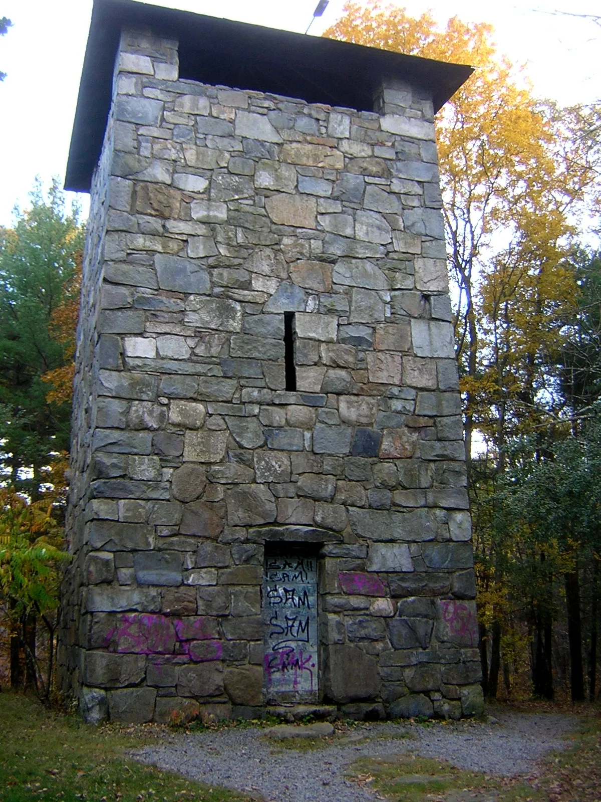
- Building Type
- building
Bus stops
Beauty salons
Tobacco shops
Streets nearby
Great Dome Trail0.2 mi
Sears Road0.4 mi
Headquarters Path0.5 mi
Chickatawbut Road0.5 mi
Randolph AvenueSaint Michaels Episcopal Church, Randolph Ave @ Chickataubut Rd, Randolph Ave @ Eager Rd, Randolph Ave @ Hillside St, Randolph Ave @ Hilltop St, Randolph Ave @ Nahanton Ave, Randolph Ave @ Ridgewood Rd, Randolph Ave @ Susi Ln, Randolph Ave opp Eager Rd, Randolph Ave opp Hallen Ave, Randolph Ave opp Hillside St, Randolph Ave opp Hilltop St, Randolph Ave opp Nahanton Ave, Randolph Ave opp Ridgewood Rd, 1248 Randolph Ave, Randolph Ave and Chickataubut Rd, Randolph Ave and Eager Rd, Randolph Ave and Hallen St, Randolph Ave and Hillside St, Randolph Ave and Hilltop St, Randolph Ave and Ridgewood Rd, Randolph Ave and Sassamon Ave, Randolph Ave @ Reedsdale Rd, Randolph Ave and Reedsdale Rd, Reedsdale Rd. and Randolph Ave, 7-Eleven, Randolph Ave @ Access Rd, Randolph Ave @ Hallen Ave, Randolph Ave @ Highland St, Randolph Ave opp Highland St, Randolph Ave and Highland St, Randolph Ave and Reed St, Randolph Ave @ Pleasant St, Randolph Ave @ Reed St, Randolph Ave opp Pleasant St, Randolph Ave and Pleasant St
0.5 mi
Red Dot Loop0.5 mi
Harbor View Road0.5 mi
Harbor View Park0.5 mi
Susi Lane0.6 mi
Eager Road0.6 mi
Hilltop Street0.6 mi
Brierbrook Street0.7 mi
Brewster Road0.7 mi
Hillside Street0.7 mi
Pipe Line0.7 mi
Bouncing Brook Path0.7 mi
Sassamon Avenue0.8 mi
Mark Lane0.8 mi
Parkwood Drive0.8 mi
Barberry Lane0.8 mi
Nahanton Avenue0.8 mi
Ridgewood Road0.8 mi
Heather Drive0.8 mi
Crags Foot Path0.9 mi
Buck Hill Path0.9 mi
Climb Bypass0.9 mi
Hawk Hill Path1.0 mi
Short Path1.0 mi
Savoy Path1.0 mi
Sawcut Notch Path1.1 mi
Indian Camp Path1.1 mi
Old Furnace Brook Path1.1 mi
Yankee Division HighwayPure Hockey, Blue Hills Dental Associates of Braintree
1.2 mi
Winnemoiset Path1.3 mi
Braintree Pass Path1.3 mi
Laurel Path1.3 mi
Old Route 1281.3 mi
Buildings nearby
Norman Smith Environmental Education Center0.2 mi
Haemonetics Corporation1.1 mi
Ryder Commercial & Consumer Truck Rental1.1 mi
Harvey Industries1.2 mi
Dams nearby
Blue Hills Reservoir Dam0.6 mi
Furniture stores nearby
Norfolk Kitchen & Bath1.2 mi
Hospitals nearby
Blue Hills Medical Center1.2 mi
Hotels nearby
Candlewood Suites1.1 mi
Hampton Inn1.2 mi
Streams nearby
Furnace Brook0.8 mi
Bouncing Brook1.3 mi
Wetlands nearby
Great Cedar Swamp1.1 mi
| Located in | Quincy |
|---|---|
| Country | United States |
| Native name | Chickatawbut Observation Tower |
 Public transit map Quincy Legend
| Railway | |
| Bus | |
| Streetcar |
 Bicycle map Quincy Legend
| Bike path | |
| Bike lane on roadway | |
| Cycling allowed on bus lane | |
| Bicycle street | |
| Open to cyclists | |
| Open to cyclists, good path | |
| Cycling prohibited | |
| Cobblestone |
| Long-distance bike route | (depending on scale) | |
| Long-distance bike route |
 Pedestrian map Quincy Legend
| Path |
| Long-distance hiking trail | (depending on scale) | |
| Long-distance hiking trail | ||
| Pedestrians prohibited |