
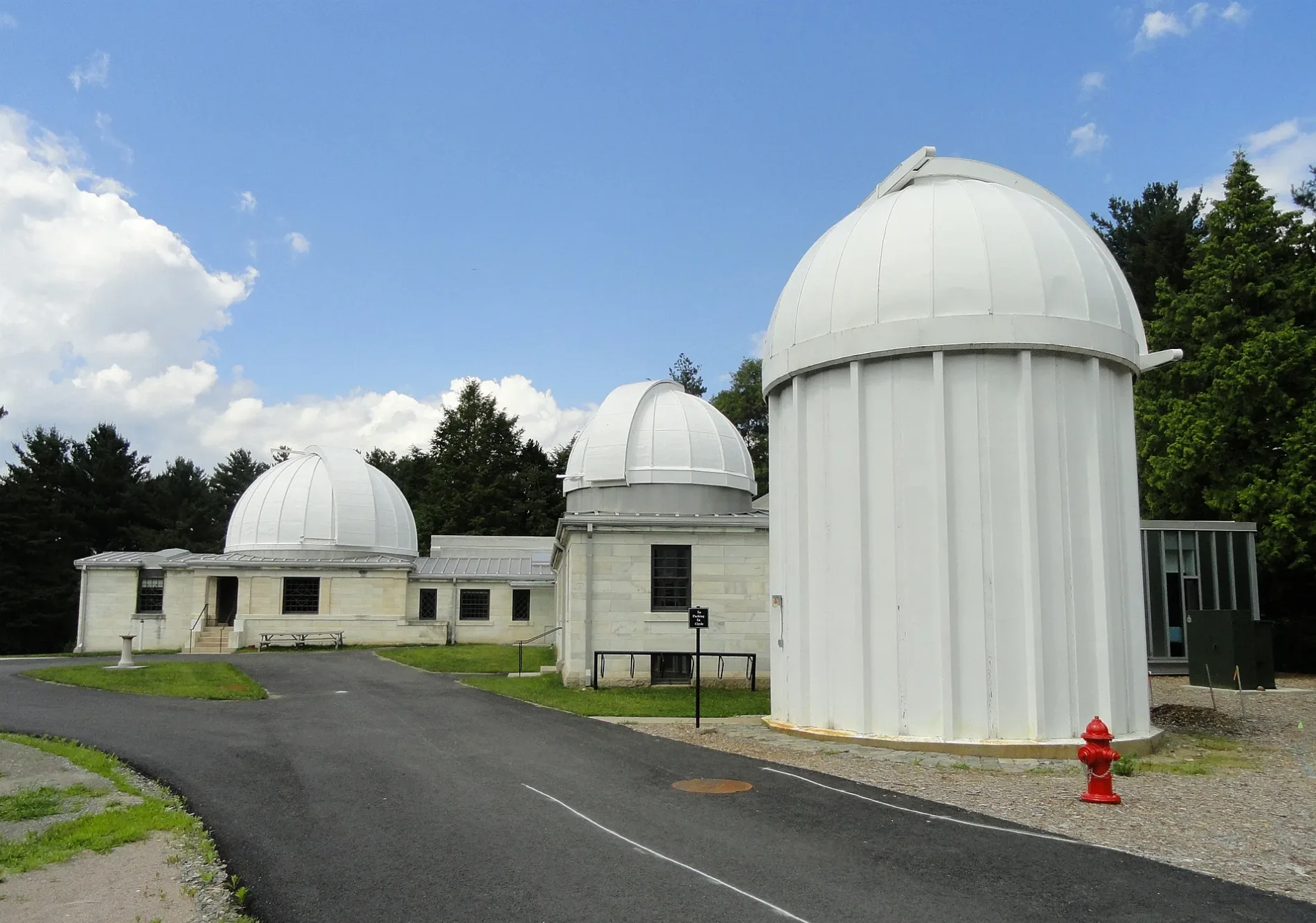
Whitin Observatory in Wellesley, Massachusetts
Whitin Observatory in Wellesley ist eine Anlage. Whitin Observatory is located near Weston Road. Ⓦ.
- Building Type
- building
Image
Jewelry stores
Cafes
Beauty salons
Banks
Restaurants
Fire stations
Museums
- Davis Museum and Cultural Center (Web) at Central Street 106 (02481) – approx. 0.3 mi.
Art galleries
Platforms
Clothing stores
Bus stops
Bookstores
Attractions
Stationery stores
Stations
Streets nearby
College RoadDavis Museum and Cultural Center
0.2 mi
Weston RoadAndrews Pharmacy, Bank of America, Fells Market
0.2 mi
Linden StreetWellesley Square, Glamour Tan, Takara Japanese Restaurant, Qdoba, Talbots, JoS. A. Bank, Bank of America, Mattress Firm, Cambridge Trust, Unleashed, Tatte Bakery & Cafe, Starbucks, Sweetgreen, Pressed Juicery, The Cottage, M&T Bank, Tiny Hanger, The Captain's Table & TakeAway, Captain Marden's Fish Market
0.2 mi
Central StreetWellesley Fire Department, Lockheart, Wellesley Books, Alta Strada, Joel Bagnal Goldsmiths & Jewelers, iCode, Wellesley College, Boston Marathon - Wellesley Scream Tunnel, Starbucks, Black and Blue, Clever Hand Gallery, Kidville, Wellesley Bank, Paper Source, Jarbo, Crane & Lion, DR/P Cafe, Cocobeet
0.2 mi
Crosstown Trail0.2 mi
Curve Street0.2 mi
Howe Street0.2 mi
Cross StreetArdan, Central/Cross Sts.
0.3 mi
Weston Terrace0.3 mi
Norfolk Terrace0.3 mi
Harvard Street0.3 mi
Sunset Road0.3 mi
Waban Street0.3 mi
Lovewell Road0.3 mi
Abbott StreetBocado Tapas Bar
0.4 mi
Summit Road0.4 mi
Church StreetLux Bond & Green, Optical Designs, Irresistibles
0.4 mi
Crest RoadWellesley Square
0.4 mi
Allotment gardens nearby
Weston Road Community Gardens0.2 mi
Apartment buildings nearby
The Bristol Wellesley0.2 mi
Haynes Managment0.2 mi
Buildings nearby
Dower House0.3 mi
Stone-Davis Hall0.3 mi
Weaver House0.3 mi
East Lodge0.4 mi
Cemeteries nearby
Wellesley Memorial Path Cemetery0.4 mi
Dormitories nearby
Munger Hall0.2 mi
Pomeroy Hall0.2 mi
Bates/Freeman/McAfee (New Dorms)0.3 mi
Duplexes nearby
Elderlife Solutions0.4 mi
Parks nearby
H.H. Hunnewell Arboretum150 ft
Alexandra Botanical Garden200 ft
Munger Meadow0.2 mi
Places of worship nearby
Houghton Chapel and Multifaith Center0.3 mi
Railways nearby
Boston Subdivision0.3 mi
Row houses nearby
Haynes Management0.2 mi
Streams nearby
Silver Thread350 ft
Technical colleges nearby
Margaret C. Ferguson Greenhouses & Visitor Center0.1 mi
Stone Center/Simpson Infirmary0.2 mi
Fiske0.2 mi
Pendleton Hall0.2 mi
Green Hall/Founders0.2 mi
Wellesley Community Children's Center0.2 mi
Child Study Center0.2 mi
Jewett Arts Center0.2 mi
Shafer Hall0.2 mi
University buildings nearby
Science Center400 ft
Waters nearby
Mirror Pond300 ft
Paramecium Pond0.1 mi
| Located in | Massachusetts |
|---|---|
| Country | United States |
 Public transit map Wellesley Legend
| Railway | |
| Bus | |
| Streetcar |
 Bicycle map Wellesley Legend
| Bike path | |
| Bike lane on roadway | |
| Cycling allowed on bus lane | |
| Bicycle street | |
| Open to cyclists | |
| Open to cyclists, good path | |
| Cycling prohibited | |
| Cobblestone |
| Long-distance bike route | (depending on scale) | |
| Long-distance bike route |
 Pedestrian map Wellesley Legend
| Path |
| Long-distance hiking trail | (depending on scale) | |
| Long-distance hiking trail | ||
| Pedestrians prohibited |