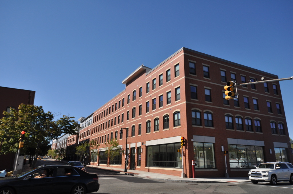
Crescent Street in Brockton, Massachusetts

Crescent Street in Brockton is a two-lane, asphalted secondary road (Road number MA 27). The street has a width of 15.2. It runs in an east-west direction starting from Main Street and crosses Burke's Court, Veterans of Foreign Wars Parkway, Maple Avenue, Montello Street, Commercial Street, Perkins Street, Reed Avenue, School Street, Otis Street, Plymouth Street and Summer Street. It ends in a cul-de-sac. This street is part of the highways 27 and 123. Nearby you can find among others a place of worship and a fast food restaurant. The nearest stops include Crescent St and VFW Parkway, Crescent and Maple ave, perkins and crescent st, Crescent St and Otis St and Crescent and Plymouth Street. The bus lines 2, 3, 5, 6, 8 and 12 serve this stop. Crescent Street also exists in Kingston, Plymouth, Rockland, Hanson and Whitman.

Road Type
secondary road
Lanes
2
Route
east-west

Image

Brocktonma Centremontellohd1
Brocktonma Centremontellohd1 – Magicpiano, cc by-sa – Wikimedia Commons

Bus stops

  • Crescent St and VFW Parkway.
  • Crescent and Maple ave.
  • perkins and crescent st.
  • Crescent St and Otis St.
  • Crescent Street near Summer Street.
  • Crescent and Plymouth Street.
  • Crescent St and Lyman St.
  • Crescent St and wendell Ave.
  • Crescent st and sprague ave.
  • Cresecent st and Cresecent ave.
  • Crescent Palza.
  • Crescent St and Draper St.
  • Crescent St and Dunham St.
  • Crescent St and Gladstone St.
  • Crescent St and Henry St.
  • Crescent St and Hill St.
  • Crescent st and Jacob st.
  • Crescent st and Washington ave.
  • Crescent st and electric ave.
  • Crescent st and perry ave.
  • crescent st and taylor ave.
  • Crescent St & Christos.
  • Caffrey Towers High Rise.
  • bus lines 2, 3, 5, 6, 8, 12

Places of worship

  • Brockton Haitian Church.

Fast food restaurants

  • McDonald's (Burger, takeout, Drive-through, Wi-Fi, opening hours: Mon–Sun 6:30–20) at Crescent Street 664 (02302).

Streets nearby

Veterans of Foreign Wars Parkway
350 ft
East Elm Street
400 ft
Burke's Court
400 ft
City Hall Square
0.1 mi
Maple Avenue
0.1 mi
White Avenue
0.1 mi
Lincoln Street
0.1 mi
School Street
School & Lincoln St
0.1 mi
Wales Avenue
0.2 mi
Bolton Place
0.2 mi
L Street
0.2 mi
West Railroad Avenue
0.2 mi
Commercial Street
Commercial st and school, Commercial and school st, Commercial at Centre St
0.2 mi
Belmont Street
Belmont and Cottage St, Dunkin', Daddy's Dairy, The Back Bay Bagel Company, Belmont St and Williamsburg Sq, Belmont St at Easton Town Line, Belmont St. at Plaza, Bertucci's, Massage Envy, European Wax Center, Starbucks, Belmont St and Lorraine Ave, Belmont St and Plaza Entrance, Belmont St and Torrey Ave, Belmont St at dunkin donuts, Belmont and Lorraine Ave, D'Angelos-CVS Plaza, DANGELOS-CVS, Belmont St and Edinboro Ave, Bristol and Belmont St, Pearl St and Belmont St, Speedway, Belmont St and Grafton St, Belmont St and Minot, Belmont St and Newbury, Belmont and Elm Ave, Belmont and Minot Ave, Belmont and Newbury St, Belmont and Wall St, Belmont st and Belmont Ave, Brockton High School, StopandShop Plaza, Belmont St at Bat Shelter, Belmont and Moraine St, Belmont and Thurber Ave, Belmont and kennleworth Ave, Belmont st and Thurber Ave, Belmont st at Fair grounds, Torrey St and Belmont Place, Belmont St and Ash St
0.2 mi
Montello Street
Montello and school St, centre St and Montello St
0.2 mi
Clinton Avenue
Dunkin'
0.2 mi
Church Street
Brockton, Main St and Church St
0.2 mi
Cottage Street
0.2 mi
Reed Avenue
0.2 mi
Centre Street
Centr St and Prince St, Centre St and Adams St, Centre St and Howland St, Centre St and Sheridan St, Centre and Brockton Ave, Centre and Galen St, Centre and Gladstone St, Centre and Hill St, Centre and Kingman St, East Junior High school, Lyman st and centre St, Brockton, Centre ST and Montello St, Brocton Ave at Line, Centre St and Bates Rd, Centre St and Edwards, Centre St and Quincy st, Centre St at Guild Road, Centre St at Harold St-Ames Rd, Brockton Hospital, Centre St and sterling St, Centre and Sterling Road
0.2 mi
Allen Street
0.2 mi
Father Kenney Way
Main St and Barlett st
0.2 mi
Perkins Street
Lawrence St and Perkins St, perkins and Middle St, Perkins st and Crescent St
0.2 mi
Mitchell Road
0.2 mi
Ridgeway Court
0.3 mi
Stillman Avenue
0.3 mi
Otis Street
0.3 mi
Middle Street
0.3 mi
Lawrence Street
Lawrence St and Otis St, Lawrence st and S.Skinner st, Perkins and lawrence st
0.3 mi
Main Street
Main and Lawrence st, Main St and VFW Parkway, Compello Hi Rise, Main St and Brookside Ave, Main St and Holmes St, Main St and Watson St, Main st and Meadow Lane, Main St and Clifton Ave, Main St at Auto Dealers, Brockton Fire Department, Main St and Calmar St, Main St and East Chestnut st, Main St and Forest Ave, Main St and Grand St, Main St and Perkins Ave, Main St and Pinkham St, Main St and Temple st, Main St and West Chestnut St, Main and Exchange st, Main and Grove St, Main and Hancock st, Main and Union St, Main st and Garfield st, Exclusive Styles Unisex Hair Salon, Main and petronelli way, Main and allen St, Main and white Ave, Maple ave and Main st, Main St and Glen ave, Main St at CVS, Main St at DAngelos, Main St at Wendy's, Main and West Elm, Main st and Court st, Main st and sargeants way
0.3 mi
Somerset Place
0.4 mi
Commercial Yard
Brock
0.4 mi
Exchange Street
0.4 mi
Skinner Street
0.5 mi
Shealey Avenue
Lawrence St and shealey Ave
0.5 mi