
Boston Police Academy
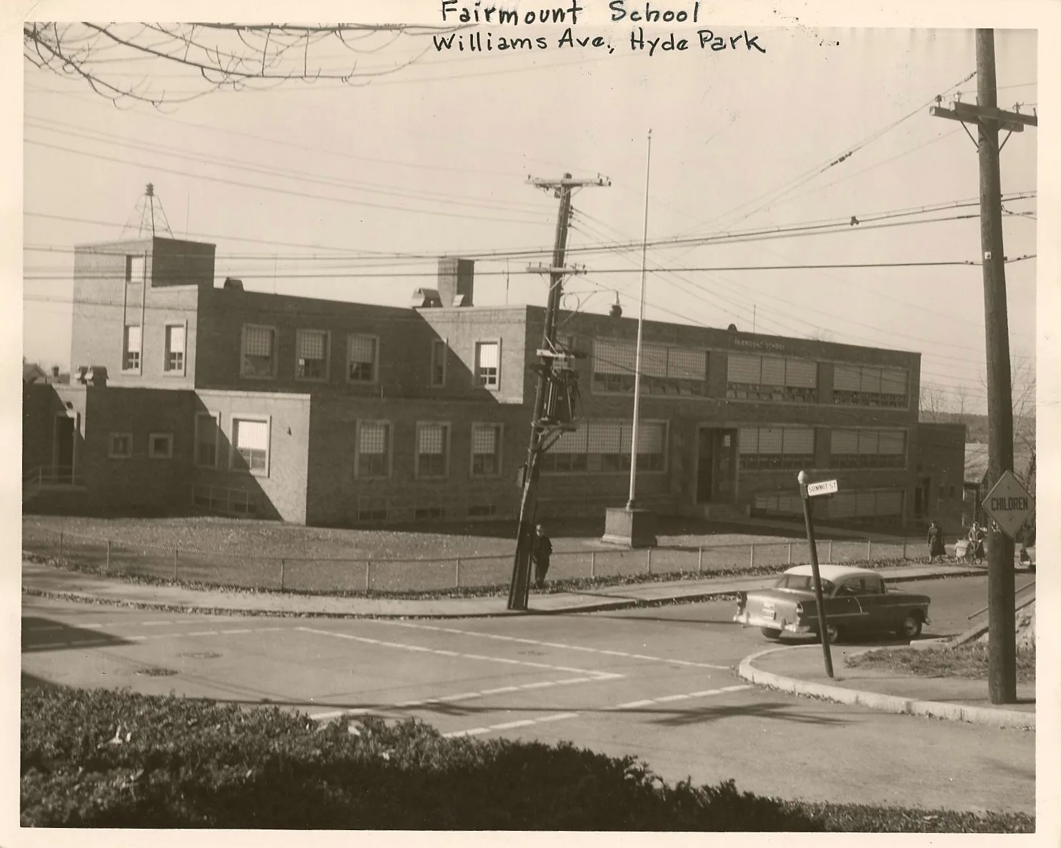
Boston Police Academy in Boston is a building (formerly Fairmount School), Williams Avenue 85 (02136).
- House Number
- 85
- Postal Code
- 02136
- Street
- Williams Avenue
- Building Type
- building
Image
Platforms
Bus stops
Streets nearby
Summit StreetSummit St @ Neponset Ave, Summit St @ Milton Ave
300 ft
Mount Pleasant Street350 ft
Pond Street17 Pond St, The Joint, Café Siete
450 ft
Floral Place500 ft
Neponset AvenueNeponset Ave @ Adams St, Neponset Ave @ Adams St King Square, Neponset Ave @ Victory Rd, Neponset Ave @ King St, Neponset Ave @ Popes Hill St, Neponset Ave @ S Monroe Ter, Neponset Ave opp King St, Salon Serenity, St Ann Elementary, 239 Neponset Ave, 248 Neponset Ave, Boston Fire Department Engine 20, Neponset Ave @ Minot St, Neponset Ave @ Tolman St, 398 Neponset Ave @ Neponset Health Center, McGonagles
550 ft
Rich-Hood Avenue0.1 mi
Williams AvenueBoston Police Academy, Williams St @ Summit St
0.1 mi
Dana Avenue0.1 mi
Aldo Terrace0.2 mi
Skyline Road0.2 mi
Leseur Road0.2 mi
New Acre Road0.2 mi
Mountfair Terrace0.2 mi
Loring Place0.2 mi
Prospect Park0.2 mi
Norway Park0.2 mi
Garfield Avenue0.2 mi
Loring Street0.2 mi
Truman ParkwayTruman Hwy @ Mountfair Terr, Truman Hwy @ Williams Ave, Truman Hwy @ Chittick Rd, Truman Hwy @ Tyler St, Truman Hwy @ Wakefield Ave, Truman Hwy @ Dana Ave, BP
0.2 mi
Franklin Terrace0.2 mi
Summit Circle0.3 mi
Robbart Lane0.3 mi
Warren AvenueAtelier | 505 Garage, Concord Baptist Church, Community Music Center of Boston
0.3 mi
Beacon StreetBeacon St @ Park St, Bulfinch Entrance, Horace Mann, Daniel Webster, Starbucks, Supercuts, Sol Azteca, Green Infrastructure, Tremont St @ Beacon St, Beacon St @ Metropolitan Ave, Beacon Junction, Trolley, Congregational Library and Archives, Emmet's, City Convenience, Roxanne's, KS Variety, High Spot Deli, English Language Center - ELC Boston, Carrie Nation, Colonial Craftsmen, Eastern Bank, Beacon St @ Albion St, Beacon St @ Fairmount Ave, Beacon St opp Walnut St, Bluebikes, Quality Mart, Goethe-Institut, Marist Fathers Church, Passport Health Boston - Back Bay Travel Clinic, New England College of Optometry, Santander, Audubon, Audubon Circle, CVS Pharmacy, Cleveland Circle, Cleveland Circle Hardware, Eagle's Deli & Restaurant, Pino's, Reservoir Wine & Spirits, Kung Fu Tea, Sunshine Center Cleaners, General Joseph Hooker, Dunkin', Lansdowne (South Station), Lansdowne (Outbound), Lansdowne, EDCO Youth Alternative, Cornwall's, Amelia's Taqueria, My Happy Hunan Kitchen, Energize: Healthy Eating, Chipotle
0.3 mi
Neponset River GreenwayButler, Dana, Blue Hill Ave @ River St, Shawmut Junction
0.3 mi
Red Pine Road0.3 mi
Warren Park0.3 mi
Fairmount AvenueFairmont Ave @ Truman Hwy, Fairmont Ave @ Pierce St, Fairmont Ave opp Nott St, Fairmount, River St @ Fairmount Ave
0.3 mi
Highland StreetFairmount, Highland St @ Albion St, Highland St @ Fairmount Ave, Highland St @ Warren Ave, Metropolitan Ave @ Highland St
0.3 mi
Prospect Street0.3 mi
Spring Hill Road0.3 mi
Milton AvenueMilton Ave @ Highland St
0.3 mi
Farwell Avenue0.3 mi
Albion Street0.3 mi
Walnut StreetFairmount
0.3 mi
Lochland Road0.3 mi
Maple StreetWeld St @ Maple St
0.4 mi
Fairmount CourtMBTA Ticket Validator - Fairmount (Inbound)
0.4 mi
Second New Way0.4 mi
Milton Terrace0.4 mi
Nott Street0.4 mi
Brushwood Circle0.4 mi
Brownfields nearby
Former Lewis Chemical Plant0.3 mi
Railways nearby
Dorchester Branch0.4 mi
Recreation grounds nearby
Williams Sqare0.2 mi
Neponset River Reservation0.3 mi
Jones Square0.3 mi
Restaurants nearby
Cappy's Pizzeria0.3 mi
Self storages nearby
U-Haul0.3 mi
| Located in | Boston |
|---|---|
| Country | United States |
 Public transit map Boston Legend
| Railway | |
| Bus | |
| Streetcar |
 Bicycle map Boston Legend
| Bike path | |
| Bike lane on roadway | |
| Cycling allowed on bus lane | |
| Bicycle street | |
| Open to cyclists | |
| Open to cyclists, good path | |
| Cycling prohibited | |
| Cobblestone |
| Long-distance bike route | (depending on scale) | |
| Long-distance bike route |
 Pedestrian map Boston Legend
| Path |
| Long-distance hiking trail | (depending on scale) | |
| Long-distance hiking trail | ||
| Pedestrians prohibited |