
Copp's Hill Burying Ground in Boston
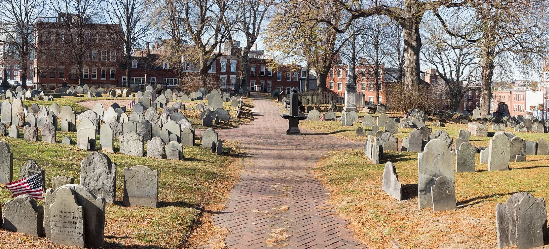
Copp's Hill Burying Ground in Boston is a cemetery (Elevation 12 m). Copp's Hill Burying Ground is also known as New North Burying Ground. Copp's Hill Burying Ground is located near North Hudson Street. Ⓦ.
- Amenity
- cemetery
- Land Use
- cemetery
Restaurants
Department stores
Bus stops
Attractions
Candy stores
Convenience stores
Pubs
Schools
Cafes
Libraries
Bakeries
Fast food restaurants
Artworks
Streets nearby
Hull StreetPaul Revere Pottery and Library Clubhouse, Skinny House
200 ft
Cleveland Place300 ft
North Hudson Street300 ft
Snow Hill Street350 ft
Copp's Hill Terrace350 ft
Jackson Avenue350 ft
Snelling Place350 ft
Sheafe StreetTheo's Cozy Corner
350 ft
Hull Street Court400 ft
Lafayette Avenue500 ft
Margaret StreetHebrew Industrial School
0.1 mi
Endicott Court0.1 mi
North Margin Street0.1 mi
Lombard Place0.1 mi
Boston HarborWalkSouth Boston: Harbor of Shame No More, Harbor Vessels, Massachusetts Saltwater Fish, Meritage and Rowes Wharf Sea Grille, Untitled Landscape, Long Wharf (South) Ferry Terminal, Ben & Jerry, New England Aquarium Whale Watching, Central Wharf Ferry Terminal, Whale Watch Ticket Booth, Boston Duck Tours Ticket Booth, Dockside Beer Garden at Central Wharf, Central Snack Bar, Harborview Cafe, Rowes Wharf Ferry Terminal, Fan Pier Ferry Terminal, Gate 4, 75 on Liberty Wharf, Legal Harborside, Tony G's, Pope John Paul II Park, JFK Library Cafeteria, Sunflowers for Vincent, Boston Fire Department Marine Unit, Café Amalfi, Boston Tea Party - Ships and Museum, World Trade Center (West) Ferry Terminal, United Way of Massachusetts Bay, World Trade Center (East) Ferry Terminal, EDIC Pier, Courthouse Dock, Salon Mirabella, Yankee Lobster Eatery, The Barking Crab, Lookout Rooftop & Bar, E 1st St @ P St, E 1st St opp O St, Pilot House Parking, Battery Wharf, Maritime Museum at Battery Wharf, Battery Wharf Grille, Logan Airport Ferry Terminal, Massachusetts Port Authority (Massport), Independence Wharf, Tea By The Sea, Summer St @ E 1st St, 776 Summer St opp Powerhouse St, Savr, Boston Harbor Cruise, Bier Bar, The Landing at Long Wharf, Bon Me, CVS Pharmacy, Kappy's Wine & Spirits, ABM Marine Park Garage, CycleWash, Long Wharf (North) Ferry Terminal, Trade By Sea, Harborwalk Lookout, ReelHouse Oyster Bar
0.1 mi
Endicott StreetBob's Grocery Store, Massimino's
0.1 mi
Causeway StreetThe Harp, Dunkin', Boston Döner, Causeway, Trolley, Qdoba, North Station Liquors, Chip City Cookies West End, Santander, Star Market, The Goal, Banners Kitchen & Tap, Hub Hall, Verizon, ArcLight Cinema, Starbucks, Momosan Morimoto, Naco Taco, Star Market Pharmacy, AMC Causeway 13, North Station Garage, Causeway St @ Medford St
0.1 mi
Thacher Court0.1 mi
Thacher StreetPizzeria Regina, Arthur T. Solari Square
0.1 mi
Lynn Street0.2 mi
Pond Street Place0.2 mi
Medford StreetBoston Fire Department Engine 32, Ladder 9, Charlestown High School, Bluebikes - Medford St at Charlestown BCYF
0.2 mi
Boston HarborWalk North EndNight Shift Brewing, Lovejoy Wharf Ferry Terminal, Alcove
0.2 mi
Valenti WayBluebikes, Rustico
0.2 mi
Cooper Street0.2 mi
Lovejoy Place0.2 mi
Stillman Place0.2 mi
North Washington StreetN Washington St @ Cooper St, N Washington St @ Medford St, William Felton "Bill" Russell Bridge, USS Constitution, Bunker Hill Monument, Custom House Tower, Old North Church
0.2 mi
Beverly StreetAngelo Anzalone Square
0.2 mi
Lovejoy Wharf0.2 mi
Apartment buildings nearby
The Beverly0.2 mi
The Victor by Windsor0.2 mi
Buildings nearby
Villa Michelangelo300 ft
Ozias Goodwin House400 ft
Vermont Building0.1 mi
Ausonia Council #1513 Knights of Columbus0.1 mi
Casa Maria0.2 mi
One Canal0.2 mi
Commercial buildings nearby
Converse Lovejoy Wharf0.2 mi
Dog parks nearby
RUFF North End200 ft
Ice rinks nearby
Steriti Memorial Rink0.1 mi
Parking lots nearby
North End Garage450 ft
Parks nearby
Langone Park0.1 mi
North Meadow on the Greenway0.2 mi
Playgrounds nearby
Defilippo Playground400 ft
Langone Park Playground0.1 mi
Recreation grounds nearby
Langone Park Bocce Courts550 ft
Sports fields nearby
Langone Little League Baseball Field0.1 mi
Prince Street Park Tennis Courts0.1 mi
| Named after | Copp's Hill |
|---|---|
| Area | 2 |
| Heritage designation | National Register of Historic Places listed place |
| Located in | Boston |
| Country | United States |
| Native name | Copp's Hill Burying Ground |
| Location | North End |
| Part of | Freedom Trail |
 Public transit map Boston Legend
| Railway | |
| Bus | |
| Streetcar |
 Bicycle map Boston Legend
| Bike path | |
| Bike lane on roadway | |
| Cycling allowed on bus lane | |
| Bicycle street | |
| Open to cyclists | |
| Open to cyclists, good path | |
| Cycling prohibited | |
| Cobblestone |
| Long-distance bike route | (depending on scale) | |
| Long-distance bike route |
 Pedestrian map Boston Legend
| Path |
| Long-distance hiking trail | (depending on scale) | |
| Long-distance hiking trail | ||
| Pedestrians prohibited |