
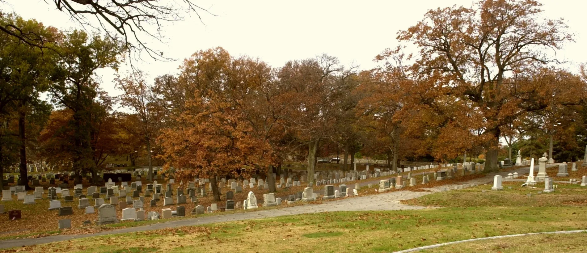
Evergreen Cemetery in Boston
Evergreen Cemetery in Boston ist ein historisches Objekt. Evergreen Cemetery is located near College Avenue. Evergreen Cemetery also exists in Essex County, Hampshire County, Worcester County, Bristol County and Middlesex County. Ⓦ.
- Land Use
- cemetery
Image
Cafes
Light rail stops
Schools
Restaurants
Parking lots
Gas stations
Bus stops
Fast food restaurants
Arts centers
Stops
Streets nearby
Beech Avenue250 ft
College Avenue350 ft
Cedar Grove Road400 ft
Western AvenueWestern Ave opp Riverdale St, Saya Patri, Faces of Allston, All That Empty Space, A Composition of Moments, ROCK CITY, Allston, I really love you!, Westen Ave at Everett St, Blue Bikes - Harvard University Housing - 111 Western Ave. at Soldiers Field Park, Western Ave opp Genzyme, Eastern Bank, Trader Joe's, Barry's Corner, Western Ave @ Everett St, Western Ave @ N Harvard St, 125 Western Ave, Bluebikes - Innovation Lab - 125 Western Ave. at Batten Way, Digital DNA, Interconnected, Western Ave @ Riverdale St, 367 Western Ave opp Brighton Mills Mall, Ariana Restaurant, 60 Western Ave, Big Daddy's, Granite City Electric Supply, P&E Auto Service, Western Ave @ Litchfield St, Western Ave opp Litchfield St, 445 Western Ave, 450 Western Ave, Charles River Community Health, Evo, Bluebikes, 156 Western Ave, Bank of America, Western Ave @ Mackin St, Western Ave opp Richardson St, 130 Western Ave, WE ALL
450 ft
Pine Avenue450 ft
Saint Thomas More Road550 ft
Campanella WayRobsham Theater Arts Center, CommAve , Hillside Cafe, Corcoran Commons, Lower Live, The Loft at Addies, The Market
550 ft
Central Avenue West0.1 mi
Central Avenue East0.1 mi
Western Path0.1 mi
Evergreen Avenue0.1 mi
Father Herlihy Drive0.1 mi
Eastern AvenueStarbucks
0.1 mi
Eastern Path0.2 mi
Knowles StreetLake Street Yard
0.2 mi
Central AvenueHyde Park Education Complex, Boston Community Leadership Academy, Central Ave and River St, River St and Central Ave
0.2 mi
Greycliff Road0.2 mi
Oak Lawn Avenue0.2 mi
Gerald Road0.2 mi
Lake Street0.3 mi
Dance floors nearby
2115 Comm. Ave Dance Studio0.2 mi
Dormitories nearby
Walsh Hall300 ft
Stayer Hall450 ft
Mod 14/27500 ft
Mod 36/38500 ft
Mod 26/39500 ft
Mod 23/25500 ft
Mod 13550 ft
Mod 10/120.1 mi
St. Thomas More Apartments0.1 mi
Mod 24/370.1 mi
Mod 110.1 mi
Mod 340.1 mi
The Mods0.1 mi
Mod 8/210.1 mi
Mod 20/220.1 mi
Mod 90.1 mi
Vanderslice Hall0.1 mi
Libraries nearby
Boston College Theology and Ministry Library0.3 mi
Light rail lines nearby
Cardinal Crossover0.1 mi
Green Line (B)0.1 mi
Light rail stops nearby
Boston College0.2 mi
Museums nearby
McMullen Museum of Art0.2 mi
Parks nearby
Boyden Park0.1 mi
Places of worship nearby
Saint Ignatius Church0.1 mi
Railway areas nearby
MBTA Lake Street Yard0.2 mi
University buildings nearby
2125 Comm. Ave.0.1 mi
3 Lake St.0.2 mi
9 Lake St.0.2 mi
| Year built | 1850 |
|---|---|
| Heritage designation | National Register of Historic Places listed place |
| Located in | Boston |
| Country | United States |
| Location | Brighton |
 Public transit map Boston Legend
| Railway | |
| Bus | |
| Streetcar |
 Bicycle map Boston Legend
| Bike path | |
| Bike lane on roadway | |
| Cycling allowed on bus lane | |
| Bicycle street | |
| Open to cyclists | |
| Open to cyclists, good path | |
| Cycling prohibited | |
| Cobblestone |
| Long-distance bike route | (depending on scale) | |
| Long-distance bike route |
 Pedestrian map Boston Legend
| Path |
| Long-distance hiking trail | (depending on scale) | |
| Long-distance hiking trail | ||
| Pedestrians prohibited |