
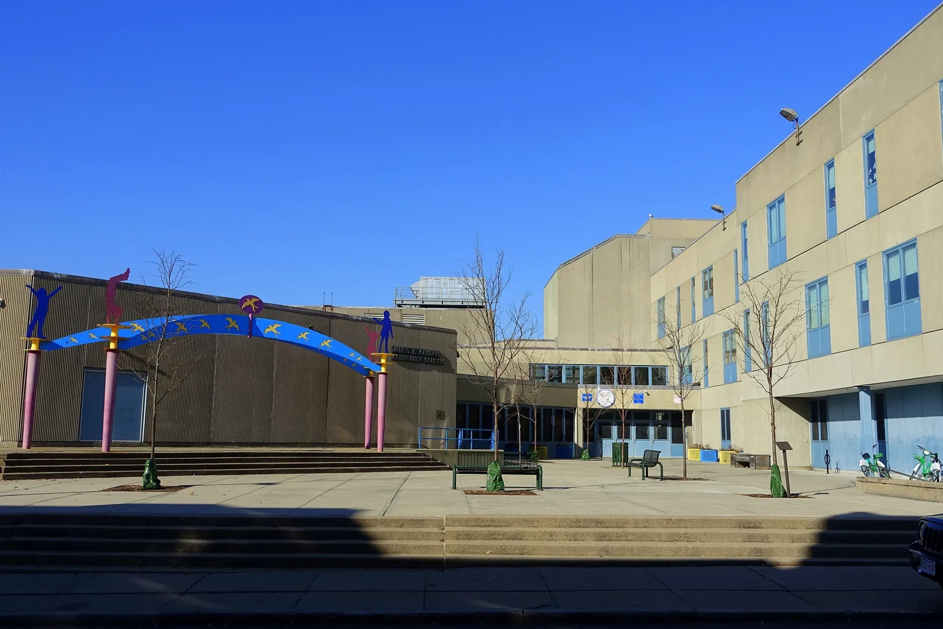
James Condon Elementary School in Boston
James Condon Elementary School in Boston is a school (Elevation 5 m), D Street 200 (02127).
- House Number
- 200
- Postal Code
- 02127
- Street
- D Street
- Amenity
- school
- Building Type
- building
Image
Cafes
Driving schools
Massage therapy clinics
Bus stops
Restaurants
Bike rentals
Bars
Fire stations
Ice cream shops
Streets nearby
Crowley-Rogers Way300 ft
Saint Casimir Street550 ft
Costello Circle0.1 mi
Flaherty Way0.2 mi
Joyce-Hayes Way0.2 mi
Linskey-Barry Court0.2 mi
Silver StreetFat Baby, Boston Police Department South Boston Neighborhood Station
0.2 mi
Orton-Marotta Way0.2 mi
Dalessio Court0.2 mi
West Fourth StreetMass Bay Credit Union, Moonshine 152
0.2 mi
South Boston Bypass Road0.2 mi
West Sixth StreetW 6th S @ Dorchester St, W 6th St @ D St, W 6th St @ E St, W 6th St @ F St
0.2 mi
West Seventh StreetW 7th @ B Street, W 7th St @ B St, W 7th St @ D St, W 7th St @ C St, W 7th St @ C St, Castle Island, W 7th St @ E St, W 7th St @ F St
0.2 mi
B StreetB St @ Silver St, Yume Ga Arukara, B St @ Seaport Blvd, Van Leeuwen Ice Cream, Borrachito, B St @ W 5th St, B St @ W 6th St
0.3 mi
West BroadwayW Broadway @ A St, W Broadway @ D St, W Broadway @ E St, W Broadway @ F St, 442 W Broadway, Bluebikes, Goodwill, City Auto School, Lincoln Tavern & Restaurant, Capo, JP Licks, W Broadway at D St, Broadway's Pastry & Coffee Shop, Lulu Green, Pizzeria 260, Croke, Eastern Bank, Rondo's Submarine Sandwiches, City of Boston Credit Union, J&J Mini-Mart, Starbucks, Broadway Jiu-Jitsu, Social Wines, Fox & The Knife, Agavero Guac and Margs, W Broadway @ Broadway Station, W Broadway @ B St, W Broadway @ C St, Bar Volpe, Olga's Kafe, Thai Spa West Broadway
0.3 mi
Gold Street0.3 mi
West Fifth StreetDoughboy Donuts & Deli
0.3 mi
A StreetLucky's Lounge, Lenox Sophia, Reunion Cafe, Indresano Studios, A Street Scrap Metals, A St @ Mt Washington Ave
0.3 mi
Bolton Street0.3 mi
West Third Street0.3 mi
West First StreetPublico, Ottavio's Barber Shop
0.4 mi
Apartment buildings nearby
Port 450.3 mi
Eleven West South Boston0.4 mi
Buildings nearby
Signal Building0.3 mi
Spice Lofts0.3 mi
MBTA Cabot Yard Fuel Oil Remediation System0.3 mi
A Street Scrap Metals0.3 mi
MBTA Cabot Bus Facility0.3 mi
Lofts at 36A0.3 mi
Commercial buildings nearby
Crispr Therapeutics Inc.0.3 mi
Artists for Humanity0.3 mi
Fast food restaurants nearby
Burger King500 ft
Gas stations nearby
Southie Gas0.3 mi
Parks nearby
Flaherty Park0.2 mi
Channel Center Park0.4 mi
Places of worship nearby
Saint Peter Lithuanian Parish0.2 mi
Police stations nearby
Boston Police Department District C-6 South Boston0.3 mi
Recreation grounds nearby
Orton Field550 ft
Residential areas nearby
West Broadway Homes0.1 mi
Residential buildings nearby
The Ceinture Condominium0.2 mi
St. Peter and St. Paul Condominium Rectory Building0.3 mi
Allele Condominium0.3 mi
St. Peter and St. Paul Condominium0.3 mi
Restaurants nearby
Amrheins0.3 mi
Teriyaki House0.4 mi
Subway lines nearby
Track 610.2 mi
Subway stops nearby
Broadway0.4 mi
Supermarkets nearby
Foodie's Market550 ft
Other nearby
James F. Walsh Square0.3 mi
| Located in | Boston |
|---|---|
| Country | United States |
 Public transit map Boston Legend
| Railway | |
| Bus | |
| Streetcar |
 Bicycle map Boston Legend
| Bike path | |
| Bike lane on roadway | |
| Cycling allowed on bus lane | |
| Bicycle street | |
| Open to cyclists | |
| Open to cyclists, good path | |
| Cycling prohibited | |
| Cobblestone |
| Long-distance bike route | (depending on scale) | |
| Long-distance bike route |
 Pedestrian map Boston Legend
| Path |
| Long-distance hiking trail | (depending on scale) | |
| Long-distance hiking trail | ||
| Pedestrians prohibited |