
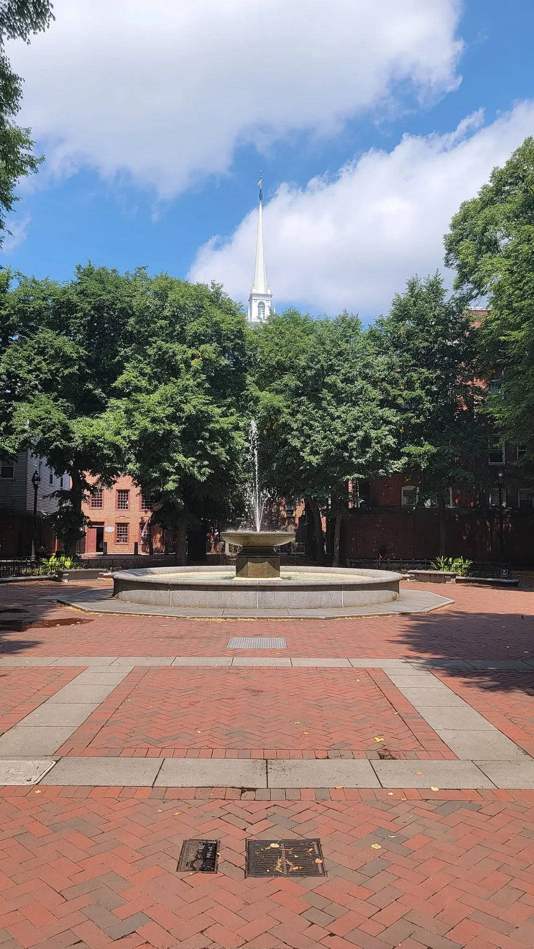
Paul Revere Mall in Boston
Paul Revere Mall in Boston is a park. Paul Revere Mall is located near Boston HarborWalk North End. Ⓦ.
- Leisure
- park
Restaurants
Places of worship
Artworks
Beauty salons
Doctor's offices
Attractions
Opticians
Tobacco shops
Liquor stores
Convenience stores
Schools
Candy stores
Cafes
Dry cleaners
Streets nearby
Tileston Place100 ft
Freedom TrailCreek Square, Union Oyster House, White Bull Tavern, TD Bank, Sons of Boston, Blackstone Grill, Kala Thai, The Bostonian Society Library and Special Collections, The Well, Citizens Bank
200 ft
Walsh Place250 ft
Harris StreetLucia Ristorante
250 ft
Fairfield PlaceChurch of the Messiah
250 ft
Paul Revere FootpathPaul Revere Statue
300 ft
Salutation StreetCommercial St @ Battery St, Boston Bottle
300 ft
Battery StreetAll Saints Way
400 ft
Hanover Avenue400 ft
Unity StreetCapt. Jackson’s Historic Chocolate Shop
400 ft
Unity Court400 ft
Belgravia Place400 ft
Clark Street450 ft
Fountain Place450 ft
Murphy Court500 ft
Powers Court550 ft
Holden Court0.1 mi
Henchman Street0.1 mi
Greenough Lane0.1 mi
Charter StreetEliot Elementary
0.1 mi
Goodridge Alley0.1 mi
Battery WharfBattery Wharf
0.1 mi
Boston HarborWalk North EndNight Shift Brewing, Lovejoy Wharf Ferry Terminal, Alcove
0.1 mi
Hanover StreetThe Wine Bottega, Giacomo's Ristorante, New Health Northend Waterfront Health, Panza, Rina’s Pizzeria & Cafe, Ristorante Cantina Italiana, Caffé Pompei, Mike's Pastry, Ristorante Saraceno, Galleria Umberto, The Daily Catch, Cafe Amaro, Hanover Dry Cleaners, Martini's Smoke Shop, Modern Pastry, Spagnulos, Caffè Paradiso, CVS Pharmacy, Santander, The Freedom Trail, Mother Anna's, Parla, Thinking Cup, Ristorante Fiore, Bank of America, United States Post Office, North End Lobster Co
0.1 mi
Petringo Court0.1 mi
Fiskes WharfCoast Guard Exchange
0.2 mi
Foster Court0.2 mi
Union Wharf0.2 mi
Callahan TunnelMeridian St @ Havre St
0.2 mi
Foster StreetDr. Maria Vasilakis, DMD
0.2 mi
Areas nearby
Battery Wharf Ballroom0.2 mi
Apartment buildings nearby
Eliot School300 ft
Boathouses nearby
Boston Station Boathouse0.2 mi
Buildings nearby
Sumner Tunnel Vent Building500 ft
Fire stations nearby
Boston Fire Department Engine 8, Ladder 1200 ft
Hotels nearby
Battery Wharf Hotel (Great Admiral Building)0.2 mi
Battery Wharf Hotel (Sea Cloud Building)0.2 mi
Military areas nearby
U.S. Coast Guard - Base Boston0.1 mi
Captain of the Port0.2 mi
Pier 30.3 mi
Pier 20.3 mi
Pier 10.3 mi
Parks nearby
Charter Street Playground0.1 mi
Places of worship nearby
Old Saint Stephens Church100 ft
Residential buildings nearby
Burroughs Wharf0.2 mi
Sports fields nearby
Andrew P. Puopolo Junior Athletic Field0.2 mi
Stations nearby
Water Taxi (Battery Wharf)0.2 mi
Swimming pools nearby
Marie E. Mirabella Pool0.2 mi
Other nearby
Liberatore Federico Square0.1 mi
| Year built | 1933 |
|---|---|
| Located in | Suffolk County |
| Country | United States |
 Public transit map Boston Legend
| Railway | |
| Bus | |
| Streetcar |
 Bicycle map Boston Legend
| Bike path | |
| Bike lane on roadway | |
| Cycling allowed on bus lane | |
| Bicycle street | |
| Open to cyclists | |
| Open to cyclists, good path | |
| Cycling prohibited | |
| Cobblestone |
| Long-distance bike route | (depending on scale) | |
| Long-distance bike route |
 Pedestrian map Boston Legend
| Path |
| Long-distance hiking trail | (depending on scale) | |
| Long-distance hiking trail | ||
| Pedestrians prohibited |