
The Parish of All Saints in Boston
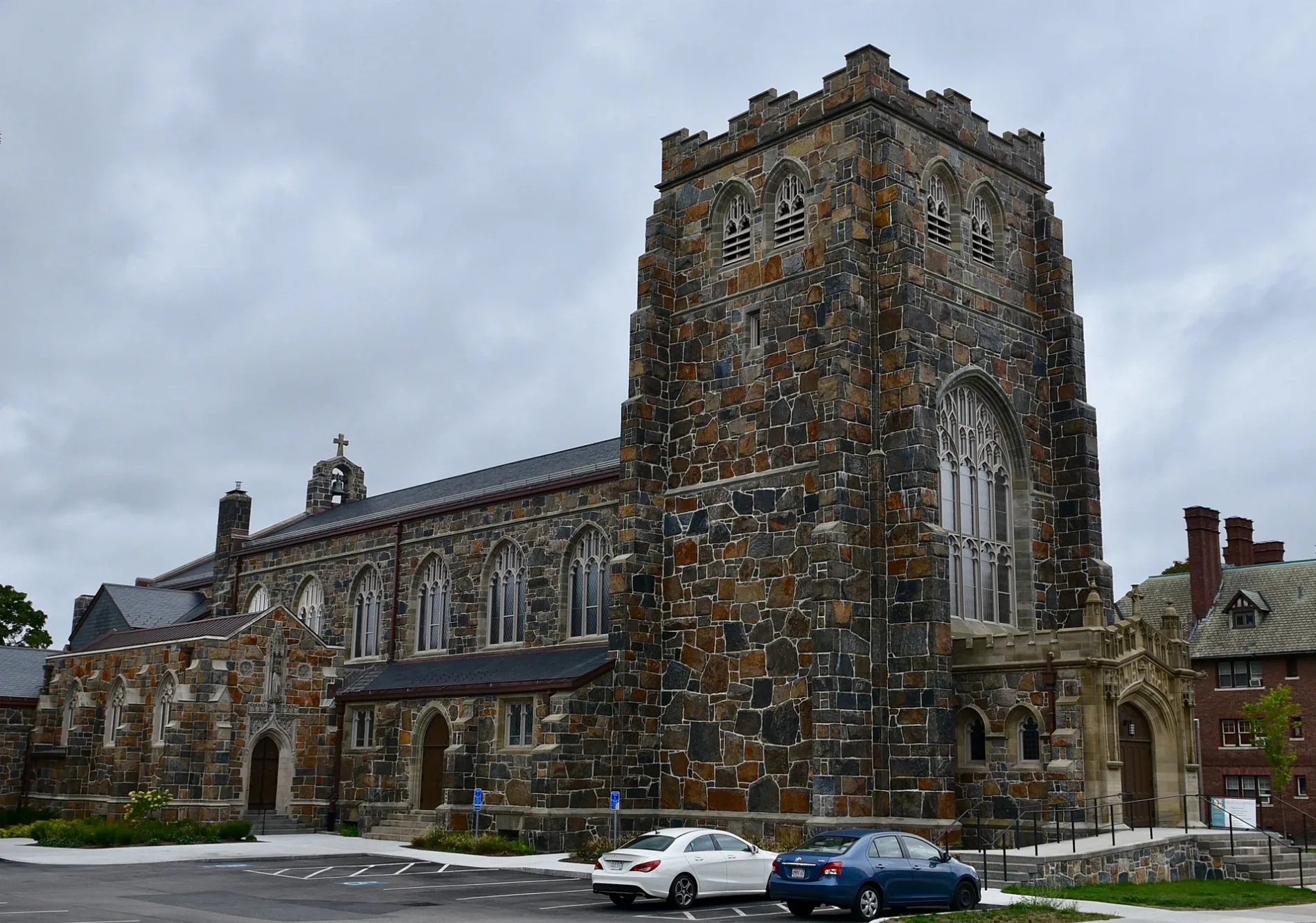
The Parish of All Saints in Boston is a Church, Ashmont Street 209 (02124). It is also known as All Saints Church and is built in the Gothic Revival style. The Church was built in 1894 and is a protected historic site. Ⓦ.
- House Number
- 209
- Postal Code
- 02124
- Street
- Ashmont Street
- Alternate Name
- All Saints Church; All-Saints Episcopal Church
- Amenity
- place of worship
- Building Type
- building
Image
Fast food restaurants
Cafes
Art galleries
Bus stops
Restaurants
Stations
Subway stops
Light rail stops
Streets nearby
Ashmont Park200 ft
Lombard Street200 ft
Bushnell Street250 ft
Dorchester AvenueSaint John Paul II Lower Mills Catholic Academy, Dorchester Ave @ Richmond St, Dorchester Ave @ Valley Rd, Dorchester Ave opp St Gregory St, Dorchester Ave opp Valley Rd, Opp 2165 Dorchester Ave, 2165 Dorchester Ave, Dorchester Ave Richmond St, Dorchester Ave and Mother Julia Road, Dorchester Ave and Richmond St, Dorchester Ave and St Gregory st, Dorchester Ave & Valley Rd, Dorchester Ave & Valley Road, Dorchester Ave @ Washington St, Dorchester Ave opp Adirondack Pl, Dorchester Ave and Washington St, 250 Dorchester Avenue, Dorchester Ave opp Kemp St, Dorchester Ave @ Dix St, Dorchester Ave @ Banton St, Dorchester Ave @ Centre St, Dorchester Ave @ Cheverus Rd, Dorchester Ave @ Dracut St, Dorchester Ave @ Gibson St, Dorchester Ave @ King St, Dorchester Ave @ Shepton St, Dorchester Ave @ Msgr Lydon Way, Dorchester Ave @ Parkman St, Dorchester Ave @ Talbot Ave, Dorchester Ave @ Welles Ave, Dorchester Ave opp Gibson St, 1621 Dorchester Ave opp Dix St, Blarney Stone, Dorchester Art Project, AKOKO - Coco Leaf Dorchester, McDonald's, Broadway, Dorchester Ave @ Gallivan Blvd, Dorchester Ave @ Hurlcroft Ave, Dorchester Ave @ Van Winkle St, Dorchester Ave & Galivan Blvd, Dorchester Ave & Hurlcroft Ave, Dorchester Ave & Van Winkle St, Ashmont Cycles, Cannonball Cafe, Park City Southie, Dorchester Ave @ Howell St, Dorchester Ave opp Howell St, Dorchester Ave @ Dorset St, Dorchester Ave @ Locust St, Dorchester Ave @ Columbia Rd, Dorchester Ave @ Crescent Ave, T&T Hair Salon, Eagle Liquors, The Banshee, Pantry Pizza, Columbia Road Gulf Service, Dorchester Ave @ Mt Vernon St, Speedway, Dorchester Ave @ Ellet St, Dorchester Ave @ Linden St, Red Line Pizza, Fort Point Post Office, Dorchester Ave @ Adams St, Bluebikes, Broadway Station - Red Line, South Boston Animal Hospital, Ashmont Station - Eastbound, Flat Black, The Local Hand, Dorchester @ Savin, Blue Bikes, Healing Thai Spa, The Munchie Station, Dorchester Ave @ Pearl St, Dorchester Ave @ Thornley Rd, Dorchester Ave @ Savin Hill Ave, JJ's Irish Pub & Grill, Shanti, Dorchester Ave @ Melvinside Ter, Cafe Polonia, Baltic European Delicatessen, Dorchester Ave opp Charles St, Just Book-ish, Dorchester Ave @ Hoyt St, Dorchester Ave @ Hancock St
400 ft
Rowena Street450 ft
Dracut Street0.1 mi
Adanac Terrace0.1 mi
Rundel Park0.1 mi
Carruth Street0.1 mi
Ashmont BuswayBerth 1: 215 / 217, Dorchester Ave and Fuller St, Tavolo, Berth 4: 21, Berth 3: 18 / 26, Berth 2: 24, Ashmont/Peabody Square, Berth 5: BAT 12, Berth 8: 23, Berth 7: 22, Berth 6: 240
0.1 mi
Radford LaneAshmont/Peabody Square, Ashmont
0.1 mi
Tilman Street0.2 mi
Talbot Place0.2 mi
Ashmont StreetSt Ann Catholic Church, Ashmont Deli
0.2 mi
Bailey StreetDunkin'
0.2 mi
Banton Street0.2 mi
Beale StreetDorchester Ave and beale st
0.2 mi
Edwin Street0.2 mi
Ocean Street0.2 mi
Alban Street0.2 mi
Denvir Street0.2 mi
Argyle Terrace0.2 mi
Carmela Lane0.3 mi
Clermont Street0.3 mi
Shepton Street0.3 mi
Burt Street0.3 mi
Hurlcroft Avenue0.3 mi
Argyle StreetTalbot Ave @ Argyle St
0.3 mi
Mellen Street0.3 mi
Welles Avenue0.3 mi
Talbot AvenueDorchester Center Post Office, Talbot Ave @ Brent St, Talbot Ave @ Dorchester Ave, Talbot Ave @ Lithgow St, Talbot Ave @ Welles Ave, 493 Talbot Ave opp Argyle St, Talbot Ave @ Kerwin St, Talbot Ave opp Kerwin St, Talbot Ave @ Bernard St, Talbot Ave @ Colonial Ave, Talbot Ave @ New England Ave, Talbot Ave @ Norwell St, Talbot Ave @ Spencer St, Opp 70 Talbot Ave, Talbot ave @ Nightingale St, Talbot Ave @ Franklin Field, Talbot Ave @ Norfolk St, Talbot Ave @ Southern Ave, Ashmont Grill, Thomas M. Casey Jr. Square
0.3 mi
Santuit Street0.3 mi
Waldorf Street0.3 mi
Mercier AvenueDorchester Ave and Mercier St
0.3 mi
Fuller Street0.3 mi
Joseph Street0.3 mi
Melbourne Street0.4 mi
Buildings nearby
Peabody Englewood Apartments0.1 mi
Convenience stores nearby
Tedeschi Food Shops350 ft
Fire stations nearby
Boston Fire Department Engine 18, Ladder 6400 ft
Light rail lines nearby
Mattapan Trolley0.2 mi
Parks nearby
Peabody Square350 ft
Places of worship nearby
Calvary Baptist Church0.2 mi
Residential buildings nearby
The Carruth0.1 mi
Subway lines nearby
Red Line - Ashmont Branch0.2 mi
Subway stops nearby
Ashmont/Peabody Square (Alewife)550 ft
Ashmont/Peabody Square (Inbound)0.1 mi
Train stations nearby
Ashmont/Peabody Square Station0.1 mi
Other nearby
Walter W. McGinn Square0.2 mi
| Year built | 1894 |
|---|---|
| Architectural style | Gothic Revival |
| Heritage designation | National Register of Historic Places listed place |
| Located in | Boston |
| Country | United States |
 Public transit map Boston Legend
| Railway | |
| Bus | |
| Streetcar |
 Bicycle map Boston Legend
| Bike path | |
| Bike lane on roadway | |
| Cycling allowed on bus lane | |
| Bicycle street | |
| Open to cyclists | |
| Open to cyclists, good path | |
| Cycling prohibited | |
| Cobblestone |
| Long-distance bike route | (depending on scale) | |
| Long-distance bike route |
 Pedestrian map Boston Legend
| Path |
| Long-distance hiking trail | (depending on scale) | |
| Long-distance hiking trail | ||
| Pedestrians prohibited |