
Southborough Town Pound in Southborough, Massachusetts
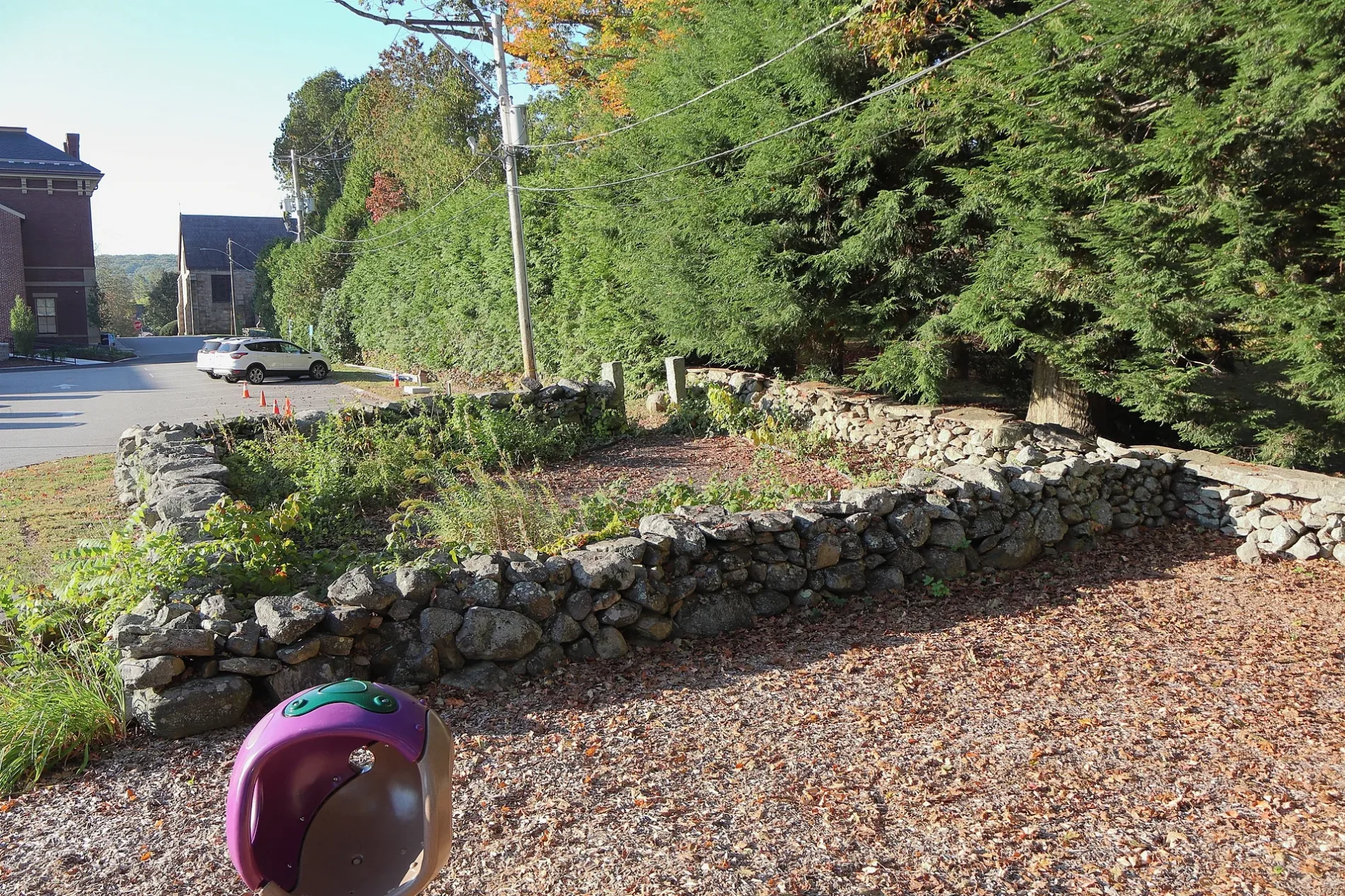
Southborough Town Pound in Southborough is a garden. Southborough Town Pound is also known as Southborough Veterans and Citizens Memorial Garden. Southborough Town Pound is located near Saint Marks Road. Southborough Town Pound is made of fieldstone.
- Alternate Name
- Southborough Veterans and Citizens Memorial Garden
- Leisure
- garden
Image
Places of worship
Fire stations
Parking lots
Opticians
Bus stops
Town halls
Artworks
Kiosks
Outdoor stores
General stores
Schools
Fast food restaurants
Police stations
Car dealerships
Doctor's offices
Platforms
Streets nearby
Saint Marks Road300 ft
Common StreetSouthborough Town Hall
450 ft
Main StreetSouthborough, Route 30 & Route 85, horseshoe sculpture
450 ft
Village Path0.2 mi
Saint Marks Circle0.2 mi
School RoadSouth Union School
0.3 mi
Middle Road0.3 mi
School Street0.3 mi
Park Street0.4 mi
Leo F Bertonazzi Avenue0.4 mi
Howes Court0.4 mi
Sudbury Reservoir Trail0.4 mi
Lyman Street0.5 mi
Marlboro Road0.5 mi
Hillside Avenue0.5 mi
Winchester Street0.6 mi
Newton Street0.6 mi
Upland Road0.6 mi
Ledge Hill Road0.7 mi
Waterways nearby
Wachusett Aqueduct0.4 mi
Banks nearby
Main Street Bank0.5 mi
Buildings nearby
Southborough Community House0.2 mi
Southborough Public Safety Building0.4 mi
Deerfoot Mansion0.4 mi
Southborough Golf Club0.4 mi
Cafes nearby
Mauro's Village Cafe0.4 mi
Canals nearby
Wacuhsett Aqueduct0.4 mi
Convenience stores nearby
Mauro's Market0.4 mi
Dormitories nearby
Thieriot House0.3 mi
West Campus0.4 mi
Fast food restaurants nearby
Fay School0.1 mi
Funeral homes nearby
Morris Funeral Home0.1 mi
Libraries nearby
Southborough Public Library0.1 mi
Nature reserves nearby
Clear Hill Hollow0.6 mi
Places of worship nearby
Pilgrim Congregational Church150 ft
Saint Marks Episcopal Church350 ft
Railways nearby
Boston Subdivision - Fitchburg Branch0.6 mi
Restaurants nearby
Southborough House of Pizza0.4 mi
School buildings nearby
Choate House0.1 mi
Putnam Family Arts Center0.3 mi
Sports centers nearby
Michel Faculty Athletic Center0.3 mi
Sports fields nearby
Flichtner Field400 ft
Barton Field0.1 mi
Sargent Family Field0.1 mi
Lawrence Field0.2 mi
Belmont Field0.2 mi
Thayer Field0.3 mi
West Field0.3 mi
Barber Field0.4 mi
| Year built | 1750 |
|---|---|
| Material | fieldstone |
| Heritage designation | National Register of Historic Places contributing property |
| Located in | Southborough |
| Country | United States |
| Key event | dedication, renovation, moved |
 Public transit map Southborough Legend
| Railway | |
| Bus | |
| Streetcar |
 Bicycle map Southborough Legend
| Bike path | |
| Bike lane on roadway | |
| Cycling allowed on bus lane | |
| Bicycle street | |
| Open to cyclists | |
| Open to cyclists, good path | |
| Cycling prohibited | |
| Cobblestone |
| Long-distance bike route | (depending on scale) | |
| Long-distance bike route |
 Pedestrian map Southborough Legend
| Path |
| Long-distance hiking trail | (depending on scale) | |
| Long-distance hiking trail | ||
| Pedestrians prohibited |