
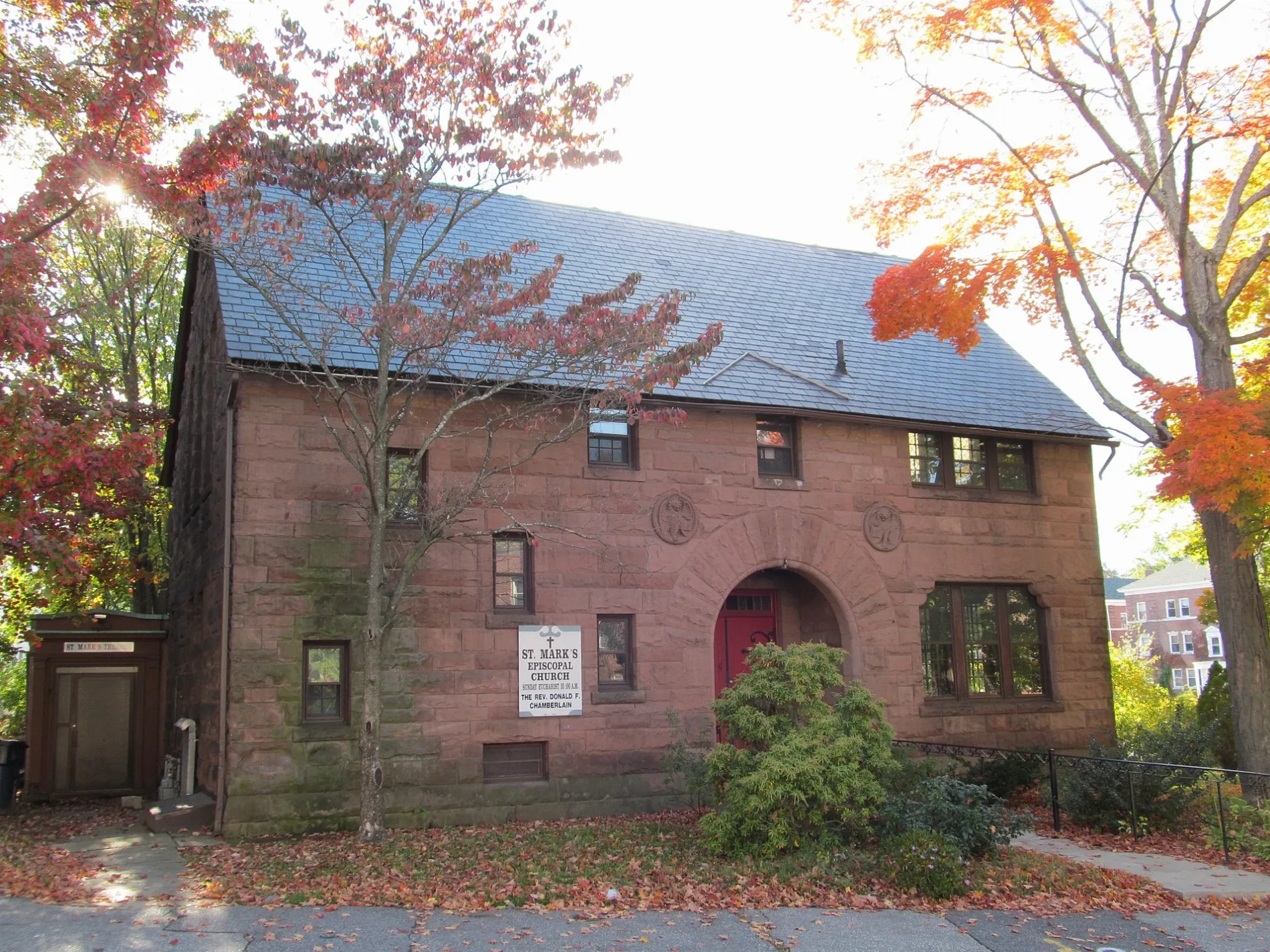
Saint Mark's Episcopal Church in Worcester, Massachusetts
Saint Mark's Episcopal Church in Worcester is a Church, Freeland Street 0. It is also known as St. Marks and is built in the Romanesque Revival architecture style. The Church is a protected historic site. Ⓦ.
- House Number
- 0
- Street
- Freeland Street
- Amenity
- place of worship
- Building Type
- building
Image
Fast food restaurants
Convenience stores
Event venues
Gift shops
Police stations
Theaters
Libraries
Supermarkets
Liquor stores
Bus stops
Artworks
Movie theaters
Restaurants
Cafes
Food courts
Bike rentals
Universities
Bakeries
Streets nearby
Freeland Terrace150 ft
Freeland Street350 ft
Lowell CourtMcDonald's
400 ft
Lowell StreetDippin Donuts
450 ft
Main StreetBrisas Tropical Restaurant, Saigon Restaurant, Webster Square Package Store, United States Post Office, Guy H. Burnham Map & Aerial Photograph Library, Higgins Cafe, The Den, Main St. + Crystal St., Clark University Campus Store, The Grind, Clark University Bike Share, Little Caesars, Onelove Cafe, Mia's Auto Detail, Chopsticks, Adom Market, Red Crab Juicy Seafood, Commerce Bank, Bowditch and Dewey Library, deadhorse hill, Joe's Albums, Country Bank, Coffee Time Cafe, St. Peter Central Catholic Elementary School, Belen Casa de Pan, Thu Duc Fast Food, Hacienda Don Juan, China Lantern, Quan Com Ga, Santana Company, Grunauer Hair Salon, Carlitos Barber Shop, Laura's Express RIA, Unique Nails Salon, Fantastic Pizza, Main South, The Community Thrift Store, Clark University Center for Geospatial Analytics
0.1 mi
Clement StreetSantiago's Market
0.1 mi
Tirrell Street0.1 mi
Beaver StreetNew Wine Pizza
0.1 mi
Marble Street0.2 mi
Oliver Street0.2 mi
Agawam Street0.2 mi
Crystal Street0.2 mi
Stoneland Road0.2 mi
Lucian Street0.2 mi
Richards Street7-Eleven, Goddard Branch Library
0.2 mi
Hitchcock Road0.2 mi
Haynes Street0.2 mi
Illinois Street0.2 mi
Irene Street0.3 mi
Ives Street0.3 mi
Cambridge StreetJennifer Lee's Gourmet Bakery, Ash Pharmacy, Sally's Boutique, Breen's, Christo's Pizza, Abrigo del Altísimo, PheChanT Beauty Pro, Accra Supermarket, Sacred Heart School, Culpeppers Bakery & Cafe
0.3 mi
Saugus Place0.3 mi
Duncan Avenue0.3 mi
Waller AvenuePrice Chopper
0.3 mi
Exeter Street0.4 mi
Knowlton AvenueWooden Bar
0.4 mi
Nixon Avenue0.4 mi
Fremont StreetCentral Massachusetts SPED Collaborative - Woodward Day School
0.4 mi
Webster StreetWebster Square Fire Station, Webster Square
0.4 mi
Buildings nearby
Clark Student Housing550 ft
Webster Square Tower East0.3 mi
Webster Square Tower West0.4 mi
Jeremiah's Inn0.4 mi
Cafes nearby
Holy Poke0.2 mi
Community centers nearby
American Legion Hall0.2 mi
Hardware stores nearby
Barrows Hardware0.4 mi
Industrial areas nearby
Applied Plastic Technology0.3 mi
Scrap It0.4 mi
Nightclubs nearby
Maya Lounge0.3 mi
Places of worship nearby
Jesus Life Center United Methodist Church0.3 mi
Railways nearby
Boston Subdivision0.3 mi
Recreation grounds nearby
Clark University Athletic Fields0.3 mi
Corash Tennis Courts0.3 mi
Restaurants nearby
Jean's Place0.3 mi
Retail areas nearby
Arena Plaza0.3 mi
Mill Street Plaza0.3 mi
Rivers nearby
Middle River0.3 mi
Social facilities nearby
Salvation Army0.3 mi
Sports centers nearby
Dolan Field House0.2 mi
| Architectural style | Romanesque Revival architecture |
|---|---|
| Heritage designation | National Register of Historic Places listed place |
| Located in | Worcester |
| Country | United States |
 Public transit map Worcester Legend
| Railway | |
| Bus | |
| Streetcar |
 Bicycle map Worcester Legend
| Bike path | |
| Bike lane on roadway | |
| Cycling allowed on bus lane | |
| Bicycle street | |
| Open to cyclists | |
| Open to cyclists, good path | |
| Cycling prohibited | |
| Cobblestone |
| Long-distance bike route | (depending on scale) | |
| Long-distance bike route |
 Pedestrian map Worcester Legend
| Path |
| Long-distance hiking trail | (depending on scale) | |
| Long-distance hiking trail | ||
| Pedestrians prohibited |