
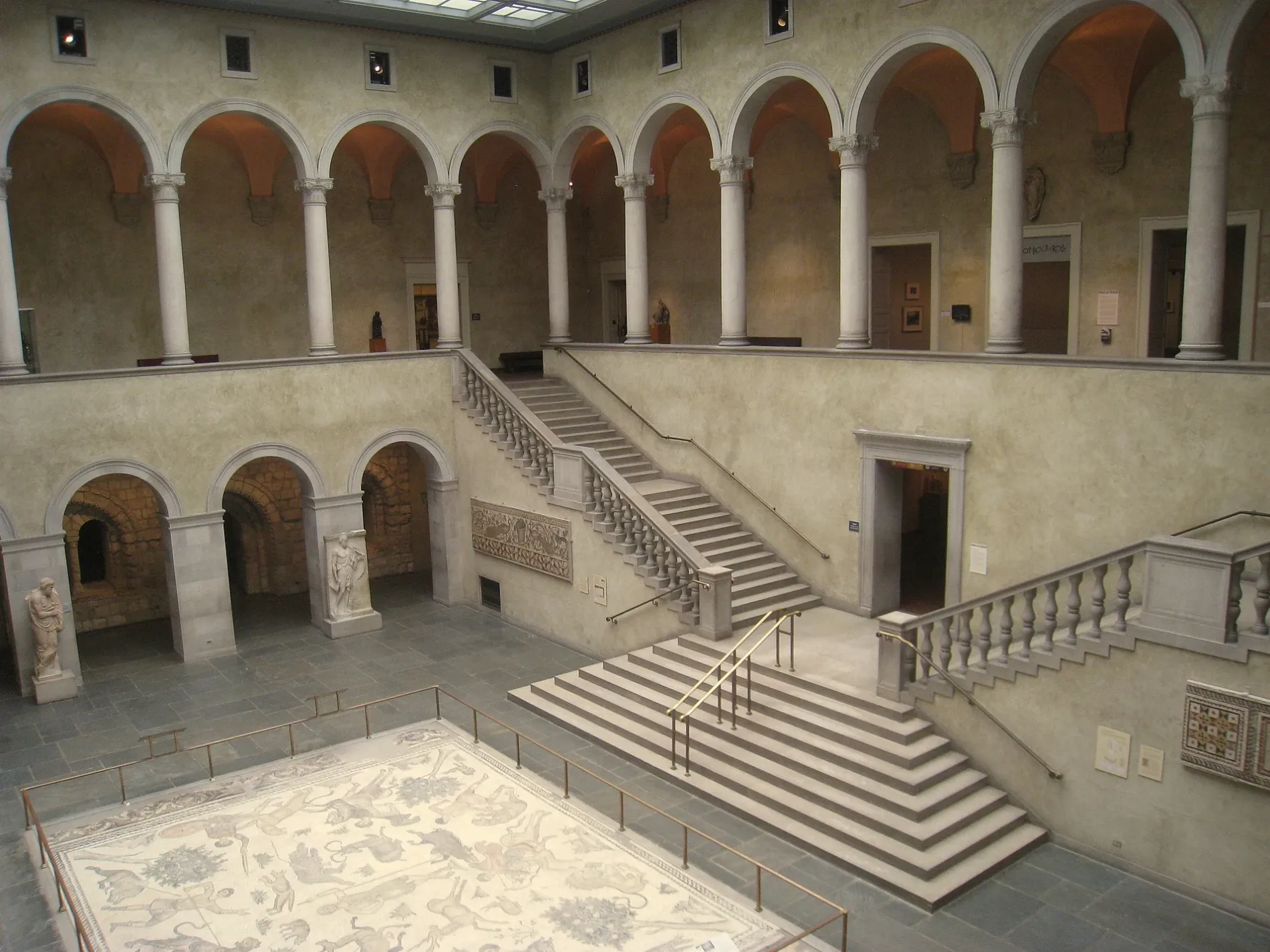
Worcester Art Museum in Worcester, Massachusetts
Worcester Art Museum in Worcester is a historic object, Salisbury Street 55. Worcester Art Museum is also known as WAM. Ⓦ.
- House Number
- 55
- Street
- Salisbury Street
- Building Type
- building
- Tourism
- museum;gallery
- Website
- https://www.worcesterart.org/
Image
Museums
Clinics
Police stations
Charging stations
Schools
Restaurants
Artworks
Cafes
Places of worship
Libraries
Galleries
- Worcester Art Museum (WLAN, Worcester Art Museum, opening hours: Wed–Sun 10–16, fee required, Web) at Salisbury Street 55 (01609) – approx. 250 ft.
Convenience stores
Pubs
Streets nearby
Tuckerman StreetWorcester Art Museum Library, Worcester Art Museum
100 ft
Institute RoadSalisbury Mansion, WPI Health Services, The Halal Shack
150 ft
Salisbury StreetTremont Columns, Upper Perrault Hall
450 ft
Lancaster Street0.1 mi
Wachusett StreetMount Olive Pentecostal Church
0.1 mi
Dean Street0.1 mi
Grove StreetWorcester Fire Department, 30, 30 The Trolley Stop, O'Reilly Auto Parts, Wachusett Spirits, Indian Lake Pathway Waypoints Directions, Armenian Apostolic Church, Indian Lake Pathway Waypoint and Direction Sign, Indian Lake Pathway Trailhead, Indian Lake Pathway Waypoint Directions, Shell, Dunkin', Ciao Bella, Northworks Bar & Grille, Fuel America - Grove Street, The Fix Burger Bar
0.1 mi
Highland StreetHuman Chess Board, The Sole Proprietor, Thai Time, Bean Counter, Boynton Restaurant & Spirits, Tech Pizza, Subway, Dragon Dynasty, The Boynton, Taqueria del Pueblo, Grill and Green, Major Taylor Museum
0.1 mi
Main StreetOnelove Cafe, Mia's Auto Detail, Brisas Tropical Restaurant, Saigon Restaurant, Webster Square Package Store, United States Post Office, Guy H. Burnham Map & Aerial Photograph Library, Higgins Cafe, The Den, Main St. + Crystal St., Clark University Campus Store, The Grind, Clark University Bike Share, Little Caesars, Chopsticks, Adom Market, Red Crab Juicy Seafood, Commerce Bank, Bowditch and Dewey Library, deadhorse hill, Joe's Albums, Country Bank, Coffee Time Cafe, St. Peter Central Catholic Elementary School, Belen Casa de Pan, Thu Duc Fast Food, Hacienda Don Juan, China Lantern, Quan Com Ga, Santana Company, Grunauer Hair Salon, Carlitos Barber Shop, Laura's Express RIA, Unique Nails Salon, Fantastic Pizza, Main South, The Community Thrift Store, Clark University Center for Geospatial Analytics
0.1 mi
Lancaster Terrace0.2 mi
Lincoln SquareLincoln Square
0.2 mi
Lincoln StreetCVS Pharmacy, Ruby Tuesday, Papa Gino's, 5 & Diner, Kyoto, Azteca, McDonald's, Press Box, Taco Bell, KFC, Walgreens
0.2 mi
Court Street0.2 mi
Concord Street0.2 mi
Faraday Street0.2 mi
State Street0.2 mi
Prescott StreetMa Academy for Math and Science School
0.2 mi
Harvard Street0.2 mi
Leisure nearby
Wheaton Square450 ft
Apartment buildings nearby
Courthouse Lofts0.1 mi
Buildings nearby
Salisbury Mansion200 ft
Worcester Historical Society350 ft
Phi Kappa Theta0.1 mi
Armory0.1 mi
Tau Kappa Epsilon0.1 mi
Zeta Psi0.1 mi
Lambda Chi Alpha0.1 mi
Theta Chi0.1 mi
Phi Sigma Kappa0.2 mi
Sigma Alpha Epsilon0.2 mi
Commercial buildings nearby
Zawada Insurance Agency0.1 mi
Dormitories nearby
Wachusett House500 ft
Faraday Hall0.2 mi
Founders Hall0.2 mi
Hotels nearby
Courtyard Worcester0.2 mi
Hampton Inn & Suites0.2 mi
Parking lots nearby
East Hall Garage0.2 mi
Parks nearby
Gateway Park0.1 mi
Places of worship nearby
United Congregational Church400 ft
Trinity Lutheran Church450 ft
Epworth United Methodist Church0.1 mi
First Unitarian Church0.2 mi
Wesley United Methodist Church0.2 mi
Residential buildings nearby
Voke Lofts0.1 mi
Sigma Pi0.1 mi
Theaters nearby
Tuckerman Hall400 ft
Worcester Memorial Auditorium400 ft
University buildings nearby
Gateway Park I0.2 mi
Other nearby
Elm Park0.2 mi
| Year built | 1898 |
|---|---|
| Official opening | 1898 |
| Located in | Worcester |
| Country | United States |
| Described by | Open GLAM Survey |
| Has part | Higgins Armory Museum |
| Location | Worcester |
 Public transit map Worcester Legend
| Railway | |
| Bus | |
| Streetcar |
 Bicycle map Worcester Legend
| Bike path | |
| Bike lane on roadway | |
| Cycling allowed on bus lane | |
| Bicycle street | |
| Open to cyclists | |
| Open to cyclists, good path | |
| Cycling prohibited | |
| Cobblestone |
| Long-distance bike route | (depending on scale) | |
| Long-distance bike route |
 Pedestrian map Worcester Legend
| Path |
| Long-distance hiking trail | (depending on scale) | |
| Long-distance hiking trail | ||
| Pedestrians prohibited |