
Image
Cafes
Bus stops
Streets nearby
Adams Elementary Nature Trail0.4 mi
96th Avenue North0.4 mi
97th Avenue NorthPenn Av N, Oliver Av N, Newton Av N, Russell Av N, Fallgold Pkwy, Vincent Av, Almond Av N, Evergreen Av, Cherrywood Av, Washburn Av, Thomas Av, Upton Av, Sheridan Av, Little Free Library
0.5 mi
Knox Avenue North0.5 mi
MN-6100.5 mi
Logan Avenue North0.5 mi
Tamarack Street Northwest0.5 mi
Russell Avenue North99 Av N, 100 Av N, Penn Av (N), Russell Circle (N)
0.5 mi
Morgan Avenue North0.5 mi
Irving Avenue North0.5 mi
99th Avenue North0.5 mi
Unity Street Northwest0.5 mi
89th Lane Northwest0.5 mi
West River RoadSunset Trail, Noble Av N, Willow Rd, Mississippi Dr N, Indiana Av, ZIegler Dr, Sunset Rd, #10449, Newton Av N, Irving Av N, Logan Av N, James Av N, #7800, 79 Av N, #7733, Brookdale Dr, #7932, 81 Av N, WayCross Evangelical Church, 100 Av N, 101 Lane, 85 Av N, 89 Av N, 92 Av N, Banfill Circle, 88 Av N, 93 Av N, Mattson Brook Ln, #9510, West River Rd, 82 Av N, Pearson Pkwy, 83 Av N, #8331, #8400
0.5 mi
100th Avenue North0.6 mi
Treetop Trail0.6 mi
Mississippi Boulevard NorthwestLittle Free Library
0.6 mi
Sycamore Street Northwest0.6 mi
95th Avenue NorthNoble Pkwy, Noble Parkway Mobil
0.6 mi
101st Lane North0.6 mi
Russell Circle North0.6 mi
96th Way North0.6 mi
Edward D. Shimek Nature Trail0.6 mi
Newton Avenue North0.6 mi
87th Avenue Northwest0.7 mi
88th Lane Northwest0.7 mi
Sheridan Avenue North0.7 mi
88th Avenue Northwest0.7 mi
Thomas Avenue North0.7 mi
Oliver Avenue North0.7 mi
94th Way North0.8 mi
86th Avenue Northwest0.8 mi
93rd Way North0.8 mi
93rd Trail North0.8 mi
93rd Avenue NorthLittle Free Library
0.8 mi
Penn Avenue North0.9 mi
James Avenue North0.9 mi
Buildings nearby
Activity Center and Warming House0.6 mi
Gateway Center0.6 mi
Event venues nearby
Leopold's Mississippi Gardens0.5 mi
Parks nearby
Coon Rapids Dam Regional Park350 ft
Mississippi Gateway Regional Park0.1 mi
Willowstone Park0.6 mi
Rivers nearby
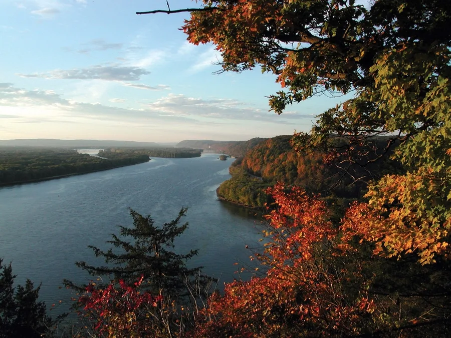
Mississippi River0.2 mi
Lower Coon Creek0.4 mi
School buildings nearby
Adams Elementary0.6 mi
Shelters nearby
Pavillion #20.5 mi
Pavillion #30.6 mi
Streams nearby
Pleasure Creek0.7 mi
Waters nearby
Cenaiko Lake0.2 mi
| Length | 3766 |
|---|---|
| Located in | United States |
| Country | United States |
| Source | Lake Itasca |
| Mouth | Gulf of Mexico |
| Tributary | Black River, Arkansas River, Ohio River, Saint Croix River, Wisconsin River, Rock River, Illinois River, Kaskaskia River, Minnesota River, Des Moines River, White River, Apple River, Big Muddy River, St. Francis River, Yazoo River, Big Black River, Maquoketa River, Wolf River, Rice Creek, Iowa River, Turkey River, Loosahatchie River, Meramec River, Wapsipinicon River, Chippewa River, River des Peres, Bayou Pierre, Catfish Creek, Crow River, Duck Creek, Hatchie River, Henderson Creek, Little Maquoketa River, Marys River, Obion River, Prairie River, Rum River, Rush River, Salt River, Schoolcraft River, Skunk River, Swan River, Trempealeau River, Turtle River, Upper Iowa River, Vermillion River, Wind River, Yellow River, Village Creek, Brazeau Creek, Cinque Hommes Creek, Nokasippi River, Apple Creek, Coles Creek, River aux Vases, Minnehaha Creek, Fox River, Bassett Creek, Sucker Creek, Missouri River |
| Native name | Mississippi River |
| Described by | Sytin Military Encyclopedia, Small Brockhaus and Efron Encyclopedic Dictionary, Brockhaus and Efron Encyclopedic Dictionary, Jewish Encyclopedia of Brockhaus and Efron, The Nuttall Encyclopædia, Great Soviet Encyclopedia (1926–1947), The Encyclopedia Americana, The American Cyclopædia, Encyclopædia Britannica 11th edition, Collier's New Encyclopedia, 1921, The New Student's Reference Work, New International Encyclopedia, Meyer’s Universum, Fünfzehnter Band, Meyer’s Universum, Siebzehnter Band, Meyer’s Universum, Achtzehnter Band, Granat Encyclopedic Dictionary |
 Public transit map Coon Rapids Legend
| Railway | |
| Bus | |
| Streetcar |
 Bicycle map Coon Rapids Legend
| Bike path | |
| Bike lane on roadway | |
| Cycling allowed on bus lane | |
| Bicycle street | |
| Open to cyclists | |
| Open to cyclists, good path | |
| Cycling prohibited | |
| Cobblestone |
| Long-distance bike route | (depending on scale) | |
| Long-distance bike route |
 Pedestrian map Coon Rapids Legend
| Path |
| Long-distance hiking trail | (depending on scale) | |
| Long-distance hiking trail | ||
| Pedestrians prohibited |