
Mississippi River in University
Mississippi River in Minneapolis is a river. Mississippi River is also known as The Mississippi. Ⓦ.
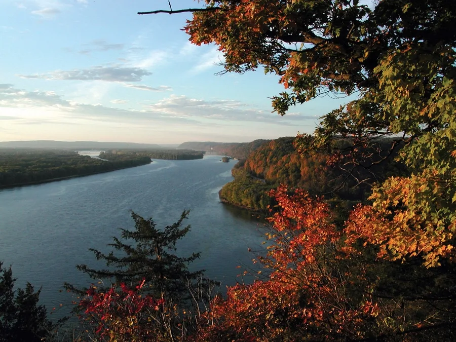
- Waterway Type
- river
Streets nearby
Lower Trail250 ft
Southeast Mill Avenue0.1 mi
Southeast 3rd Avenue0.2 mi
Southeast Main StreetThe Cabana Club, Jefe, Water Power on the East Side, Lonely's Bar, Aster Cafe, The Main Cinema
0.2 mi
Southeast 5th Avenue0.2 mi
Southeast University AvenueAlma, University Ave SE & 2nd Ave SE, University Ave SE & 6th Ave SE, Union Bank & Trust, Cafe Alma, Mr. Santana
0.2 mi
Southeast 2nd Avenue0.2 mi
Southeast 2nd StreetWatershed Spa, Upper Garage, Lower Garage
0.3 mi
Southeast 7th Avenue0.3 mi
Southeast 6th AvenueStone Arch Tattoo, Alma
0.3 mi
Southeast 8th Avenue0.3 mi
4th Street Southeast4th St SE & 6th Ave SE, Frank from Philly & Andrea Pizza, Maxwell's Cafe and Grill, Ramadan’s Egyptian Coffee House, 4th St SE & 10th Ave SE
0.4 mi
Southeast 4th Avenue0.4 mi
Southeast 6th StreetMarcy-Holmes, DOME Salon, Grey Fox Pottery, Hazel & Rose, Prospect Refuge Gallery
0.5 mi
Apartment buildings nearby
Red Tile Elevator0.1 mi
Mill & Main0.1 mi
Phoenix on the River0.2 mi
Flour Sack Flats0.2 mi
Stone Arch Apartments0.2 mi
Expo Minneapolis0.2 mi
Winslow House0.3 mi
Archer0.3 mi
Oliver & Wendell0.3 mi
Thomas Place Apartments0.3 mi
Coze Flats0.3 mi
Lume0.3 mi
Ashmore0.3 mi
Labor Retreat0.4 mi
Saint Anthony Village0.5 mi
Bars nearby
Hideaway Cabin Bar0.2 mi
Buildings nearby
Southeast Steam Plant0.2 mi
Conference centers nearby
Minneapolis Event Centers0.2 mi
Event venues nearby
Machine Shop0.2 mi
Houses nearby
Horatio P. Van Cleve House0.4 mi
Industrial buildings nearby
Saint Anthony Falls Laboratory0.1 mi
Pillsbury A Mill0.1 mi
Office buildings nearby
United Labor Centre0.4 mi
Parking lots nearby
St. Anthony Falls Ramp0.2 mi
Parks nearby
Lucy Wilder Morris Park0.1 mi
Holmes Park0.4 mi
Places of worship nearby
Alfa y Omega0.3 mi
Residential areas nearby
Holmes Park Village0.3 mi
Residential buildings nearby
Mill & Main West0.1 mi
Stone Arch 20.2 mi
Retail buildings nearby
St. Anthony Main0.2 mi
Rivers nearby
Mississippi River East Channel500 ft
School buildings nearby
Marcy Elementary0.4 mi
Single-family houses nearby
Woodbury Fisk House0.4 mi
Other nearby
Williams Island250 ft
| Length | 3766 |
|---|---|
| Located in | United States |
| Country | United States |
| Source | Lake Itasca |
| Mouth | Gulf of Mexico |
| Tributary | Black River, Arkansas River, Ohio River, Saint Croix River, Wisconsin River, Rock River, Illinois River, Kaskaskia River, Minnesota River, Des Moines River, White River, Apple River, Big Muddy River, St. Francis River, Yazoo River, Big Black River, Maquoketa River, Wolf River, Rice Creek, Iowa River, Turkey River, Loosahatchie River, Meramec River, Wapsipinicon River, Chippewa River, River des Peres, Bayou Pierre, Catfish Creek, Crow River, Duck Creek, Hatchie River, Henderson Creek, Little Maquoketa River, Marys River, Obion River, Prairie River, Rum River, Rush River, Salt River, Schoolcraft River, Skunk River, Swan River, Trempealeau River, Turtle River, Upper Iowa River, Vermillion River, Wind River, Yellow River, Village Creek, Brazeau Creek, Cinque Hommes Creek, Nokasippi River, Apple Creek, Coles Creek, River aux Vases, Minnehaha Creek, Fox River, Bassett Creek, Sucker Creek, Missouri River, Rice River |
| Native name | Mississippi River |
| Described by | Sytin Military Encyclopedia, Small Brockhaus and Efron Encyclopedic Dictionary, Brockhaus and Efron Encyclopedic Dictionary, Jewish Encyclopedia of Brockhaus and Efron, The Nuttall Encyclopædia, Great Soviet Encyclopedia (1926–1947), The Encyclopedia Americana, The American Cyclopædia, Encyclopædia Britannica 11th edition, Collier's New Encyclopedia, 1921, The New Student's Reference Work, New International Encyclopedia, Meyer’s Universum, Fünfzehnter Band, Meyer’s Universum, Siebzehnter Band, Meyer’s Universum, Achtzehnter Band, Granat Encyclopedic Dictionary |
Public transit map University Legend
| Railway | |
| Bus | |
| Streetcar |
Bicycle map University Legend
| Bike path | |
| Bike lane on roadway | |
| Cycling allowed on bus lane | |
| Bicycle street | |
| Open to cyclists | |
| Open to cyclists, good path | |
| Cycling prohibited | |
| Cobblestone |
| Long-distance bike route | (depending on scale) | |
| Long-distance bike route |
Pedestrian map University Legend
| Path |
| Long-distance hiking trail | (depending on scale) | |
| Long-distance hiking trail | ||
| Pedestrians prohibited |