
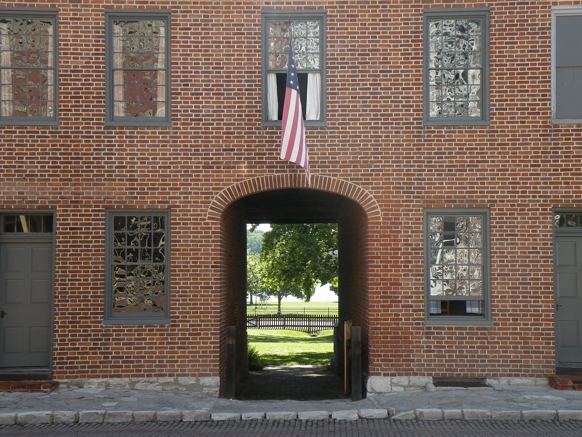
Washington Street in St. Charles, Missouri
Washington Street in Saint Charles is a residential street. It runs in a southeast-northwest direction and crosses North Main Street and ends at Riverside Drive, while the other end is a cul-de-sac. Washington Street also exists in Augusta.
- Road Type
- pedestrian zone
- Route
- southeast-northwest
Image
Restaurants
Antique stores
Ice cream shops
Galleries
- Missouri Artists On Main (opening hours: Mon–Sun 11–17, Web) at South Main Street 321 (63301) – approx. 0.2 mi.
Doctor's offices
Bus stops
Bookstores
Housewares stores
Cafes
Town halls
Tourist information centers
Fire stations
Courthouses
Drugstores
Clothing stores
Bakeries
Streets nearby
Katy TrailLewis and Clark Statue, L&C Expedition, Lewis & Clark Campsite, Captain Clark's Journal, 39, Water Quality, What you can do to help, Why is this area a wetland, Insects & Wetlands, Water in wetlands, Wetlands-Where land & water meet, Ecopark Information, Plants in wetlands, Wildlife & Wetlands, What happens when wetlands are lost, Why wetlands are valuable, 40, Mammals, Birds All Around
500 ft
North Second StreetSaint Charles, Saint Charles Fire Department, Saint Charles City Hall, Second Street and Clark Street, Second Street and Lawrence Street, Second Street and Tecumseh Street
500 ft
South Main StreetFig & Lyle's Bakery, MOss Boutique, Riverside Sweets, Provenance Soapworks, Siostra Polish Pottery, Saint Charles Coffee & Creperie, Missouri Artists On Main, Main Street Books, Salt + Smoke, Sugar & Slice Bakery, Main Street and Ameristar Boulevard, Lewis & Clark Restaurant
0.1 mi
North Main Street0.1 mi
South Second StreetSecond Street and Boone's Lick Road
0.1 mi
Adams StreetBenton Elementary School
0.1 mi
Madison StreetMedical Office Building 2, Medical Office Building 1, Missouri State Park Visitor Center Tour Information
0.1 mi
North Third StreetOld Court House, Franklin School, Dairy Queen, Hardee's
0.1 mi
Monroe Street0.1 mi
Riverside DriveFoundry Art Centre, First Capitol Drive and Riverside Drive, Riverside Drive and First Capitol Drive
0.2 mi
South Third Street0.2 mi
Clark StreetSecond Street and Clark Street, Kingshighway and Clark Street
0.2 mi
First Capitol DriveSaint Joseph Health Center, First United Methodist Church, First Capitol Drive and Kingshighway, Fifth Street and First Capitol Drive, SSM Health St. Joseph Hospital, Kilwins, Kabab N Kurry, Spirit Shoppe, Campus Service Center
0.2 mi
Jefferson StreetOld City Hall, Picasso's Coffee, French Flea
0.2 mi
North Fourth StreetForth Street and Tecumseh Street
0.2 mi
South Fourth Street0.3 mi
Jackson StreetGrandma's Cookies
0.3 mi
North Fifth StreetFifth Street and Jefferson Street, Fifth Street and Randolph Street
0.4 mi
Decatur StreetSacred Heart Academy
0.4 mi
North Main Center0.4 mi
Arts centers nearby
Performing Arts Center300 ft
Foundry Art Centre0.2 mi
Banks nearby
First Bank450 ft
Bars nearby
Bombshell Bar and Grill200 ft
Baha Rock Club400 ft
Big A's On the Riverfront450 ft
Mr Thirsty's500 ft
Buildings nearby
The Grand Opera House450 ft
hsgw insurance services500 ft
Old City Hall500 ft
St. Charles County Executive Office0.1 mi
WSI Distributors0.1 mi
First Missouri State Capitol State Historic Site0.2 mi
Churches nearby
St. Peter Catholic Church0.2 mi
Clothing stores nearby
Thro Clothing Co200 ft
Stitches Etc0.1 mi
Hospitals nearby
SSM St Joseph Hospital St Charles0.2 mi
Industrial buildings nearby
Wesco Machinery & Industrial Movers(Under Construction)0.3 mi
Jewelry stores nearby
Walters Jewelry Inc300 ft
Parking lots nearby
Saint Josephs Hospital Parking Garage0.2 mi
Parks nearby
Berthold Square Park0.2 mi
Places of worship nearby
Shrine of St Rose Philippine Duchesne0.3 mi
Restaurants nearby
Novellus50 ft
Burger Underground200 ft
Picasso's Coffee400 ft
Taiaynas Pizza0.1 mi
Sports centers nearby
Main Street Gym0.1 mi
Climb So iLL at the Steel Shop0.4 mi
Tourist information centers nearby
Katy Trail St. Charles0.2 mi
Public transit map Saint Charles Legend
| Railway | |
| Bus | |
| Streetcar |
Bicycle map Saint Charles Legend
| Bike path | |
| Bike lane on roadway | |
| Cycling allowed on bus lane | |
| Bicycle street | |
| Open to cyclists | |
| Open to cyclists, good path | |
| Cycling prohibited | |
| Cobblestone |
| Long-distance bike route | (depending on scale) | |
| Long-distance bike route |
Pedestrian map Saint Charles Legend
| Path |
| Long-distance hiking trail | (depending on scale) | |
| Long-distance hiking trail | ||
| Pedestrians prohibited |