
Image
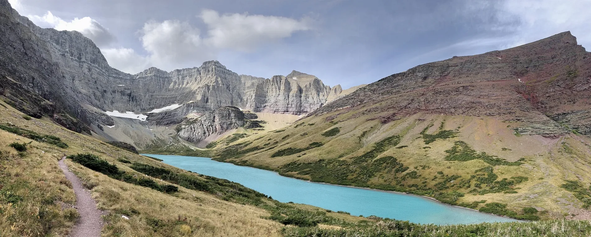
Streets nearby
Cracker Lake Trail2.2 mi
South Shore Josephine Lake Trail2.7 mi
Piegan Pass Cutoff2.8 mi
Hidden Falls Trail2.9 mi
Josephine Walk2.9 mi
Grinnell Lake Trail2.9 mi
Swiftcurrent Cutoff Trail2.9 mi
North Shore Josephine Lake Trail2.9 mi
Swiftcurrent LakeGrinnell Glacier Trailhead;Swiftcurrent Lake Trailhead
3.1 mi
Siyeh Pass TrailBaring Creek Trailhead
3.2 mi
Sawmill RoadSouth Shore Josephine Lake Trailhead
3.2 mi
Swiftcurrent Lake TrailIceberg Lake Trailhead, Swiftcurrent Picnic Area Trailhead, Many Glacier
3.2 mi
Piegan Pass TrailPiegan Pass North Trailhead, Piegan Pass Trailhead, Gunsight Pass Trailhead
3.3 mi
Cracker Flats Horse Trail3.3 mi
Many Glacier Hotel ConnectorSwiftcurrent Trailhead;Iceberg Ptarmigan Trailhead
3.3 mi
Siyeh Bend CutoffSiyeh Bend Trailhead
3.4 mi
Many Glacier Hotel Parking RoadCracker Lake Trailhead, Ptarmigan Dining Room
3.4 mi
Going-to-the-Sun RoadSiyeh Bend, Saint Mary Backcountry Permit Office, Saint Mary Visitor Center, Saint Mary, Trail & Creek Outfitters, Jackson Glacier Overlook, Sunrift Gorge, Golden Staircase
3.5 mi
Buildings nearby
Oastler Shelter/Head Josephine Lake2.7 mi
Lake Josephine (foot) boathouse3.1 mi
Residence (Birch)3.1 mi
Boat Concessions Storage Shed3.2 mi
Boathouse (GPI)3.2 mi
Ice House3.2 mi
Fire Shed3.4 mi
Horse Concession ticket sales3.4 mi
Outhouse3.4 mi
Utility3.5 mi
Ticket Office3.5 mi
Shed (utility)3.5 mi
Dormitory3.6 mi
Shed3.7 mi
Campgrounds nearby
Cracker Lake Camps0.4 mi
Glaciers nearby
Siyeh Glacier1.5 mi
Sexton Glacier2.8 mi
Hotels nearby
Many Glacier Lodge3.5 mi
Rivers nearby
Boulder Creek2.1 mi
Streams nearby
Canyon Creek100 ft
Allen Creek2.0 mi
Siyeh Creek2.0 mi
Cataract Creek2.8 mi
Grinnell Creek3.0 mi
Baring Creek3.4 mi
Waters nearby
Falling Leaf Lake1.9 mi
Snow Moon Lake2.0 mi
Otokomi Lake2.8 mi
Stump Lake2.8 mi
Lake Josephine2.9 mi
Governor Pond3.2 mi
| Protected area | Glacier National Park |
|---|---|
| Located in | Glacier County |
| Country | United States |
 Public transit map Glacier County Legend
| Railway | |
| Bus | |
| Streetcar |
 Bicycle map Glacier County Legend
| Bike path | |
| Bike lane on roadway | |
| Cycling allowed on bus lane | |
| Bicycle street | |
| Open to cyclists | |
| Open to cyclists, good path | |
| Cycling prohibited | |
| Cobblestone |
| Long-distance bike route | (depending on scale) | |
| Long-distance bike route |
 Pedestrian map Glacier County Legend
| Path |
| Long-distance hiking trail | (depending on scale) | |
| Long-distance hiking trail | ||
| Pedestrians prohibited |