
The Garden Wall in East Glacier Park, MT 59434
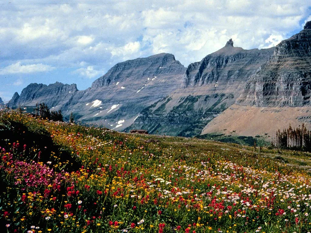
The Garden Wall in East Glacier Park, MT 59434 (Glacier County) is a Arete. Ⓦ.
- Nature
- arete
Image
Streets nearby
Highline TrailHighline Trailhead South, Fifty Mountain
0.6 mi
Feather Plume Cutoff1.2 mi
Going-to-the-Sun RoadBig Bend, Sinclair, West Glacier, Food Market, Oberlin Bend, Logan Pass Continental Divide, Sun Tours, Glacier National Park, Granite Park Trailhead, Crystal Point, Bird Woman Falls Overlook, Weeping Wall, The Loop, Sprague Creek Campground, McDonald Creek Overlook, Red Rock Point, Red Rocks
1.3 mi
Piegan Pass TrailPiegan Pass North Trailhead, Piegan Pass Trailhead, Gunsight Pass Trailhead
1.5 mi
Hidden Falls Trail1.9 mi
Grinnell Glacier Trail2.1 mi
Grinnell Lake Trail2.1 mi
Garden Wall TrailGrinnell Glacier Overlook
2.3 mi
Josephine Walk2.7 mi
Packer's Roost Road2.7 mi
North Shore Josephine Lake Trail3.3 mi
Swiftcurrent Pass TrailSwiftcurrent Pass Trailhead, Redrock Falls
3.4 mi
Siyeh Bend CutoffSiyeh Bend Trailhead
3.5 mi
South Shore Josephine Lake Trail3.5 mi
Siyeh Pass TrailBaring Creek Trailhead
3.6 mi
Piegan Pass Cutoff3.6 mi
Attractions nearby
Weeping Wall1.3 mi
Buildings nearby
maintenance1.7 mi
Outhouse2.6 mi
Oastler Shelter/Head Josephine Lake2.7 mi
Annex/Dormitory3.3 mi
Maintenance/trails cabin3.3 mi
Chlorinator3.3 mi
Cabins nearby
Patrol Cabin2.6 mi
Campgrounds nearby
Cracker Lake Camps3.2 mi
Glaciers nearby
Grinnell Glacier0.6 mi
Gem Glacier0.7 mi
Salamander Glacier1.7 mi
Swiftcurrent Glacier2.1 mi
Piegan Glacier2.5 mi
Siyeh Glacier2.8 mi
Public restrooms nearby
Composting toilet3.3 mi
Streams nearby
Cataract Creek1.0 mi
Haystack Creek1.0 mi
Grinnell Creek1.3 mi
Logan Creek2.0 mi
Alder Creek2.2 mi
Lunch Creek3.0 mi
Siyeh Creek3.5 mi
Swiftcurrent Creek3.6 mi
Allen Creek3.6 mi
Tourist information centers nearby
Logan Pass Visitor Center3.3 mi
Vacation homes nearby
Granite Park Chalet3.3 mi
Waters nearby
Upper Grinnell Lake1.3 mi
Grinnell Lake1.8 mi
Lake Josephine3.1 mi
Bullhead Lake3.2 mi
Windmaker Lake3.5 mi
Stump Lake3.6 mi
| Elevation | 9553 |
|---|---|
| Protected area | Glacier National Park |
| Located in | Flathead County |
| Country | United States |
| Highest point | Mount Gould (Montana) |
 Public transit map Glacier County Legend
| Railway | |
| Bus | |
| Streetcar |
 Bicycle map Glacier County Legend
| Bike path | |
| Bike lane on roadway | |
| Cycling allowed on bus lane | |
| Bicycle street | |
| Open to cyclists | |
| Open to cyclists, good path | |
| Cycling prohibited | |
| Cobblestone |
| Long-distance bike route | (depending on scale) | |
| Long-distance bike route |
 Pedestrian map Glacier County Legend
| Path |
| Long-distance hiking trail | (depending on scale) | |
| Long-distance hiking trail | ||
| Pedestrians prohibited |