
Lewis & Clark Landing in Omaha, Nebraska
Lewis & Clark Landing in Omaha is a park. Lewis & Clark Landing is located near Riverfront Plaza. Ⓦ.
- Leisure
- park
Image
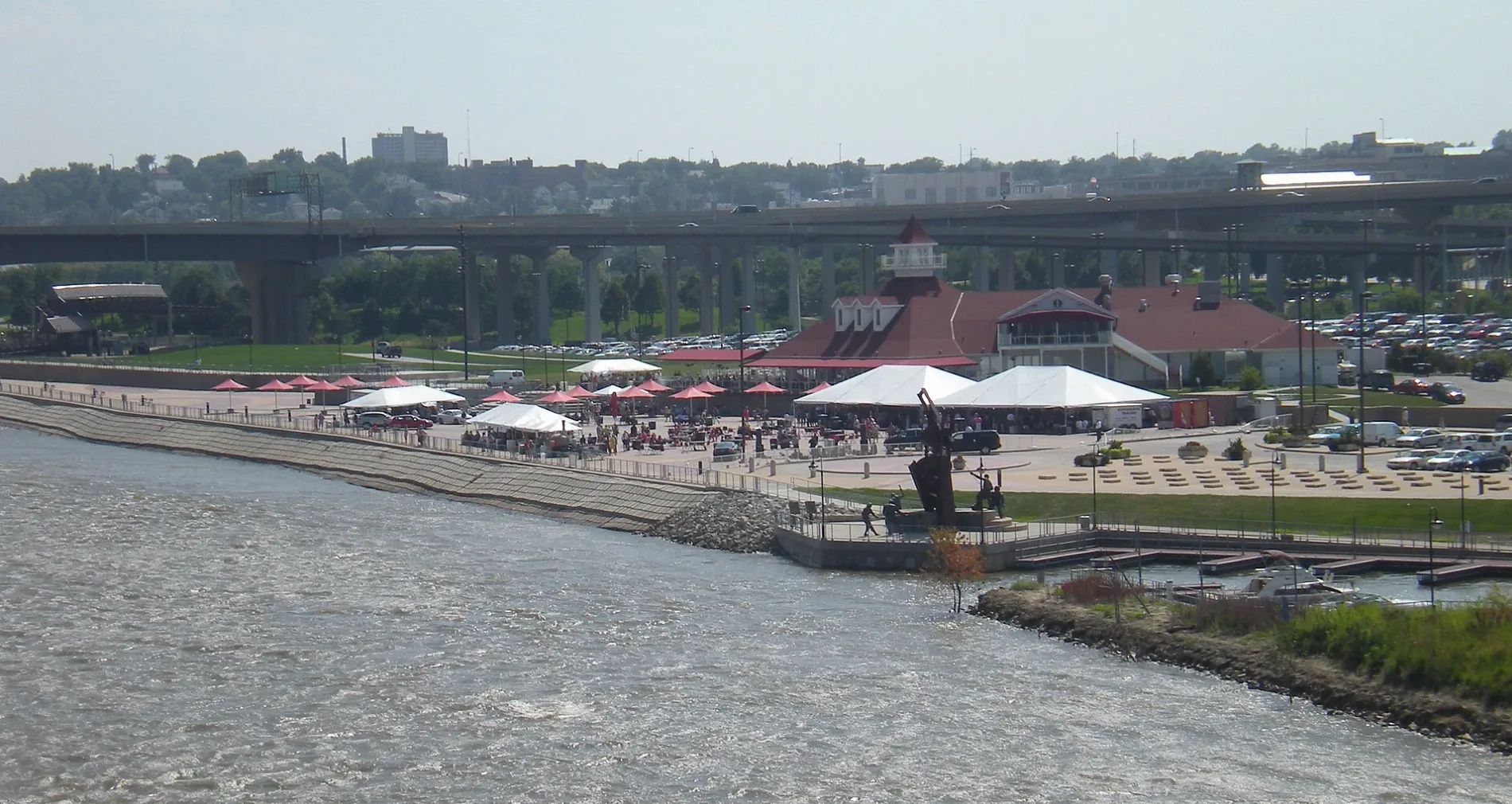
Bus stops
Cafes
Bike rentals
Restaurants
Pubs
Artworks
Bars
Nightclubs
Parking lots
Streets nearby
Baby Bob Pedestrian Bridge0.2 mi
MECA Drive0.2 mi
Martin Luther King Junior BridgeSioux Warrior sculpture
0.2 mi
Bob Kerrey Pedestrian Bridge0.2 mi
Riverfront Plaza0.3 mi
Cass StreetA V Sorenson Branch Library, Lewis Art Gallery, Personal Threads Boutique, Lied Education Center for the Arts, Fazoli's
0.3 mi
North 8th Street0.3 mi
Gerald R Ford Expressway0.3 mi
North 9th Street0.3 mi
Omaha Riverfront TrailChief Big Elk Statue, Holiday Inn Express & Suites Omaha Airport
0.3 mi
Capitol AvenueMoe & Curly's, J. Gilberts, Starbucks, Howard & Fine, DJ's Dugout, Bright Horizons Edward Zorinsky Child Development Center, 16th & Capitol
0.3 mi
South 8th Street8th & Farnam, 8th & Farnam ORBT Stop
0.4 mi
North 11th Street0.4 mi
Dodge StreetLOCAL Beer Patio & Kitchen, 72nd & Dodge ORBT Station NW, Nosh, Scmitt Music, Five Guys, Beauty Brands Salon Spa Superstore, Panera Bread, Casey's General Store, Jimmy John's, 33rd & Dodge ORBT Stop SW, 33rd & Dodge ORBT Station NW, Children's Physicians, 49th & Dodge ORBT Station NE, 49th & Dodge ORBT Station SE, Merle Norman, Lola's Cafe, Kohll's, The Bike Union, 20th & Dodge ORBT Station, Anna's Place, Tous les Jours, JINYA Ramen Bar, Wolf Brothers Western Store, Fuddruckers, Aspen Dental, 72nd & Dodge ORBT Station SE, Scooter's Coffee, Physicians Clinic - First Eye Associates, West Omaha Sports Medicine and Orthopedic Surgery PC Center, 12th & Dodge ORBT Station, 24th & Dodge ORBT Station, 24th and Dodge ORBT Station NW, Central High School, Capitol Hill, BP, Summit Dental Health, Pageturners lounge, Buchanan Service, 62nd & Dodge ORBT Station SE, 62nd & Dodge ORBT Station NW, 72nd & Dodge (SW), Potbelly, Skechers, Stereo West Autotoys, LongHorn Steakhouse, 42nd & Dodge ORBT Station SE, Keystone Trail & Dodge ORBT Stop NE, Keystone Trail & Dodge ORBT Stop SE, Dodge St & 76th St, Element Omaha Midtown Crossing, 42nd & Dodge ORBT Station NE, Burger King, Park Ave & Dodge ORBT Stop, 15th & Dodge ORBT Station, 44th & Dodge SW, 44th & Dodge NE
0.4 mi
Davenport StreetEpoca Cantina, Beer Can Alley, The Exchange, Saint Barnabas Parish, Yates Alternative School, Society 1854, The Jewell, Burdock + Bitters, Muenster Chiropractic Clinic, 16th and Davenport, Fuzzy's Taco Shop, American Eagle Outfitters, Cold Stone Creamery, Gap, J.Crew, Maurices, Eat Fit Go, Lululemon, V Nails, Kumon, claire's, Bath & Body Works, Carter's, 402 Eat + Drink, Altar'd State, Arula, Warby Parker, Coach, Sunglass Hut, CHI Health Amphitheatre, Rowan, Gunderson's Jewelry, Madewell, Lush, White House Black Market, Old Navy, JoS. A. Bank, Village Pointe East, Christopher & Banks, Loft, Banana Republic, DSW, Apple Store, Sephora, Francesca's, Soma, Evereve, Ancho & Agave, Fabletics, Aerie, Athleta, Tradehome Shoes, Scooter's Coffeehouse, Buckle, Yellow Ascending, 22 1/2 Degrees with Crayon Tips, Annie's, Garbo's Salon & Spa, Chico's, J.Jill, Kendra Scott, Goodly Cookies
0.4 mi
River Edge Service Road0.4 mi
North 12th StreetBurgerIM, The Brunch Box
0.4 mi
Gallup Drive0.4 mi
Mike Fahey StreetLawlor's Custom Sportswear, Ruth Sokolof Theater, NoDo, Rocco's Pizza & Cantina, Lefty's, Mike Fahey St & N 16th St (SW), Mike Fahey St & N 15th St (SW)
0.4 mi
North 10th StreetMarriott/Capitol District Valet, 10th & Capitol
0.4 mi
Cuming StreetCuming & 30th NW, The Salvation Army Chapel, Harvest Community Church, Village Pointe Toyota, China Taste, IDEAL, 24th & Cuming SW, The Road to Omaha, CL and Rachel Werner Center for Health Sciences Education, 24th & Cuming NW, Subway, The Dugout, Burger Theory, 23rd & Cuming NE, 22nd & Cuming SW
0.5 mi
Riverfront TrailLewis & Clark Landing, Fig. Café
0.5 mi
Avenue BHoly Family Church, Epworth United Methodist Church
0.5 mi
Riverfront DriveBob Kerry Pedestrian Bridge Omaha
0.5 mi
Abbott DriveAvis, Enterprise, Hertz, Dance of the Cranes
0.5 mi
North 41st Street0.5 mi
Avenue ECouncil Bluffs Bible Chapel, Church of God of Prophecy, Peace Church of the Brethren
0.5 mi
Avenue CDodge Memorial Congregational Church
0.5 mi
Avenue FWalk of Grace Chapel
0.5 mi
Aaron Ferer Plaza0.6 mi
Abandoned railways nearby
Union Pacific0.2 mi
Apartment buildings nearby
Riverfront Place Tower II0.2 mi
Riverfront Place Tower I0.2 mi
Buildings nearby
Carl T. Curtis Building500 ft
Construction sites nearby
The Beam Construction Site0.4 mi
Grasslands nearby
Gallup Open Field0.6 mi
Hotels nearby
Hilton Omaha0.3 mi
Marriott Hotel Downtown Omaha at The Capitol District0.4 mi
Museums nearby
Kiewit Luminarium0.2 mi
Office buildings nearby
Gallup0.4 mi
Parking lots nearby
The Capitol District Garage0.4 mi
Parks nearby
Tom Hanafan River's Edge Park0.3 mi
Playgrounds nearby
Discovery Playground0.2 mi
Public buildings nearby
River's Edge Pavilion0.4 mi
Pubs nearby
Blatt Beer & Table0.4 mi
Residential areas nearby
Riverfront Place0.3 mi
Row houses nearby
Riverfront Place Townhomes0.2 mi
Sports centers nearby
CHI Health Center Omaha0.3 mi
Stadiums nearby
CHI Health Center Arena0.2 mi
| Located in | Nebraska |
|---|---|
| Country | United States |
 Public transit map Omaha Legend
| Railway | |
| Bus | |
| Streetcar |
 Bicycle map Omaha Legend
| Bike path | |
| Bike lane on roadway | |
| Cycling allowed on bus lane | |
| Bicycle street | |
| Open to cyclists | |
| Open to cyclists, good path | |
| Cycling prohibited | |
| Cobblestone |
| Long-distance bike route | (depending on scale) | |
| Long-distance bike route |
 Pedestrian map Omaha Legend
| Path |
| Long-distance hiking trail | (depending on scale) | |
| Long-distance hiking trail | ||
| Pedestrians prohibited |