This page is the City map of Nebraska, a state of the United States of America with streets, paths and places. Nebraska covers about 200,520 square kilometres and had approximately 1,961,504 residents according to the supplied regional data. The population increased from 1,826,341 in 2010 to 1,961,504 in 2020. Nebraska was founded as a state in 1867 and lies at an elevation of about 790 metres above sea level.
Emerson is a village in Nebraska recorded at administrative level 8. The village lies in Dixon, Dakota and Thurston counties. Its recorded population is 840, and its elevation is 455 metres. The mapped area is 1,226,613 square metres.
Cedar Creek is a village in Nebraska recorded at administrative level 8. It is included in the Nebraska City map as a distinct local place. The regional map records Cedar Creek separately from the surrounding county areas. Its administrative classification identifies it as a village rather than a county or city.
Oxford is a village in Nebraska recorded at administrative level 8. The place appears as an individual settlement in the Nebraska map data. Oxford is distinct from the county areas listed elsewhere on this page. Its mapped classification identifies the settlement as a village.
Halsey is a village in Nebraska recorded at administrative level 8. The village is located in Blaine and Thomas counties. Halsey has a recorded population of 68 and an elevation of 822 metres. Its mapped area is 501,217 square metres.
Palisade is a village in Nebraska recorded at administrative level 8. The village lies in Hitchcock and Hayes counties. Its recorded population is 294, and its elevation is 841 metres. The mapped area covers 919,483 square metres.
United States Navy Band from Washington, D.C., USA, Public domain – Wikimedia Commons
Wakefield is a city in Nebraska recorded at administrative level 8. It is shown as a separate urban place in the regional map data. The city classification distinguishes Wakefield from the villages listed in the same region. Wakefield is also separate from the county-level units of Nebraska.
Tilden is a city in Nebraska recorded at administrative level 8. The city lies in Antelope and Madison counties and was established in 1880. Tilden has a recorded population of 992 and an elevation of 513 metres. Its mapped area is 1,911,361 square metres.
Stanton County is a county-level administrative area in Nebraska recorded at administrative level 6. It is shown separately from Stanton County’s settlements and roads in the regional map. The county is one of Nebraska’s 93 counties. Its county boundary forms part of the administrative structure represented on this page.
Madison County is a Nebraska county recorded at administrative level 6. The county is distinct from the city of Madison and from villages such as Tilden. It forms a separate administrative unit in the Nebraska map. County roads and local places are represented within its boundary.
Pierce County is a county in Nebraska recorded at administrative level 6. The county was established in 1856 and has a recorded population of 7,317. Its mapped area is approximately 1,490,000,000 square metres. The county is distinct from the city and village places shown elsewhere in the regional data.
Wayne County is a Nebraska county recorded at administrative level 6. It was established in 1867 and has a recorded population of 9,697. The county appears as a separate administrative unit on the Nebraska map. Its boundary includes local streets, paths and places represented in the map data.
Deuel County is a county-level administrative area in Nebraska recorded at administrative level 6. It is shown as a distinct county on the regional map. The county boundary is separate from those of Cheyenne, Kimball and Perkins counties. Local roads and places are mapped within the administrative framework.
Cheyenne County is a county in Nebraska recorded at administrative level 6. The county was established in 1867 and has a recorded population of 9,468. Its mapped area is approximately 3,099,000,000 square metres. Cheyenne County is represented separately from neighbouring county units in the regional map.
Perkins County is a Nebraska county recorded at administrative level 6. It was established in 1887 and has a recorded population of 2,858. The county covers approximately 2,290,000,000 square metres in the supplied map data. Its administrative boundary is shown separately from Chase and Keith counties.
Kimball County is a county-level administrative area in Nebraska recorded at administrative level 6. It is represented as an individual county on the Nebraska map. The county is distinct from Cheyenne and Deuel counties. Roads and places within its boundary belong to the regional map structure.
Dundy County is a Nebraska county recorded at administrative level 6. It was established in 1873 and has a recorded population of 1,654. Its mapped area is approximately 2,385,000,000 square metres. The county forms a separate administrative unit in southwestern Nebraska.
Chase County is a Nebraska county recorded at administrative level 6. The county was established in 1886 and has a recorded population of 3,893. It covers approximately 2,325,000,000 square metres in the supplied data. Chase County is mapped separately from Dundy, Perkins and Frontier counties.
Saunders County is a Nebraska county recorded at administrative level 6. Its supplied population is 21,016. The county is represented as a separate administrative unit in the regional map. County boundaries distinguish Saunders County from Douglas and Butler counties.
Garfield County is a county-level administrative area in Nebraska recorded at administrative level 6. It appears as an individual county in the Nebraska map data. The county is distinct from Valley, Wheeler and Blaine counties. Its local roads and places are represented within the mapped boundary.
Banner County is a Nebraska county recorded at administrative level 6. It is shown as a separate administrative area in the western part of the state map. Banner County is distinct from adjacent Cheyenne and Scotts Bluff county units. The regional map records streets, paths and places within its boundary.
Nuckolls County is a county-level administrative area in Nebraska recorded at administrative level 6. It appears as a separate county in the regional map. The county is distinct from Thayer, Webster and Clay counties. Its administrative boundary organizes the local places and transport network shown on the map.
Thomas County is a Nebraska county recorded at administrative level 6. It is represented as an individual county in the Nebraska map data. The county is distinct from Blaine, Hooker and Cherry counties. Its roads and settlements are included within the county boundary.
Loup County is a Nebraska county recorded at administrative level 6. It was established in 1883 and has a recorded population of 607. The mapped area is approximately 1,479,000,000 square metres. Loup County is shown as a separate administrative area in central Nebraska.
Thayer County is a county-level administrative area in Nebraska recorded at administrative level 6. It appears as an individual county on the regional map. The county is distinct from Jefferson, Nuckolls and Fillmore counties. Local roads and places are organized within its mapped boundary.
McPherson County is a Nebraska county recorded at administrative level 6. It is shown as a separate county in the Nebraska map data. The county is distinct from Thomas, Lincoln and Logan counties. Its administrative boundary contains the mapped local transport network and places.
Valley County is a Nebraska county recorded at administrative level 6. It was established in 1871 and has a recorded population of 4,059. The county covers approximately 1,478,000,000 square metres. Valley County is represented separately from Garfield, Greeley and Sherman counties.
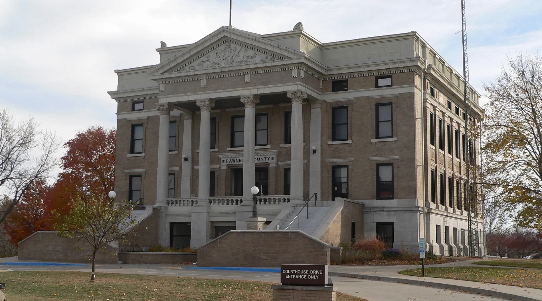
Pawnee County is a county-level administrative area in Nebraska recorded at administrative level 6. It is shown as an individual county in the state map. Pawnee County is distinct from Richardson, Nemaha and Johnson counties. Streets, paths and places are mapped within its county boundary.
Sarpy County is a Nebraska county recorded at administrative level 6. It has a recorded population of 190,604 and an area of approximately 640,000,000 square metres. The county was established in 1857 and forms part of the urban area around Omaha. Its location is distinct from neighbouring Douglas and Saunders counties.
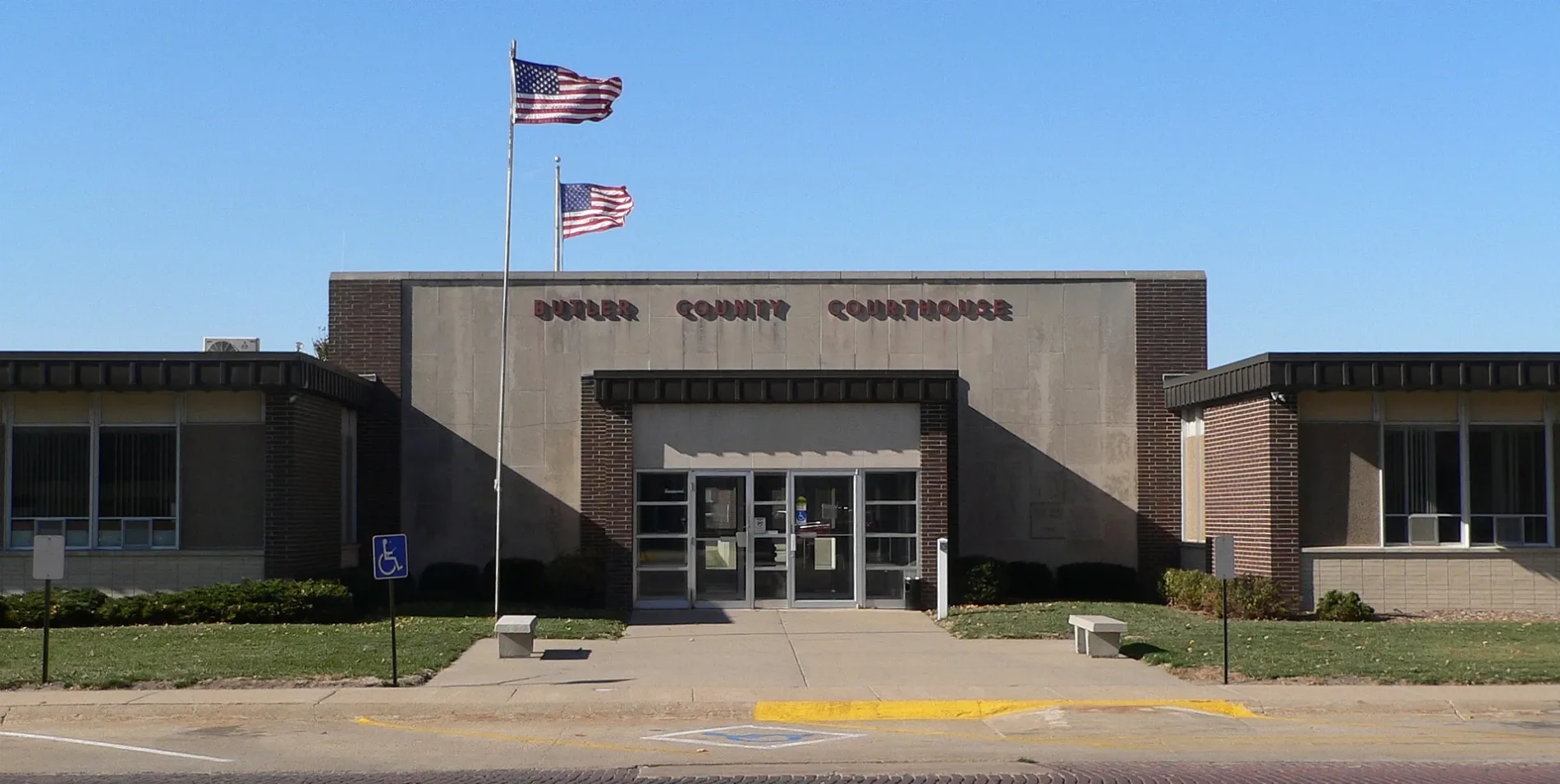
Butler County is a Nebraska county recorded at administrative level 6. It was established in 1868 and has a recorded population of 8,369. The mapped area is approximately 1,514,000,000 square metres. Butler County is represented separately from Saunders, Platte and Colfax counties.
Frontier County is a Nebraska county recorded at administrative level 6. It was established in 1872 and has a recorded population of 2,519. The county covers approximately 2,438,000,000 square metres. Frontier County is shown separately from Lincoln, Dawson, Gosper and Chase counties.
Cherry County is a county-level administrative area in Nebraska recorded at administrative level 6. It is represented as a separate county in the north-central part of the regional map. Cherry County is distinct from Thomas, Brown and Sheridan counties. Its mapped boundary contains local roads and places.
Nance County is a Nebraska county recorded at administrative level 6. It appears as an individual county in the state map data. The county is distinct from Merrick, Boone and Platte counties. Its streets, paths and places are organized within the county boundary.
Blaine County is a Nebraska county recorded at administrative level 6. It was established in 1885 and has a recorded population of 431. The county covers approximately 1,850,000,000 square metres. The village of Halsey is associated with Blaine County and Thomas County.
Dawes County is a Nebraska county recorded at administrative level 6. It was established in 1885 and has a recorded population of 8,199. Its mapped area is approximately 3,628,000,000 square metres. Dawes County is a separate county unit in western Nebraska.
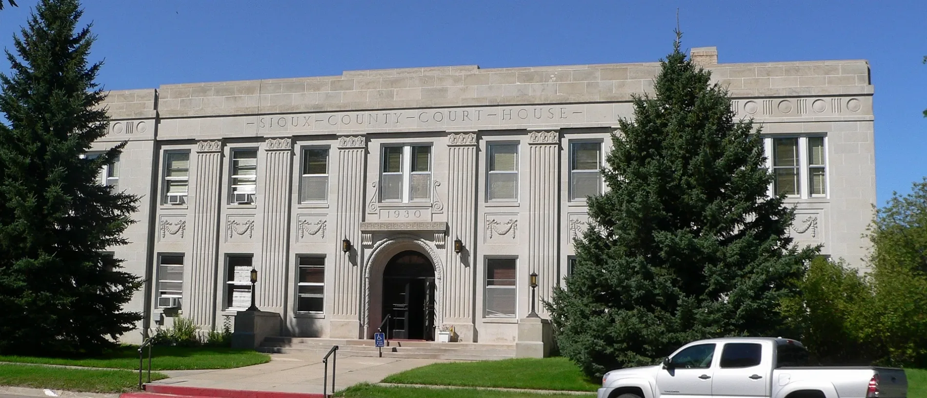
Sioux County is a county-level administrative area in Nebraska recorded at administrative level 6. It is shown as an individual county in the western part of the state map. Sioux County is distinct from Dawes, Box Butte and Scotts Bluff counties. The mapped boundary includes its local roads and places.
Jefferson County is a Nebraska county recorded at administrative level 6. It appears as a separate administrative unit in the southeastern part of the Nebraska map. The county is distinct from Thayer, Gage and Saline counties. Local streets and places are represented inside its county boundary.
Williamborg ( talk ) 02:04, 16 June 2008 (UTC), Public domain – Wikimedia Commons
Douglas County is a Nebraska county recorded at administrative level 6 and contains the city of Omaha. The county was established in 1854 and has a recorded population of 584,526. It covers approximately 880,000,000 square metres and has a recorded elevation of 376 metres. Douglas County is one of the principal urban administrative areas represented on the Nebraska map.
Webster County is a Nebraska county recorded at administrative level 6. It was established in 1871 and has a recorded population of 3,395. The county appears as a separate administrative area in southern Nebraska. Its boundary is distinct from Adams, Nuckolls and Franklin counties.
Burt County is a county-level administrative area in Nebraska recorded at administrative level 6. It appears as an individual county on the regional map. The county is distinct from Washington, Cuming and Thurston counties. Its local streets and places are represented within the county boundary.
Scotts Bluff County is a Nebraska county recorded at administrative level 6. It was established in 1888 and has a recorded population of 36,084. The county covers approximately 1,931,000,000 square metres. Scotts Bluff County includes Scottsbluff, and the regional image data identifies Scotts Bluff Summit at Scottsbluff National Monument as a notable Nebraska landscape.
Franklin County is a Nebraska county recorded at administrative level 6. It was established in 1871 and has a recorded population of 2,889. Its mapped area is approximately 1,492,000,000 square metres. Franklin County is represented separately from Webster, Harlan and Kearney counties.
Red Willow County is a county-level administrative area in Nebraska recorded at administrative level 6. It is shown as a separate county in the southern part of the Nebraska map. The county is distinct from Frontier, Hitchcock and Furnas counties. Roads and local places are included within its mapped boundary.
Fillmore County is a Nebraska county recorded at administrative level 6. It appears as an individual county in the regional map. The county is distinct from Thayer, Clay, York and Saline counties. Its administrative boundary contains the local streets and places shown on the map.
Gosper County is a county-level administrative area in Nebraska recorded at administrative level 6. It is represented as a separate county in the central part of the state map. Gosper County is distinct from Frontier, Dawson, Phelps and Furnas counties. Local roads and settlements are mapped within its boundary.
Merrick County is a Nebraska county recorded at administrative level 6. It was established in 1858 and has a recorded population of 7,668. The mapped area is approximately 1,281,000,000 square metres. Merrick County is shown separately from Nance, Platte, Polk and Hall counties.
Knox County is a Nebraska county recorded at administrative level 6. It was established in 1854 and has a recorded population of 8,391. The county covers approximately 2,952,000,000 square metres. Knox County is represented separately from Cedar, Antelope and Holt counties.
Clay County is a Nebraska county recorded at administrative level 6. It was established in 1871 and has a recorded population of 6,104. Its mapped area is approximately 1,485,000,000 square metres. Clay County is distinct from Fillmore, Adams, Nuckolls and Hamilton counties.
Mississippi Department of Archives and History, Public domain – Wikimedia Commons
Adams County is a Nebraska county recorded at administrative level 6. It was established in 1871 and has a recorded population of 31,205. The county covers approximately 1,461,000,000 square metres. Adams County is represented separately from Clay, Webster, Hall and Kearney counties.
Richardson County is a Nebraska county recorded at administrative level 6. It was established in 1855 and has a recorded population of 7,871. The mapped area is approximately 1,440,000,000 square metres. Richardson County is located in southeastern Nebraska and is distinct from Pawnee, Nemaha and Johnson counties.
Sherman County is a Nebraska county recorded at administrative level 6. It was established in 1871 and has a recorded population of 2,959. The county covers approximately 1,481,000,000 square metres. Sherman County is represented separately from Valley, Custer, Howard and Buffalo counties.
Phelps County is a Nebraska county recorded at administrative level 6. It was established in 1873 and has a recorded population of 8,968. Its mapped area is approximately 1,400,000,000 square metres. Phelps County is distinct from Gosper, Dawson, Kearney and Harlan counties.
Dodge County is a Nebraska county recorded at administrative level 6. It was established in 1855 and has a recorded population of 37,167. The county covers approximately 1,409,000,000 square metres. Dodge County is represented separately from Burt, Saunders, Washington and Colfax counties.
Harlan County is a county-level administrative area in Nebraska recorded at administrative level 6. It appears as an individual county in the southern-central part of the regional map. Harlan County is distinct from Phelps, Franklin, Furnas and Phillips counties. Its local roads and places are represented within its boundary.
Seward County is a Nebraska county recorded at administrative level 6. It was established in 1867 and has a recorded population of 17,609. The county covers approximately 1,491,000,000 square metres. Seward County is represented separately from York, Butler, Saline and Lancaster counties.
Antelope County is a Nebraska county recorded at administrative level 6. It was established in 1871 and has a recorded population of 6,295. Its mapped area is approximately 2,223,000,000 square metres. Antelope County includes the city of Tilden together with Madison County and is distinct from Knox, Holt and Boone counties.
York County is a Nebraska county recorded at administrative level 6. It was established in 1855 and has a recorded population of 14,125. The county is represented as a separate administrative unit in the central-eastern part of the state. York County is distinct from Seward, Butler, Hamilton and Fillmore counties.
Brown County is a Nebraska county recorded at administrative level 6. It was established in 1883 and has a recorded population of 2,903. The county covers approximately 3,173,000,000 square metres. Brown County is represented separately from Cherry, Keya Paha, Rock and Knox counties.
Hitchcock County is a county-level administrative area in Nebraska recorded at administrative level 6. It appears as an individual county in the southern part of the regional map. The village of Palisade is associated with Hitchcock County and Hayes County. Hitchcock County is distinct from Red Willow, Dundy and Frontier counties.
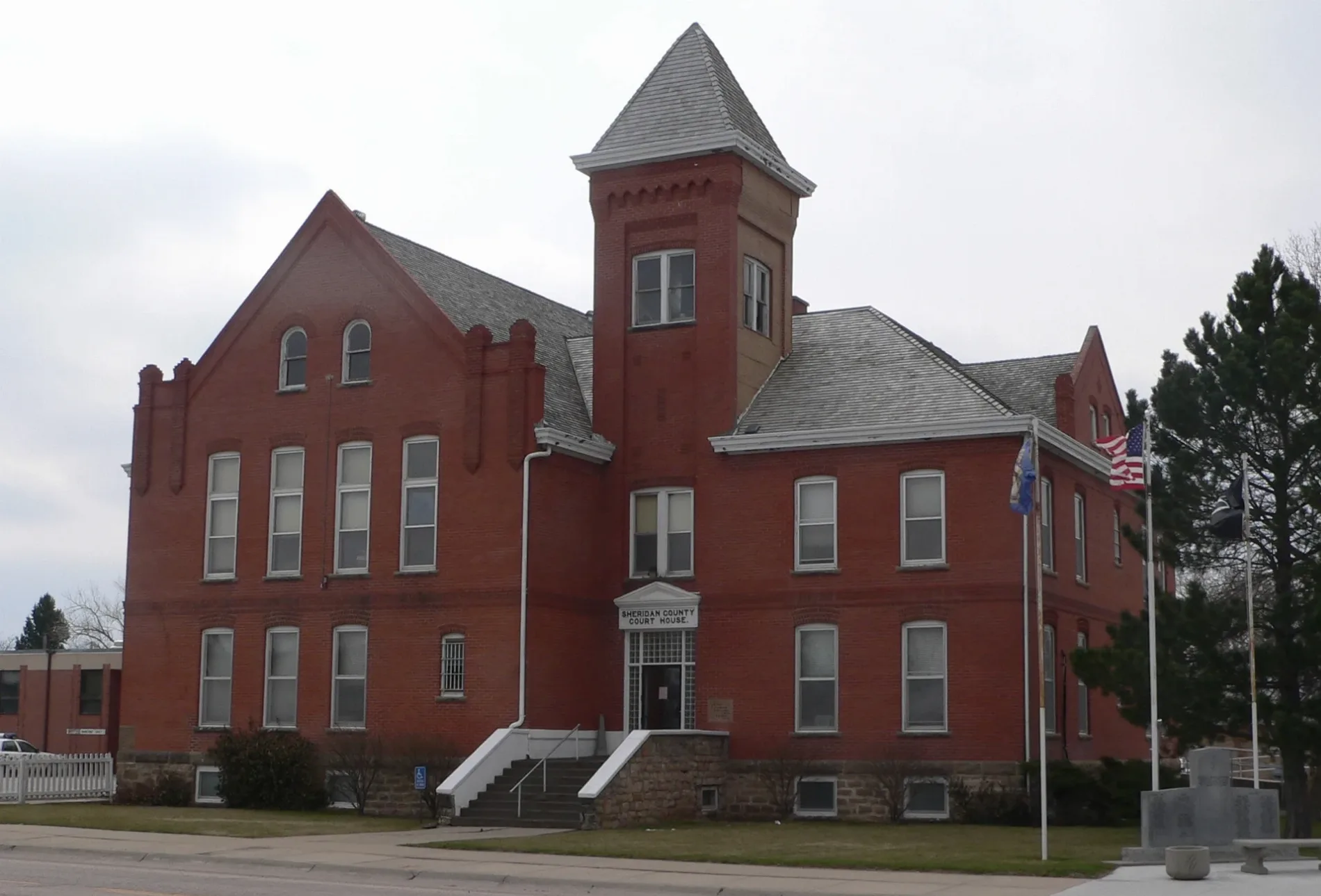
Sheridan County is a Nebraska county recorded at administrative level 6. It was established in 1885 and has a recorded population of 5,127. The county covers approximately 6,397,000,000 square metres, making it one of the largest mapped county areas in the supplied data. Sheridan County is represented separately from Dawes, Cherry and Garden counties.
Keya Paha County is a county-level administrative area in Nebraska recorded at administrative level 6. It appears as a separate county in the northern part of the regional map. The county is distinct from Brown, Rock and Boyd counties. Its roads and places are represented within the mapped county boundary.













 Public transit map Nebraska Legend
  Bicycle map Nebraska Legend
  Pedestrian map Nebraska Legend