
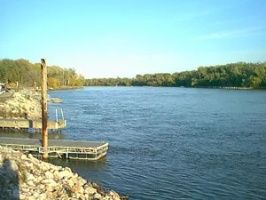
N. P. Dodge Memorial Park in Omaha, Nebraska
N. P. Dodge Memorial Park in Omaha is a park. N. P. Dodge Memorial Park is also known as Dodge Park. N. P. Dodge Memorial Park is located near Dodge Park Road. Ⓦ.
- Alternate Name
- Dodge Park
- Leisure
- park
Image
Fast food restaurants
Schools
Pharmacies
Restaurants
Places of worship
Marketplaces
Doctor's offices
Museums
Gas stations
Hospitals
Artworks
Cafes
Streets nearby
Dodge Park Road0.5 mi
Omaha Riverfront TrailChief Big Elk Statue, Holiday Inn Express & Suites Omaha Airport
0.5 mi
John J Pershing Drive0.6 mi
North 29th Court0.7 mi
Oakridge Road0.7 mi
North 29th Avenue0.7 mi
Sleepy Hollow Lane0.7 mi
Sleepy Hallow Lane0.7 mi
Rainwood Road0.8 mi
North 30th Circle0.8 mi
North 29th StreetCalvary Foursquare Gospel Church
0.9 mi
North 34th Avenue0.9 mi
South Lookout Trail0.9 mi
Canyon Road0.9 mi
145th Street0.9 mi
River Road North0.9 mi
Woodney Boulevard1.0 mi
Lindenwood Lane1.0 mi
Pilcher Road1.0 mi
North 36th Street1.0 mi
Copper Hollow Road1.0 mi
Hole 51.0 mi
Joshua Road1.0 mi
Sargent Street1.0 mi
Hole 61.0 mi
Ferry Street1.0 mi
Hole 41.0 mi
Bridge Street1.1 mi
High Point Circle1.1 mi
Florence Heights Boulevard1.1 mi
130th Street1.1 mi
North 31st StreetGreater Macedonia Baptist Church, Third Church of Christ, Scientist, Florence Presbyterian Church
1.2 mi
North 30th Avenue1.2 mi
Dick Collins RoadFlorence Mill Museum
1.2 mi
McKinley StreetTussey's Casual Grill, Scooter's Coffee
1.2 mi
Bondesson Street1.2 mi
Fillmore Street1.2 mi
North 30th StreetNew Zion Baptist Church, 'Welcome To Historic Florence' Mural, Florence, Mandela Elementary School, Florence Home, Creighton Family Healthcare Building - Florence, KFC, 30th & Binney, Valero, 30th & Lindsay, Hardy Coffee, K-N-J Express, 30th & Redick (SE), N 30th St & California St, 30th & Cuming NE, Farmers Market, 30th & Cuming SW
1.3 mi
Buildings nearby
Missouri River Project Office0.7 mi
Fire stations nearby
Omaha Fire Department - Station 231.2 mi
Industrial areas nearby
Buoy Yard0.7 mi
Libraries nearby
Florence Library & Recreation Center1.3 mi
Marinas nearby
Corps of Engineers Basin0.6 mi
Military areas nearby
Missouri River Boatyard0.6 mi
USACE0.6 mi
U.S. Coast Guard - Omaha Moorings0.6 mi
Shelters nearby
Pavilion0.2 mi
Sports fields nearby
Soccer Fields0.4 mi
Streams nearby
Ponca Creek1.1 mi
| Year built | 1930 |
|---|---|
| Located in | Nebraska |
| Country | United States |
 Public transit map Omaha Legend
| Railway | |
| Bus | |
| Streetcar |
 Bicycle map Omaha Legend
| Bike path | |
| Bike lane on roadway | |
| Cycling allowed on bus lane | |
| Bicycle street | |
| Open to cyclists | |
| Open to cyclists, good path | |
| Cycling prohibited | |
| Cobblestone |
| Long-distance bike route | (depending on scale) | |
| Long-distance bike route |
 Pedestrian map Omaha Legend
| Path |
| Long-distance hiking trail | (depending on scale) | |
| Long-distance hiking trail | ||
| Pedestrians prohibited |