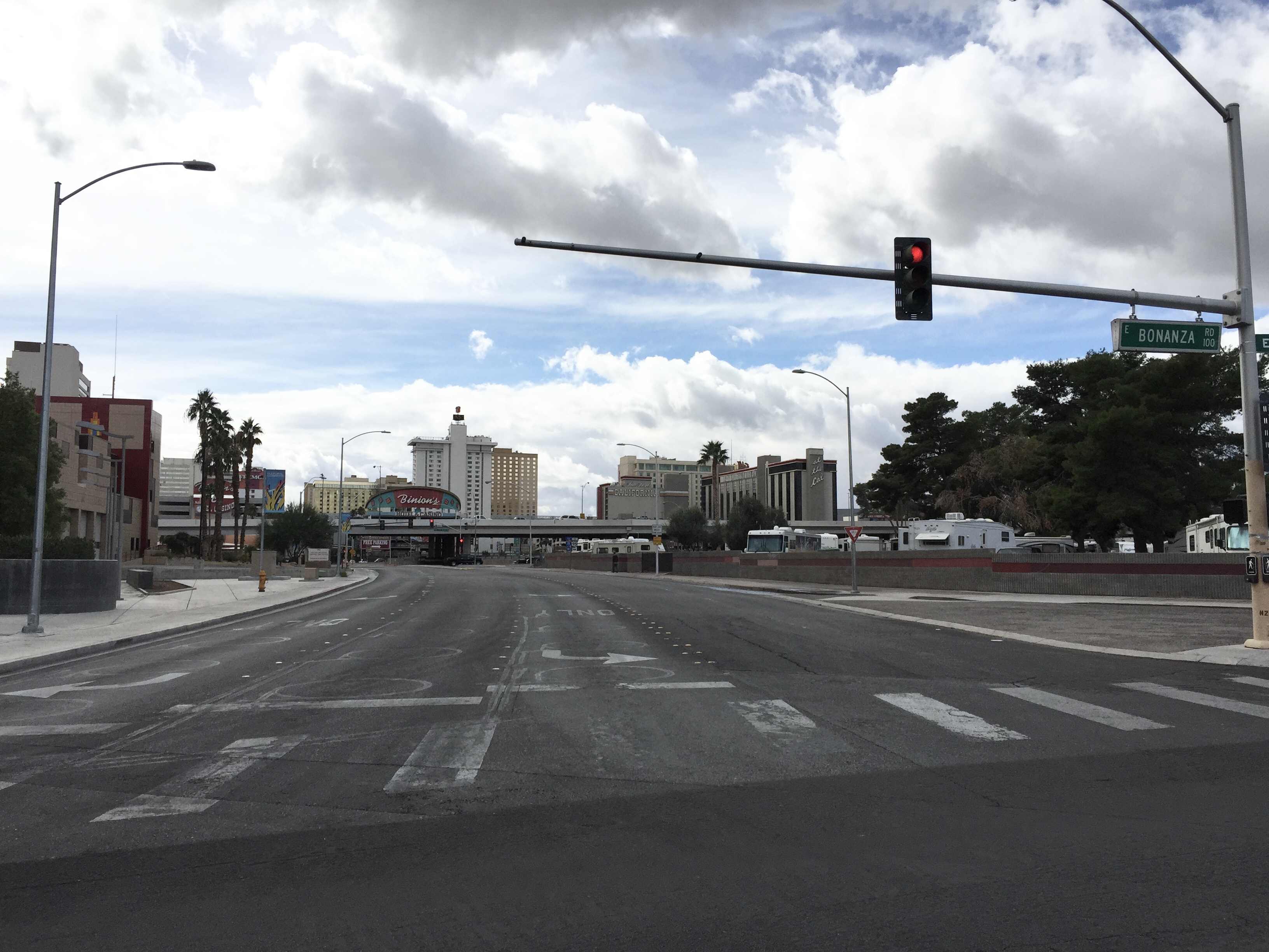
East Bonanza Road in Las Vegas

East Bonanza Road in Las Vegas is an asphalted secondary road (Road number NV 579). The condition of the road surface is excellent. It runs in an east-west direction and crosses North 16th Street, North 15th Street, North 14th Street, North 13th Street, North Pecos Road, North 7th Street, 28th Street, North Mojave Road, Marion Drive, 23rd Street, 22nd Street and 21st Street. This street is part of the highways 579 and Bonanza Road. Nearby you can find among others 5 fast food restaurants, 3 gas stations, 2 post offices and 2 restaurants. The nearest stops include Eastbound Bonanza after Page, Eastbound Bonanza after Lamb, Westbound Bonanza after Page, Eastbound Bonanza after Bruce and Eastbound Bonanza after Sandhill. The bus lines 106A, 106B, 214W and 215 serve this stop.

Road Type
secondary road
Speed Limit
35 mph
Route
east-west

Image

2015 11 04 11 37 22 View South From The North End Of Nevada State Route 602 (Casino Center Drive) At Nevada State Route 579 (Bonanza Road) In Downtown Las Vegas, Nevada
2015 11 04 11 37 22 View South From The North End Of Nevada State Route 602 (Casino Center Drive) At Nevada State Route 579 (Bonanza Road) In Downtown Las Vegas, Nevada – Famartin, cc by-sa – Wikimedia Commons

Restaurants

  • Thai Cuisine (Thai).
  • The Blue Skillet.

Post offices

  • Poe 61 Post Office.

Cell phone stores

  • T-Mobile.

Bus stops

  • Eastbound Bonanza after Page.
  • Eastbound Bonanza after Lamb.
  • Westbound Bonanza after Page.
  • Eastbound Bonanza after Bruce.
  • Eastbound Bonanza after Sandhill.
  • Westbound Bonanza after Triest.
  • Westbound Bonanza after Lillian.
  • Westbound Bonanza after Nellis.
  • Eastbound Bonanza before Lillian.
  • Eastbound Bonanza after Eastern.
  • Westbound Bonanza after McKnight.
  • Eastbound Bonanza after Honolulu.
  • Eastbound Bonanza after Pecos.
  • Eastbound Bonanza after Mojave.
  • bus lines 106A, 106B, 214W, 215

Fast food restaurants

  • Popeyes (Chicken, takeout, delivery service, Drive-through, opening hours: 10–21) at East Bonanza Road 4505 (89110).
  • Domino's (Pizza, takeout, opening hours: Mon 11–24; Tue 10–24; Wed 11–24; Thu 10–24; Fri 11–1; Sat 10–1; Sun 10–24) at East Bonanza Road 4515 (89110).
  • McDonald's (Burger, takeout, Drive-through, Wi-Fi, opening hours: 5–22) at East Bonanza 3500 (89110).
  • Carl's Jr. (Burger, takeout, Drive-through) at East Bonanza Road 5091 (89110).
  • Tropical Smoothie Cafe (Juice, takeout).

Pharmacies

  • Walgreens.

Gas stations

  • Smith's Fuel Center (Self-service).

Streets nearby

North 4th Street
Northbound 4th after Stewart
350 ft
Bonanza Way
500 ft
Tiffany Lane
0.1 mi
Purple Heart Highway
901 South Phantom, 901 North Phantom
0.1 mi
East Wilson Avenue
Walgreens, Halle Hewetson Elementary School
0.1 mi
North 7th Street
0.1 mi
Bell Drive
0.1 mi
North Las Vegas Boulevard
Normandie Motel Neon Sign, Northbound Las Vegas after Stewart, Society Cleaners Neon Sign, Southbound Las Vegas after Mesquite, Lucky Cuss Motel Neon Sign, Northbound Las Vegas after Washington, Axehole Vegas, The Nerd, First Christian Church Child Development Center, Northbound Las Vegas after Foremaster, Southbound Las Vegas before Cashman, Southbound Las Vegas before Bonanza, Northbound Las Vegas after Bonanza, Silver Slipper Neon Sign, Bow & Arrow Motel Neon Sign, Southbound Las Vegas Boulevard at Fremont Street Experience
0.2 mi
Veterans Memorial Drive
Biltmore Special School
0.2 mi
East McWilliams Avenue
Cesars Palace Sign, La Concha Motel Sign, Tropicana Sign, Ugly Duckling Sign
0.2 mi
Encanto Drive
Sahara Sign, Jerry Sign, Stardust Sign, Aladdin's Lamp, Treasure Island Skull, Frontier Sign, Golden Nuget Sign, Moulin Rouge Sign, Steiner Cleaners Sign, Riviera Sign, Liberace Sign, Sassy Sally's Sign, Binion's Horseshoe Sign, Tam O'Shanter Sign, Yucca Motel Sign, Algiers Sign, Desert Rose Motel
0.2 mi
Pioneer Trail
Northbound Las Vegas at Cashman Field, The True Vine Missionary Baptist Church, Southbound D after Monroe, McDonald's, Eastbound Washington before Robin, Eastbound Washington after Rancho, Eastbound Washington at Lorenzi Park, Westbound Bonanza after Sunny, Westbound Bonanza across from 901 West Bonanza, Westbound Bonanza after H, Southbound H after McWilliams, Southbound H after Washington, Northbound Valley View after Meadows, Northbound Valley View before U.S. 95, Bus Stop 113, Southbound Las Vegas before Foremaster, Eastbound Owens before Las Vegas, Neon Museum Sign, Eastbound Washington after Twin Lakes, Southbound Las Vegas before Washington
0.2 mi
North 6th Street
0.2 mi
North 8th Street
0.2 mi
Biltmore Drive
0.3 mi
Linden Avenue
0.3 mi
Stewart Avenue
Westbound Stewart after Eastern, Eastbound Stewart after Eastern, Eastbound Streetewart before Sandhill, Westbound Stewart after Bruce, Westbound Stewart after 21st, Eastbound Stewart after 21st, Eastbound Stewart after Bruce, Eastbound Stewart after Greenbrook, Westbound Stewart after Nellis, Eastbound Stewart after 28th, Westbound Stewart after 28th, Zappos Bike Share, Eastbound Stewart after 4th, Mob Bar, Westbound Stewart after Marion, Westbound Stewart after Page, Eastbound Streetewart after Sandhill, Eastbound Streetewart after Ronald, Eastbound Stewart after Mojave, Eastbound Stewart after Pecos, Westbound Streetewart after Lamb, Westbound Streetewart before Century, Westbound Streetewart after Sandhill, Westbound Stewart after Coast, Westbound Stewart after Pecos, Westbound Stewart after Mojave, Eastbound Streetewart after Lamb, Eastbound Stewart after Page, Westbound Stewart after 6th, Westbound Stewart after 14th, Eastbound Stewart after 13th, Westbound Stewart after 10th, Westbound Stewart after Maryland, Eastbound Stewart before 10th, Westbound Streetewart after Nellis, Westbound Stewart before Pecos, Westbound Streetewart after Greenbrook, Eastbound Stewart after Marion, Eastbound Stewart after 7th
0.3 mi
North 9th Street
0.3 mi
Sycamore Lane
0.3 mi
East Mesquite Avenue
0.3 mi
Harris Avenue
Wells Fargo, Bank of America, Calvary Lutheran Church, Ivy Dental, Iglesia De Cristo Luz Admirable, Carousel Christian Child Development Center
0.3 mi
North 11th Street
11th & Stewart
0.4 mi
North 10th Street
10th & Fremont
0.4 mi
North Maryland Parkway
Southbound Maryland after Bonanza, Westbound Maryland before Wilson, Northbound Maryland after Mesquite, Southbound Maryland before Ogden, Northbound Maryland after Bonanza, Southbound Maryland after Mesquite, Westbound Maryland after Sagman, Northbound Maryland after Cashman
0.4 mi
12th Street
0.4 mi
I-11 Trail
Eastbound Stewart after Pecos
0.4 mi