
Purple Heart Highway in Las Vegas
Purple Heart Highway in Las Vegas is a four-lane, concrete highway (Road number I 11;US 95). The condition of the road surface is excellent. It crosses a bridge and comes from Veterans Memorial Highway. Purple Heart Highway is also known as Veterans Memorial Highway. This street is part of the highways 93, 95 and 11. The nearest stops are 901 South Phantom and 901 North Phantom. The bus lines 2009 and CX serve this stop. Purple Heart Highway also exists in Henderson.
- Alternate Name
- Great Basin Highway;Veterans Memorial Highway
- Bicycle
- no
- Road Type
- highway
- Lanes
- 4
- Speed Limit
- 65 mph
Image
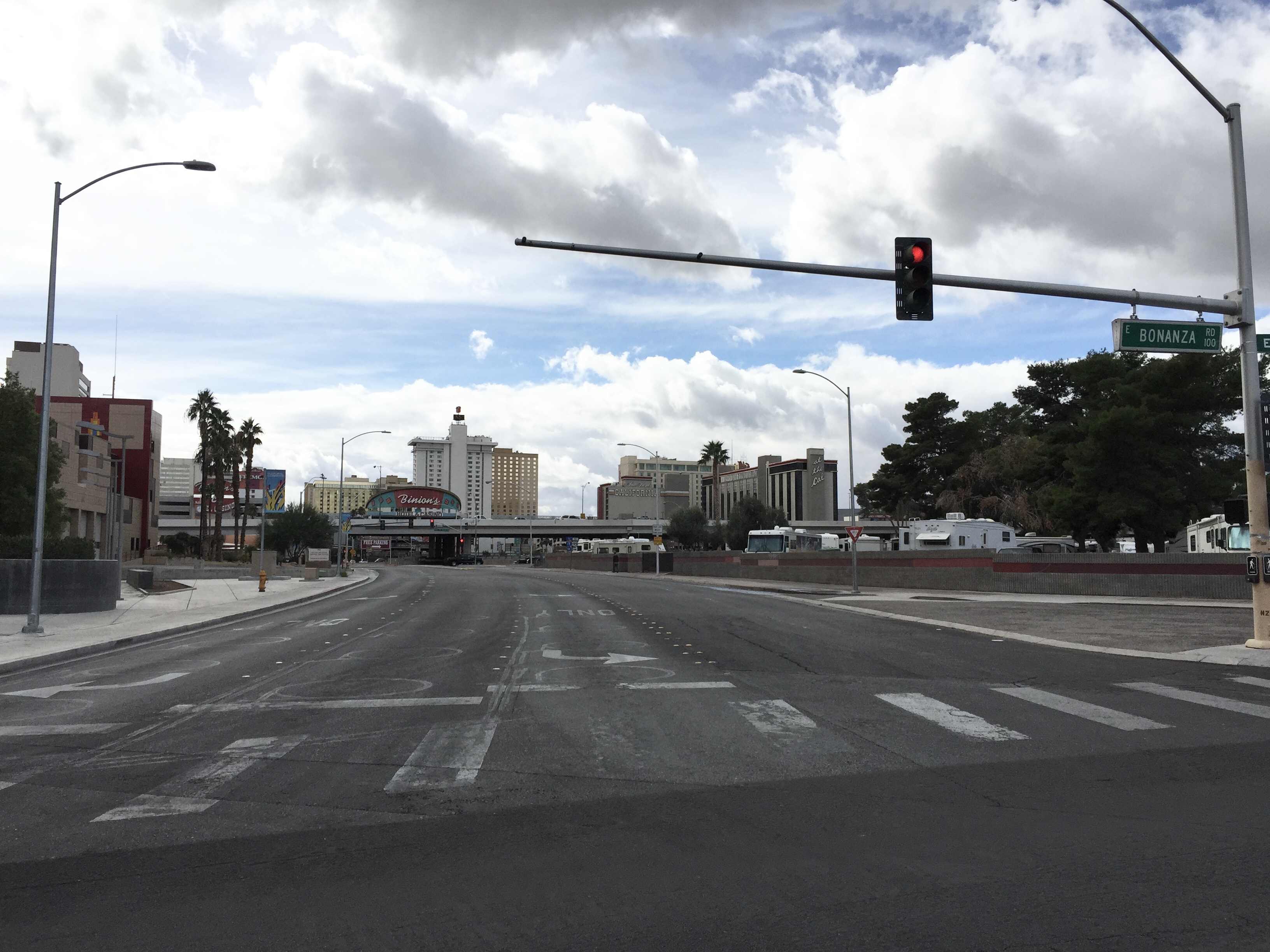
Bus stops
- bus lines 2009, CX
Streets nearby
North Las Vegas BoulevardNormandie Motel Neon Sign, Northbound Las Vegas after Stewart, Society Cleaners Neon Sign, Southbound Las Vegas after Mesquite, Lucky Cuss Motel Neon Sign, Northbound Las Vegas after Washington, Axehole Vegas, The Nerd, First Christian Church Child Development Center, Northbound Las Vegas after Foremaster, Southbound Las Vegas before Cashman, Southbound Las Vegas before Bonanza, Northbound Las Vegas after Bonanza, Silver Slipper Neon Sign, Bow & Arrow Motel Neon Sign, Southbound Las Vegas Boulevard at Fremont Street Experience
450 ft
East Mesquite Avenue0.1 mi
North 4th StreetNorthbound 4th after Stewart
0.1 mi
Bonanza Way0.2 mi
North 6th Street0.2 mi
Veterans Memorial DriveBiltmore Special School
0.2 mi
Tiffany Lane0.2 mi
North 3rd StreetDowntown Grand - 3rd & Stewart, Mob Museum, Tomo Noodles, Huey Magoos Chicken Tenders, Steak 'n Shake, Roli Roti, Dunkin'
0.2 mi
East Wilson AvenueWalgreens, Halle Hewetson Elementary School
0.2 mi
East Ogden AvenueVegas Vickie's Cocktail Lounge, Tattoo Ink 69, Downtown Grand free shuttle bus, Downtown East, Bruce & Ogden
0.2 mi
Bell Drive0.2 mi
North 1st Street1st & Ogden, Circa
0.3 mi
Verdy Lane0.3 mi
East Bonanza RoadPoe 61 Post Office, Walgreens, Popeyes, Domino's, T-Mobile, Eastbound Bonanza after Page, Eastbound Bonanza after Lamb, Westbound Bonanza after Page, Eastbound Bonanza after Bruce, Eastbound Bonanza after Sandhill, Westbound Bonanza after Triest, Smith's Fuel Center, McDonald's, Carl's Jr., Thai Cuisine, The Blue Skillet, Westbound Bonanza after Lillian, Westbound Bonanza after Nellis, Eastbound Bonanza before Lillian, Eastbound Bonanza after Eastern, Westbound Bonanza after McKnight, Tropical Smoothie Cafe, Eastbound Bonanza after Honolulu, Eastbound Bonanza after Pecos, Eastbound Bonanza after Mojave, Westbound Bonanza after Wardelle, Eastbound Bonanza after 28th, Eastbound Bonanza after 9th, Eastbound Bonanza after Las Vegas, Eastbound Bonanza after Maryland, Westbound Bonanza after Maryland, Westbound Bonanza before Marion, Eastbound Bonanza after Marion, Eastbound Bonanza after Casino Center, Westbound Bonanza before Las Vegas, Westbound Bonanza after Pecos, Westbound Bonanza after Mojave, East Las Vegas, Arco, Circle K, ampm, Eastbound Bonanza after Triest, Westbound Bonanza after Legion, Westbound Bonanza after Lamb, Westbound Bonanza after Eastern, Westbound Bonanza after Bruce, Las Vegas Post Office Station Number 4, Eastbound Bonanza after 23rd
0.3 mi
Biltmore Drive0.3 mi
North Casino Center BoulevardSouthbound Casino Center before Fremont
0.3 mi
Stewart AvenueWestbound Stewart after Eastern, Eastbound Stewart after Eastern, Eastbound Streetewart before Sandhill, Westbound Stewart after Bruce, Westbound Stewart after 21st, Eastbound Stewart after 21st, Eastbound Stewart after Bruce, Eastbound Stewart after Greenbrook, Westbound Stewart after Nellis, Eastbound Stewart after 28th, Westbound Stewart after 28th, Zappos Bike Share, Eastbound Stewart after 4th, Mob Bar, Westbound Stewart after Marion, Westbound Stewart after Page, Eastbound Streetewart after Sandhill, Eastbound Streetewart after Ronald, Eastbound Stewart after Mojave, Eastbound Stewart after Pecos, Westbound Streetewart after Lamb, Westbound Streetewart before Century, Westbound Streetewart after Sandhill, Westbound Stewart after Coast, Westbound Stewart after Pecos, Westbound Stewart after Mojave, Eastbound Streetewart after Lamb, Eastbound Stewart after Page, Westbound Stewart after 6th, Westbound Stewart after 14th, Eastbound Stewart after 13th, Westbound Stewart after 10th, Westbound Stewart after Maryland, Eastbound Stewart before 10th, Westbound Streetewart after Nellis, Westbound Stewart before Pecos, Westbound Streetewart after Greenbrook, Eastbound Stewart after Marion, Eastbound Stewart after 7th
0.3 mi
North Main StreetSouthbound Main after Washington, Southbound Main after Bonanza, Northbound Main after Bonanza, Southbound Main before Fremont Street, Main at Ogden (North)
0.3 mi
West Bonanza RoadWestbound Bonanza after Main, Westbound Bonanza after D, Eastbound Bonanza after City Parkway, Dotty's Gaming & Spirit's, Eastbound Bonanza after Rancho, Eastbound Bonanza before H, Eastbound Bonanza at 919 West Bonanza, Eastbound Bonanza after Martin Luther King, Eastbound Bonanza before Martin Luther King, Eastbound Bonanza after Tonopah, Westbound Bonanza before Dike, Westbound Bonanza after Tonopah
0.3 mi
Palm Lane0.4 mi
Bars nearby
The Underground Speakeasy and Distillery0.1 mi
Buildings nearby
Biomat USA0.2 mi
Casinos nearby
Gold Spike0.2 mi
Binion's Gambling Hall and Hotel0.3 mi
Commercial buildings nearby
300 N.0.1 mi
Community centers nearby
American Legion Hall0.3 mi
Convenience stores nearby
Pump N Snack0.1 mi
7-Eleven0.2 mi
Fire stations nearby
Headquarters Las Vegas Fire & Rescue0.1 mi
City of Las Vegas Fire Station Number 10.1 mi
Fitness centers nearby
Dula Gym400 ft
Hotels nearby
Downtown Grand0.1 mi
Oasis at Gold Spike0.2 mi
Fremont Hotel & Casino Las Vegas0.3 mi
California Hotel and Casino0.3 mi
Motels nearby
Regency Motel0.4 mi
Museums nearby
The Mob Museum0.1 mi
Parking lots nearby
Zappos Self Parking250 ft
California Hotel and Casino Self Parking0.3 mi
Binion's Gambling Hall and Hotel Self Parking0.3 mi
Main Street Station Self Parking0.3 mi
Police stations nearby
Nevada Parole and Probation0.1 mi
Restaurants nearby
Triple George Grill0.2 mi
Pizza Rock - Downtown0.2 mi
Rv parks nearby
Main Street Station RV Park0.2 mi
Sports centers nearby
Municipal Pool400 ft
Streams nearby
Vegas Creek0.3 mi
Supermarkets nearby
Laos Market0.2 mi
Transportation buildings nearby
Regional Transportation Commission of Southern Nevada0.1 mi
Public transit map Las Vegas Legend
| Railway | |
| Bus | |
| Streetcar |
Bicycle map Las Vegas Legend
| Bike path | |
| Bike lane on roadway | |
| Cycling allowed on bus lane | |
| Bicycle street | |
| Open to cyclists | |
| Open to cyclists, good path | |
| Cycling prohibited | |
| Cobblestone |
| Long-distance bike route | (depending on scale) | |
| Long-distance bike route |
Pedestrian map Las Vegas Legend
| Path |
| Long-distance hiking trail | (depending on scale) | |
| Long-distance hiking trail | ||
| Pedestrians prohibited |