
North Carolina

North Carolina
This page is the City map of North Carolina, a state of the United States with roads, paths and places. The state covers approximately 139,390 square kilometres and had 10,439,388 residents in 2020, compared with 9,535,483 in 2010. North Carolina extends from the Atlantic coastal plain through the Piedmont to the Blue Ridge Mountains, with an elevation listed at 215 metres. Founded as a state in 1789, it is divided into 111 mapped subregions, and the state dialing code is 252.
Blowing Rock

Blowing Rock is a town in North Carolina at an elevation of 1,087 metres. The town covers 7,886,148 square metres and had 1,376 residents. Its municipal history records an inception year of 1889.
Blowing Rock lies in the Blue Ridge Mountains near the town of Boone in western North Carolina. The name is also associated with the Blowing Rock cliff overlooking the Johns River gorge.
To the mapWhitakers

Whitakers is an admin-level 8 settlement in North Carolina. It lies in the eastern part of the state near the Tar River and the town of Enfield.
The settlement is associated with Edgecombe and Nash County communities in the coastal plain. Its mapped boundary is represented in the North Carolina City map with local streets and connecting roads.
To the mapHighlands

Highlands is a human settlement in North Carolina at an elevation of 1,255 metres. It covers 15,938,064 square metres and had 1,072 residents. The settlement was established in 1875.
Highlands lies in the southern Blue Ridge Mountains near the headwaters of the Chattooga and Cullasaja rivers. The town is located in Macon County near the Georgia and South Carolina borders.
To the mapFalcon

Falcon is a town in North Carolina with an elevation of 43 metres. Its area is 3,586,954 square metres, and the town had 324 residents.
The town lies in the coastal plain of central-eastern North Carolina near the city of Fayetteville. Falcon is located in Cumberland County and is connected to nearby communities by local roads.
To the mapGrifton

Grifton is a town in Pitt and Lenoir counties, North Carolina. It covers 5,324,116 square metres and had 2,448 residents, with a listed elevation of 8 metres.
The town stands in eastern North Carolina near the Contentnea Creek and the Neuse River basin. Its position connects communities around Kinston in Lenoir County and Greenville in Pitt County.
To the mapLong View

Long View is an admin-level 8 municipality in North Carolina. It is located in the western part of the state near Hickory and the Catawba River.
The settlement lies in the foothills between the Blue Ridge Mountains and the Piedmont. Local roads connect Long View with Catawba County communities and the city of Hickory.
To the mapLittleton

Littleton is an admin-level 8 settlement in North Carolina. It lies in Halifax County near the southern shore of Lake Gaston.
Lake Gaston is a reservoir on the Roanoke River along the Virginia border. Littleton is connected by roads with Halifax, Warrenton and other communities in the northern coastal plain.
To the mapFair Bluff

Fair Bluff is a town in Columbus County, North Carolina, at an elevation of 20 metres. The town covers 6,085,841 square metres and had 709 residents.
Fair Bluff lies on the Lumber River in southeastern North Carolina. The river flows through Columbus County toward the coastal plain and is a defining geographic feature of the town.
To the mapSharpsburg

Sharpsburg is an admin-level 8 municipality in North Carolina. It lies in the eastern Piedmont near Rocky Mount and the Tar River.
The town is situated in Nash and Edgecombe County surroundings, where local roads connect the Piedmont with the coastal plain. Rocky Mount is the nearest major urban centre in the mapped area.
To the mapCurrituck County

Currituck County is a county in North Carolina with 28,100 residents. It covers approximately 1,361 square kilometres and records an inception year of 1672.
The county occupies the northeastern coastal plain between Currituck Sound and the Atlantic Ocean. Its mainland and barrier-island areas include communities near Corolla and the Virginia state line.
To the mapDare County

Dare County is a North Carolina county with 36,915 residents and an area of approximately 4,044 square kilometres. The county was established in 1870.
Its territory includes much of the Outer Banks, including the towns of Nags Head, Kitty Hawk and Manteo. Cape Hatteras and the Roanoke Island area are among its best-known geographic features.
To the mapHyde County

Hyde County is a county in North Carolina with 4,589 residents. It covers approximately 3,688 square kilometres and records an inception year of 1705.
The county includes mainland coastal plain areas and Ocracoke Island in the Outer Banks. Pamlico Sound lies to the west of the barrier islands and separates Hyde County from much of the mainland.
To the mapHertford County

Hertford County is a North Carolina county with 21,552 residents. Its area is approximately 933 square kilometres, and the county was established in 1759.
The county lies in the northeastern coastal plain near the Meherrin River. Murfreesboro and Winton are principal communities within Hertford County.
To the mapPerquimans County

Perquimans County is a county in North Carolina with 13,005 residents. It covers approximately 852 square kilometres and records an inception year of 1672.
The county lies on the Albemarle Sound and includes the town of Hertford. The Perquimans River flows through the county toward the sound in the northeastern coastal plain.
To the mapCamden County

Camden County is a North Carolina county with 10,355 residents. Its area is approximately 792 square kilometres, and its county government dates from 1777.
The county borders Virginia and lies west of Currituck County in the northeastern coastal plain. The Pasquotank River and the Dismal Swamp region are important geographic features nearby.
To the mapGates County

Gates County is a county in North Carolina with 10,478 residents. It covers approximately 895 square kilometres and was established in 1779.
The county lies along the Virginia border and includes lowland areas near the Chowan River. Gatesville is the county seat, and local roads connect the county with Suffolk, Virginia.
To the mapPasquotank County

Pasquotank County is a North Carolina county with 40,568 residents. It covers approximately 750 square kilometres and records an inception year of 1672.
The county lies around the Pasquotank River and Elizabeth City in the northeastern coastal plain. The river flows north toward the Albemarle Sound and connects the county with the wider Inner Banks.
To the mapBertie County

Bertie County is a North Carolina county with 17,934 residents. Its area is approximately 1,920 square kilometres, and the county was established in 1722.
The county lies along the Cashie River and the western side of the Albemarle Sound. Windsor is the county seat, while the Roanoke River forms part of the northern county landscape.
To the mapChowan County
Chowan County is a North Carolina county with 13,708 residents. It covers approximately 604 square kilometres and records an inception year of 1672.
The county lies on the Albemarle Sound and includes Edenton, one of North Carolina's oldest incorporated towns. The Chowan River reaches the sound near the county's western boundary.
Alamance County
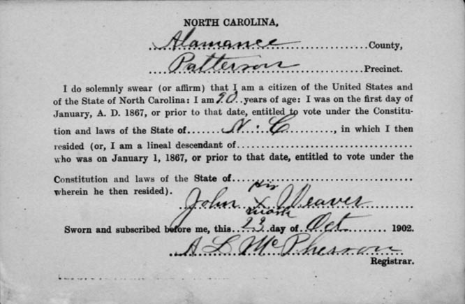
Alamance County is a North Carolina county with 171,415 residents. Its area is approximately 1,126 square kilometres, and it was established in 1849.
The county lies in the central Piedmont between Greensboro and Durham. Burlington is the largest city in Alamance County, and the Haw River crosses the county from north to south.
To the mapAlexander County

Alexander County is a North Carolina county with 36,444 residents. It covers approximately 682 square kilometres and was established in 1847.
The county lies in the western Piedmont near the foothills of the Blue Ridge Mountains. The Catawba River forms its eastern boundary in the area near Hickory and Lake Hickory.
To the mapAlleghany County

Alleghany County is a county-level administrative area in northwestern North Carolina. It lies along the Virginia border in the Blue Ridge foothills.
The county includes the New River valley and the town of Sparta. Mountain roads connect Alleghany County with Ashe County, Wilkes County and southwestern Virginia.
To the mapAnson County

Anson County is a North Carolina county with 22,055 residents. Its area is approximately 1,391 square kilometres, and the county was established in 1750.
The county lies in the southern Piedmont near the South Carolina border. Wadesboro is the county seat, and the Pee Dee River forms the county's eastern boundary.
To the mapAshe County

Ashe County is a North Carolina county with 26,577 residents. It covers approximately 1,105 square kilometres and records an inception year of 1799.
The county occupies the northwestern Blue Ridge Mountains near the Virginia and Tennessee borders. The New River flows through the county, while Jefferson and West Jefferson are principal communities.
To the mapAvery County

Avery County is a North Carolina county with 17,806 residents. Its area is approximately 640 square kilometres, and it was established in 1911.
The county lies in the high Blue Ridge Mountains near the Tennessee border. Beech Mountain and parts of the Grandfather Mountain area are located in or near Avery County.
To the mapBeaufort County

Beaufort County is a North Carolina county with 44,652 residents. It covers approximately 2,483 square kilometres and was established in 1705.
The county lies on the Pamlico River and Pamlico Sound in the eastern coastal plain. Washington is the county seat, and the river reaches the sound east of the city.
To the mapBladen County

Bladen County is a North Carolina county with 29,606 residents. Its area is approximately 2,298 square kilometres, and the county was established in 1734.
The county lies in the southeastern coastal plain along the Cape Fear River. Elizabethtown is the county seat, while the river connects the area with Fayetteville and Wilmington.
To the mapBrunswick County

Brunswick County is a North Carolina county with 136,693 residents. It covers approximately 2,720 square kilometres and records an inception year of 1764.
The county occupies the southern coast between the Cape Fear River and the South Carolina border. It includes the towns of Southport and Shallotte, as well as barrier-island communities along the Atlantic Ocean.
To the mapBuncombe County

Buncombe County is a North Carolina county with 269,452 residents. Its area is approximately 1,709 square kilometres, and it was established in 1791.
The county lies in the Blue Ridge Mountains and includes Asheville, the largest urban centre in western North Carolina. The French Broad River runs through Asheville before continuing north toward Tennessee.
To the mapBurke County

Burke County is a North Carolina county with 88,842 residents. It lies in the western Piedmont and foothills near the Catawba River.
Morganton is the county seat, and Lake James lies near the northern edge of the county. The Blue Ridge Mountains rise west and north of Burke County.
To the mapCabarrus County

Cabarrus County is a North Carolina county with 225,804 residents. It covers approximately 945 square kilometres and was established in 1792.
The county lies northeast of Charlotte in the Piedmont. Concord is the county seat, and the city is known for its connection with Charlotte Motor Speedway in nearby Harrisburg.
To the mapCaldwell County

Caldwell County is a North Carolina county with 80,652 residents. Its area is approximately 1,228 square kilometres, and the county was established in 1841.
The county extends from the Piedmont into the Blue Ridge foothills. Lenoir is the county seat, while the Wilson Creek area lies near the western mountain boundary.
To the mapCarteret County

Carteret County is a North Carolina county with 68,879 residents. It occupies the central section of the state's Atlantic coast.
The county includes Morehead City, Beaufort and parts of the Crystal Coast. Bogue Sound separates the mainland from barrier islands such as Atlantic Beach and Emerald Isle.
To the mapCaswell County

Caswell County is a North Carolina county with 22,736 residents. It covers approximately 1,110 square kilometres and was established in 1777.
The county lies in the northern Piedmont along the Virginia border. The Dan River forms part of the northern boundary, and Yanceyville is the county seat.
To the mapCatawba County

Catawba County is a North Carolina county with 155,056 residents. It lies in the western Piedmont around Hickory, Newton and Conover.
The Catawba River and Lake Hickory define major parts of the county's drainage network. The county sits east of the Blue Ridge Mountains and west of the Charlotte metropolitan area.
To the mapChatham County

Chatham County is a North Carolina county with 76,285 residents. Its area is approximately 1,836 square kilometres, and the county was established in 1771.
The county lies in the central Piedmont between Raleigh, Durham and Greensboro. The Haw River crosses Chatham County before joining the Deep River to form the Cape Fear River.
To the mapCherokee County

Cherokee County is a North Carolina county with 28,774 residents. It covers approximately 1,209 square kilometres and was established in 1839.
The county occupies the far southwestern corner of North Carolina near Tennessee and Georgia. Murphy is the county seat, and the Hiwassee River flows through the surrounding Appalachian valleys.
To the mapClay County

Clay County is a North Carolina county with 11,089 residents. Its area is approximately 571 square kilometres, and the county was established in 1861.
The county lies in the southwestern Appalachian Mountains near the Georgia border. Hayesville is the county seat, and Lake Chatuge lies on the Hiwassee River near the county's western side.
To the mapCleveland County

Cleveland County is a North Carolina county with 99,519 residents. It covers approximately 1,214 square kilometres and was established in 1841.
The county lies in the southwestern Piedmont between Charlotte and the Blue Ridge foothills. Shelby is the county seat, and Kings Mountain lies near the South Carolina border.
To the mapColumbus County

Columbus County is a North Carolina county with 50,623 residents. Its area is approximately 2,470 square kilometres, and the county was established in 1808.
The county lies in the southeastern coastal plain near the Lumber River and the South Carolina border. Whiteville is the county seat, while Fair Bluff lies along the county's western river corridor.
To the mapCraven County

Craven County is a North Carolina county with 103,451 residents. It lies in the eastern coastal plain around the lower Neuse River.
New Bern, located at the confluence of the Neuse and Trent rivers, is the county seat. The county extends eastward toward the Pamlico Sound and includes riverine and coastal lowlands.
To the mapCumberland County

Cumberland County is a North Carolina county with 334,728 residents. It covers approximately 1,705 square kilometres and was established in 1754.
Fayetteville is the county seat and the principal city of the Cape Fear River valley. Fort Liberty, formerly known as Fort Bragg, is a major military installation in the county.
To the mapDavidson County

Davidson County is a North Carolina county with 168,930 residents. Its area is approximately 1,468 square kilometres, and it was established in 1822.
The county lies in the central Piedmont west of Greensboro. Lexington is the county seat, and the Yadkin River forms part of the county's western boundary.
To the mapDavie County

Davie County is a North Carolina county with 42,712 residents. It covers approximately 691 square kilometres and was established in 1836.
The county lies in the northern Piedmont near Winston-Salem and the Yadkin River. Mocksville is the county seat, and Interstate 40 crosses the county from east to west.
To the mapDuplin County

Duplin County is a North Carolina county with 48,715 residents. Its area is approximately 2,121 square kilometres, and the county was established in 1750.
The county lies in the southeastern coastal plain between the Neuse and Cape Fear river basins. Kenansville is the county seat, while the city of Wallace lies near the county's eastern side.
To the mapDurham County

Durham County is a North Carolina county with 324,833 residents. It covers approximately 771 square kilometres and was established in 1881.
The county includes the city of Durham, a major centre of the Research Triangle. Duke University and the Eno River are prominent features of the county's urban and natural geography.
To the mapWake County

Wake County is a North Carolina county with 1,129,410 residents and a listed elevation of 103 metres. The county was established in 1771 and includes the state capital, Raleigh.
The county lies in the central Piedmont and also includes Cary, Apex and Wake Forest. Raleigh is connected with Durham and Chapel Hill through the Research Triangle metropolitan area.
To the mapEdgecombe County

Edgecombe County is a North Carolina county with 48,900 residents. It covers approximately 1,312 square kilometres and was established in 1741.
The county lies in the eastern coastal plain along the Tar River. Tarboro is the county seat, and Rocky Mount occupies the county's western urban area near Nash County.
To the mapForsyth County

Forsyth County is a North Carolina county with 382,590 residents. Its area is approximately 1,069 square kilometres, and the county was established in 1849.
Winston-Salem is the county seat and the principal urban centre. The county lies in the northern Piedmont near the Yadkin River and the foothills of the Blue Ridge Mountains.
To the mapFranklin County

Franklin County is a North Carolina county with 68,573 residents. It covers approximately 1,281 square kilometres and was established in 1779.
The county lies northeast of Raleigh in the upper coastal plain. Louisburg is the county seat, and the Tar River crosses the northern part of the county.
To the mapGaston County

Gaston County is a North Carolina county with 227,943 residents. Its area is approximately 942 square kilometres, and the county was established in 1846.
The county lies west of Charlotte along the Catawba River. Gastonia is the county seat, while Belmont and Mount Holly are located near the Catawba River and Lake Wylie.
To the mapGraham County

Graham County is a county-level administrative area in western North Carolina. It lies in the Great Smoky Mountains near the Tennessee border.
The county includes Robbinsville and Fontana Lake, a large reservoir on the Little Tennessee River. The Appalachian Trail crosses the broader mountain region near the county's northern boundary.
To the mapGranville County

Granville County is a North Carolina county with 58,674 residents. It lies in the northern Piedmont along the Virginia border.
Oxford is the county seat, and the southern part of the county is near Falls Lake and the Neuse River. U.S. Route 1 connects Granville County with Raleigh and Virginia.
To the mapGreene County

Greene County is a North Carolina county with 20,451 residents. Its area is approximately 689 square kilometres, and it was established in 1791.
The county lies in the eastern coastal plain southwest of Greenville. Snow Hill is the county seat, and Contentnea Creek crosses the county before reaching the Neuse River.
To the mapGuilford County

Guilford County is a North Carolina county with 517,600 residents. It lies in the central Piedmont and includes Greensboro and High Point.
Greensboro is the county seat and a major transport centre between the mountains and the coastal plain. Lake Brandt and Lake Higgins lie north of Greensboro, while the Piedmont Triad airport area is southwest of the city.
To the mapHalifax County

Halifax County is a North Carolina county with 48,622 residents. It covers approximately 1,894 square kilometres and was established in 1758.
The county lies along the Roanoke River and Lake Gaston in the northern coastal plain. The town of Halifax is associated with the Halifax Resolves of 1776, an important event in North Carolina's colonial history.
To the mapHarnett County

Harnett County is a North Carolina county with 133,568 residents. Its area is approximately 1,557 square kilometres, and it was established in 1855.
The county lies between the Piedmont and the coastal plain along the Cape Fear River. Lillington is the county seat, while the towns of Dunn and Fuquay-Varina lie near the county's western and northern edges.
To the mapHaywood County

Haywood County is a North Carolina county with 59,868 residents. It lies in the western Blue Ridge Mountains and includes the city of Waynesville.
The Pigeon River flows through the county toward Tennessee, while Mount Pisgah rises to the east. Haywood County is part of the mountain region west of Asheville and south of the Great Smoky Mountains.
To the mapHenderson County

Henderson County is a North Carolina county with 116,281 residents. It covers approximately 971 square kilometres and was established in 1838.
The county lies in the Blue Ridge Mountains southeast of Asheville. Hendersonville is the county seat, and the French Broad River runs through the northern part of the county near Fletcher.
To the mapHoke County

Hoke County is a North Carolina county with 52,082 residents. Its area is approximately 1,016 square kilometres, and the county was established in 1911.
The county lies in the Sandhills region near Fayetteville and the South Carolina border. Raeford is the county seat, while Fort Liberty lies immediately east in Cumberland County.
North Carolina also contains six documented long-distance cycling routes, including the East Coast Greenway and NC Bike Routes.
To the mapData sources: OpenStreetMap (ODbL), Wikidata (CC0) · Image: Wikimedia Commons
| Named after | Province of Carolina, north |
|---|---|
| Year built | 1789 |
| Area | 139390 km² |
| Elevation | 215 m |
| Located in | United States |
| Country | United States |
| Body of water | Atlantic Ocean |
| Population | 10439388 |
| Website | https://www.nc.gov/ |
| Nickname | Old North State |
| Native name | North Carolina |
| Official name | State of North Carolina |
| Described by | Brockhaus and Efron Encyclopedic Dictionary, Small Brockhaus and Efron Encyclopedic Dictionary, The Nuttall Encyclopædia, Jewish Encyclopedia of Brockhaus and Efron, 1922 Encyclopædia Britannica, Encyclopædia Britannica 11th edition, The American Cyclopædia, Collier's New Encyclopedia, 1921, New International Encyclopedia, The New Student's Reference Work, Desktop Encyclopedic Dictionary, Armenian Soviet Encyclopedia, vol. 6 |
| Part of | contiguous United States, South Atlantic states |

 Public transit map North Carolina Legend
 | Railway | |
| Bus | |
| Tram |
 Bicycle map North Carolina Legend
 | Bike path | |
| Bike lane on roadway | |
| Cycling allowed on bus lane | |
| Bicycle street | |
| Open to cyclists | |
| Open to cyclists, good path | |
| Cycling prohibited | |
| Cobblestone |
| Long-distance bike route | (depending on scale) | |
| Long-distance bike route |
 Pedestrian map North Carolina Legend
 | Path |
| Long-distance hiking trail | (depending on scale) | |
| Long-distance hiking trail | ||
| Pedestrians prohibited |