
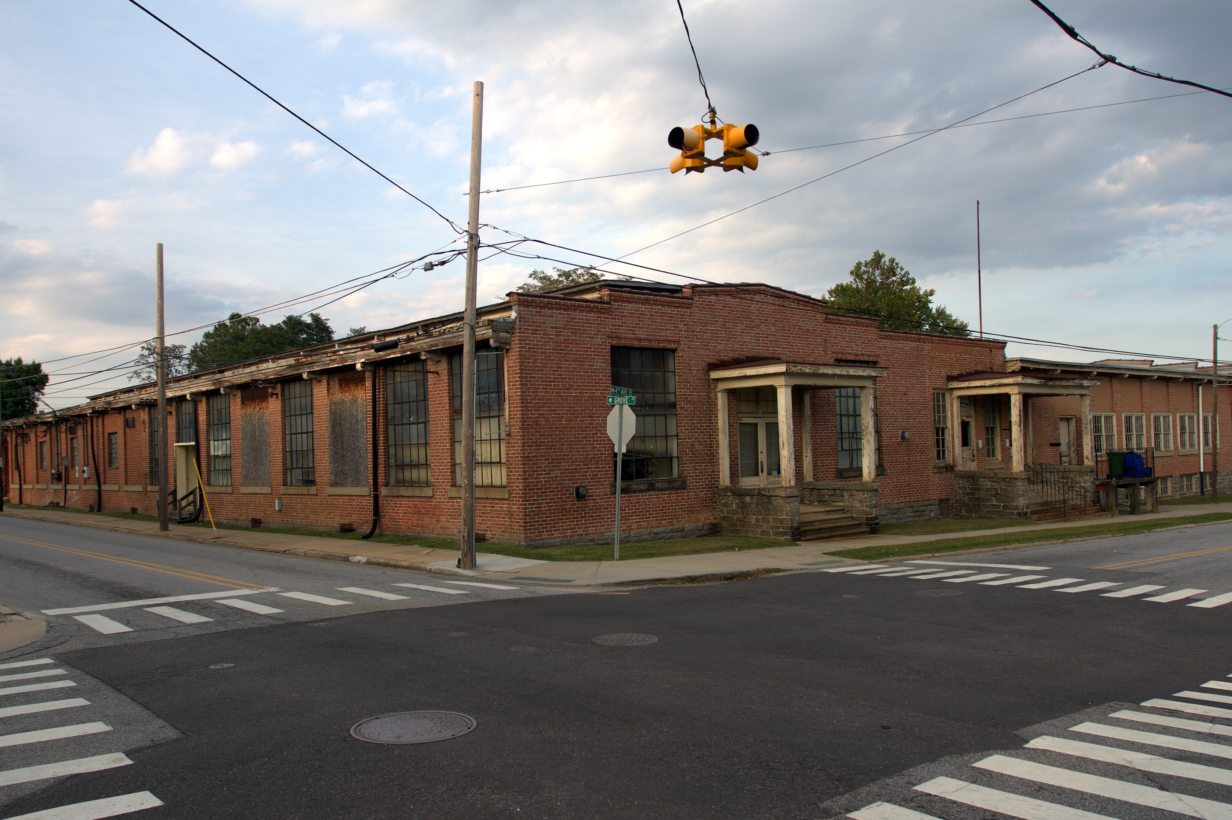
North Grove Street in Hendersonville, North Carolina
North Grove Street in Hendersonville is a local road. It runs in a South direction starting from Bearcat Boulevard and crosses 8th Avenue East, 7th Avenue East, Martin Luther King Junior Boulevard, 6th Avenue East, 5th Avenue East, 4th Avenue East, 3rd Avenue East, 2nd Avenue East and 1st Avenue East and continues as South Grove Street. Nearby you can find a doctor's office and a veterinary clinic. North Grove Street also exists in Bladen County.
- Road Type
- local road
- Speed Limit
- 35 mph
- Route
- north-south
Image
Streets nearby
North King Street350 ft
4th Avenue EastMineral & Lapidary Museum, La Magia, The Fountainhead Book Store, Tribal Trends, Jane Asher's Antiques & Fine Traditions, Mean Mustard's Cafe, Old Towne Market, The Corner Pocket
0.1 mi
North Pine Street0.1 mi
5th Avenue EastGillians Gallery, Carolina Mountain Artists Guild
0.1 mi
6th Avenue East0.1 mi
Maple StreetCabbage Rose Venue
0.1 mi
Four Seasons BoulevardExxon, Applebee's, Champion Credit Union
0.1 mi
7th Avenue EastMarathon, Underground Baking Co., The Blood and Brews Tattoo Studio, Junk And Disorderly Resale, Stacey's Grooming, Bright and Beautiful Salon, Marco's Pizza, M & M Meatlocker, Telco Community Credit Union - Hendersonville Branch
0.1 mi
North Main StreetBlack Bear Coffee Co., First Citizens Bank, Asheville Savings Bank, Black Rose Pub, Forest Commercial Bank, GypsyHeart, La Vida Loca, Mezzaluna, T's Blue Note, DAD'S C.A.T.S., Four Seasons Hospice, Moon on Main, Wag! A Unique Pet Boutique, Dancing Bear Toys, Kilwins Chocolates, Silver Fox Gallery, Village Green Antique Mall, Goldsmith By Rudi, The Dugout, Young Designs LLC, Wickwire Fine Art Folk Art, Vessel
0.1 mi
Martin Luther King Junior Boulevard0.1 mi
3rd Avenue EastTempo Music Center, Three Chopt Sandwich Shoppe
0.2 mi
B Street0.2 mi
2nd Avenue EastSherman's Sports
0.2 mi
Boxcar Street0.2 mi
North Edwards StreetMacon Bank
0.2 mi
Barker StreetThe Brandy Bar
0.2 mi
Harris Street0.3 mi
Williams Street0.3 mi
South Pine Street0.3 mi
North Wall StreetMcFarland Old Fashioned Bakery, Mean Mr Mustard's Cafe, Narnia Studios, Linda Spry Design Interiors, Marble Slab Creamery, Mountain Song Gallery, Shelley's Jewelry, Swanson's & Sons LLC
0.3 mi
Jonas Street0.3 mi
South Edwards Street0.3 mi
South Wall Street0.3 mi
South Walnut Tree Street0.3 mi
Walnut Tree Circle0.3 mi
1st Avenue EastHomestead Fine Linens, Salon 104
0.3 mi
South King StreetThai Spice
0.3 mi
East Allen Street0.3 mi
South Grove StreetAdair's Cajun Cooking, Hertiage Hall School, Alice's Playground Center
0.4 mi
East Barnwell StreetTruist
0.4 mi
Attractions nearby
Historical Downtown500 ft
Southern X7930.2 mi
Banks nearby
HomeTrust Bank300 ft
Bars nearby
Bear Falls Wine Company0.1 mi
Buildings nearby
Team ECCO Aquarium & Shark Lab0.1 mi
Henderson County Jail0.2 mi
Courthouses nearby
Henderson County Courthouse0.2 mi
Florists nearby
Narnia Studios0.1 mi
Ice cream shops nearby
Celtic Creamery WNC0.2 mi
Parks nearby
Dr. Martin Luther King Jr. Memorial Park550 ft
Jackson Park0.3 mi
Police stations nearby
Henderson County Sheriff's Office0.2 mi
Pubs nearby
Hannah Flanagan’s Irish Pub0.2 mi
Railways nearby
Blue Ridge Southern (TR-Line)0.3 mi
Blue Ridge Southern (W-Line)0.4 mi
Restaurants nearby
Shine0.2 mi
Streams nearby
Mud Creek0.4 mi
Johnson Ditch0.5 mi
Train stations nearby
Hendersonville Depot0.2 mi
Public transit map Hendersonville Legend
| Railway | |
| Bus | |
| Streetcar |
Bicycle map Hendersonville Legend
| Bike path | |
| Bike lane on roadway | |
| Cycling allowed on bus lane | |
| Bicycle street | |
| Open to cyclists | |
| Open to cyclists, good path | |
| Cycling prohibited | |
| Cobblestone |
| Long-distance bike route | (depending on scale) | |
| Long-distance bike route |
Pedestrian map Hendersonville Legend
| Path |
| Long-distance hiking trail | (depending on scale) | |
| Long-distance hiking trail | ||
| Pedestrians prohibited |