
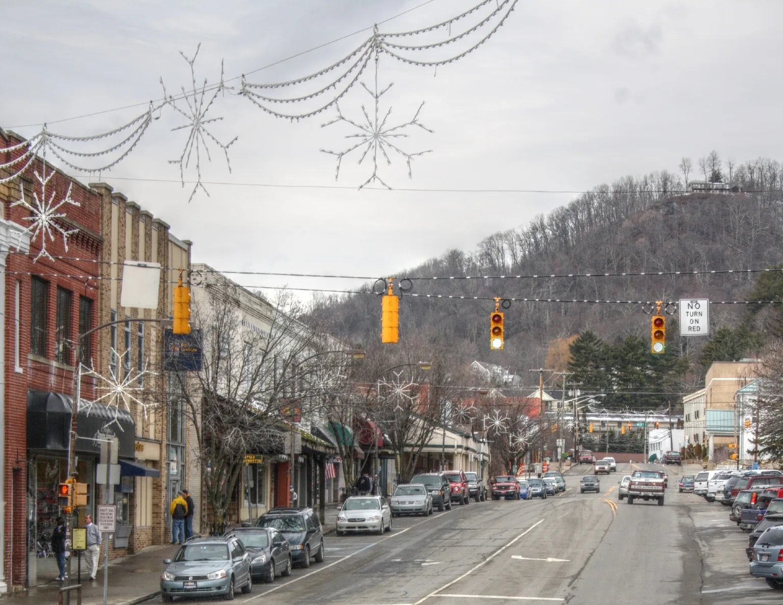
North Depot Street in Boone, North Carolina
North Depot Street in Boone is a two-lane, asphalted residential street. It runs in a northeast-southwest direction starting from Queen Street and crosses West King Street and ends at Depot Street. Nearby you can find among others an artwork and a cafe. North Depot Street also exists in Catawba County, Gaston County, Montgomery County, Randolph County and Stanly County.
- Road Type
- residential street
- Lanes
- 2
- Route
- northeast-southwest
Image
Streets nearby
Queen StreetAustin & Barnes Funeral Directors
150 ft
Linney Street350 ft
West King StreetHands Gallery, Lililu on King, Appalachian Sportswear, Venture Chocolate and Wine, Highway Robbery, Boone Belles, The Social, Earth Fare, Boone Drug at King Street Fountain & Grill, Miller Industries, Human Services Center, Pinnacle Drive, High County Condos, Edgecliff Lane, Vidalia Restaurant & Wine Bar, Watauga County Courthouse, Ram's Rack, Water Street / King Street, Off the Rack, Common Good Co, Mountain Running Company, Lucky Penny, Shear Shakti, Care Collective, The Nthº Gallery & Studios, Village Jewellers, High Country Souvenir, Watsonatta Western World, Ellison, Future Relics, Elevated Piercing, South End Brewing Co., Come Back Shack, Ben & Jerry's, The Shoppes at Farmers, Alumni Hall, Famous Toastery, King Street / North Depot Street, F.A.R.M. Cafe, Appalachian Antique Mall, The Happy Place, Betty's Biscuits, Noble Tattoos & Piercings, Grandpa Joe's, Sabeing, Charleston Hemp Collective, The Magic Mailbox, Tetness, the Polar Bear, El Tacorriendo, Dan'l Boone Inn
0.1 mi
Depot StreetMagic Cycles, Black Cat Burrito, Anna Banana's Fine Consignment, King Street / Depot Street
0.1 mi
Tremont Street0.1 mi
North Street0.1 mi
Howard StreetFootsloggers, Doc and Merle Watson, University Post Office, Lucy Brock Child Development Center, Howard Street / Hardin Street, Dan'l Boone Inn Restaurant
0.1 mi
Shanthi Way0.2 mi
Appalachian StreetInsomnia Cookies, 3rd Place
0.2 mi
Austin Lane0.2 mi
Grand Boulevard0.2 mi
Carolina AvenueJunaluska
0.2 mi
Summit Street0.2 mi
Apartment buildings nearby
Orchard Place0.2 mi
King & College0.2 mi
Ivy Hall Duplex0.2 mi
Ivy Hall Apartments0.2 mi
494 Lofts0.2 mi
Artworks nearby
Time and Honor550 ft
Bars nearby
FizzEd0.1 mi
Bookstores nearby
The Dancing Moon0.1 mi
Buildings nearby
ECRS550 ft
Appalachian Theatre Administrative Office0.1 mi
Buildings under construction nearby
Mint Cuisine of India250 ft
Cafes nearby
Espresso News500 ft
Clothing stores nearby
Mi Rancho Western Apparel450 ft
Appalachian Tees0.2 mi
Commercial buildings nearby
Olde Bailey Building0.1 mi
Community centers nearby
Jones House Community Center350 ft
Fast food restaurants nearby
Jimmy John's0.1 mi
Fire stations nearby
Boone Fire Station0.1 mi
Gift shops nearby
Mountaineer Mania0.2 mi
Libraries nearby
Watauga County Public Library400 ft
Outdoor stores nearby
Mast General Store250 ft
Parking lots nearby
Queen Street Parking Deck550 ft
Parks nearby
North Street Park0.1 mi
Junaluska City Park0.2 mi
Places of worship nearby
Boone Mennonite Brethren Church0.2 mi
Post offices nearby
United States Post Office250 ft
Residential areas nearby
Daniel Boone Condomiums500 ft
Restaurants nearby
Lost Province Brewing Company200 ft
Howard Station0.1 mi
Boone Bagelry0.1 mi
Macado's0.1 mi
Wild Craft Eatery0.2 mi
Retail buildings nearby
Allen Tate500 ft
Tattoo studios nearby
Speakeasy Tattoo Company450 ft
Theaters nearby
Appalachian Theatre of the High Country0.1 mi
Town halls nearby
Boone Town Hall0.1 mi
Public transit map Boone Legend
| Railway | |
| Bus | |
| Streetcar |
Bicycle map Boone Legend
| Bike path | |
| Bike lane on roadway | |
| Cycling allowed on bus lane | |
| Bicycle street | |
| Open to cyclists | |
| Open to cyclists, good path | |
| Cycling prohibited | |
| Cobblestone |
| Long-distance bike route | (depending on scale) | |
| Long-distance bike route |
Pedestrian map Boone Legend
| Path |
| Long-distance hiking trail | (depending on scale) | |
| Long-distance hiking trail | ||
| Pedestrians prohibited |