
6th Street South in Hettinger, North Dakota
6th Street South in Hettinger is a two-lane, asphalted residential street. It runs in a north-south direction starting from 6th Street North and crosses Adams Avenue, 2nd Avenue South and 3rd Avenue South and ends at Railroad Avenue. 6th Street South also exists in Dickey County, Cass County, Eddy County, Foster County and Morton County.
- Road Type
- residential street
- Lanes
- 2
- Route
- north-south
Image
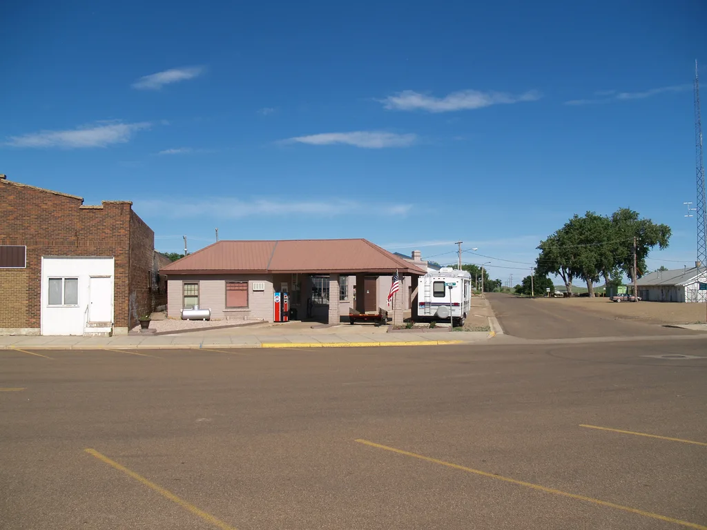
Streets nearby
Adams AvenueTop Coat Autobody
550 ft
7th Street South550 ft
3rd Avenue SouthHettinger Elementary School, Hettinger High School
550 ft
South Main Street0.1 mi
2nd Avenue South0.1 mi
8th Street South0.1 mi
2nd Avenue North0.1 mi
4th Street South0.1 mi
North Main StreetHettinger
0.2 mi
3rd Avenue North0.2 mi
Mirror Lake Road0.2 mi
3rd Street South0.2 mi
9th Street South0.2 mi
4th Avenue South0.3 mi
6th Street North0.3 mi
7th Street North0.3 mi
5th Street North0.3 mi
4th Avenue North0.3 mi
2nd Street South0.3 mi
10th Street South0.3 mi
8th Street North0.3 mi
4th Street North0.3 mi
2nd Street North0.3 mi
5th Avenue South0.3 mi
3rd Street North0.3 mi
North Airport Road0.4 mi
North 1st Street0.4 mi
5th Avenue North0.4 mi
6th Avenue North0.4 mi
1st Street SouthWelcome to North Dakota
0.5 mi
Christy Court0.5 mi
Banks nearby
Dakota Western Bank250 ft
Dacotah Bank0.2 mi
Bars nearby
Pastime Bar & Lounge0.1 mi
Community centers nearby
The Granary0.2 mi
Courthouses nearby
Adams County Courthouse550 ft
Funeral homes nearby
Evenson Jensen Funeral Home0.3 mi
Libraries nearby
Adams County Library500 ft
Movie theaters nearby
Hettinger Theater0.2 mi
Parks nearby
Mirror Lake Park0.2 mi
Places of worship nearby
Assembly of God Church0.2 mi
Hettinger Luthern Church0.2 mi
United Methodist Church0.5 mi
Post offices nearby
United States Post Office0.1 mi
Railways nearby
Hettinger Siding0.3 mi
BNSF Hettinger Subdivision0.4 mi
Restaurants nearby
Suzie's Woodfire Grill100 ft
Schools nearby
Hettinger Public School0.1 mi
Supermarkets nearby
Kenedy's Fresh Foods0.2 mi
Public transit map Hettinger Legend
| Railway | |
| Bus | |
| Streetcar |
Bicycle map Hettinger Legend
| Bike path | |
| Bike lane on roadway | |
| Cycling allowed on bus lane | |
| Bicycle street | |
| Open to cyclists | |
| Open to cyclists, good path | |
| Cycling prohibited | |
| Cobblestone |
| Long-distance bike route | (depending on scale) | |
| Long-distance bike route |
Pedestrian map Hettinger Legend
| Path |
| Long-distance hiking trail | (depending on scale) | |
| Long-distance hiking trail | ||
| Pedestrians prohibited |