
East 6th Street in Dickinson, North Dakota
East 6th Street in Dickinson is a residential street. It runs in an east-west direction starting from West 6th Street and crosses Sims Street, 1st Avenue East, 2nd Avenue East, 3rd Avenue East and 4th Avenue East and ends at Summit Drive. East 6th Street also exists in Pembina County and Walsh County.
- Road Type
- residential street
- Route
- east-west
Image
Restaurants
Hearing aid centers
Computer stores
Fire stations
Banks
Schools
Doctor's offices
Libraries
Pet stores
Places of worship
Hair salons
Massage therapy clinics
Frame shops
Fast food restaurants
Streets nearby
East 5th Street400 ft
7th Street East450 ft
East 8th Street0.1 mi
East 4th Street0.1 mi
2nd Avenue East0.1 mi
Summit Drive0.2 mi
4th Avenue East0.2 mi
Brick Drive0.2 mi
East 3rd Street0.2 mi
West 6th Street0.2 mi
1st Avenue EastAffinity on First
0.3 mi
West 5th Street0.3 mi
3rd Street EastSaint Wenceslaus Roman Catholic Church, Trinity Elementary East
0.3 mi
Colfax Street0.3 mi
West 8th Street0.3 mi
Sims StreetRedeemer Lutheran Church, Holiday Inn Express, Candlewood Suites
0.3 mi
Dupont Street0.3 mi
West 4th StreetFirst Congregational Church
0.3 mi
2nd Street EastGate City Bank
0.3 mi
6th Avenue East0.3 mi
East 9th Street0.3 mi
7th Avenue East0.3 mi
West 3rd StreetMiracle-Ear, TS Therapeutic Massage, Dickinson Area Public Library
0.3 mi
Johnson Drive0.3 mi
3rd Avenue East0.3 mi
West 2nd StreetSaint Patricks Roman Catholic Church, U.S. Bank
0.3 mi
Alder Avenue0.3 mi
Tweeten Place0.4 mi
Box Avenue0.4 mi
3rd Avenue WestSimonson Station Stores
0.4 mi
East 10th Street0.4 mi
West 9th StreetGreat Plains Clinic, P.C.
0.4 mi
1st Avenue WestLemongrass, Kirkwood Bank and Trust, Bravera Bank
0.4 mi
2nd Avenue WestKinderkidz Learning Center, de Porres House of Barbering, Dickinson Fire Station 1
0.5 mi
Allen Street0.5 mi
Foster Drive0.5 mi
Park Avenue0.5 mi
West 10th Street0.5 mi
Apartment buildings nearby
Park Place0.2 mi
Buildings nearby
Saint Wenceslaus Parish Office0.2 mi
Schwartz Offices0.2 mi
Courthouses nearby
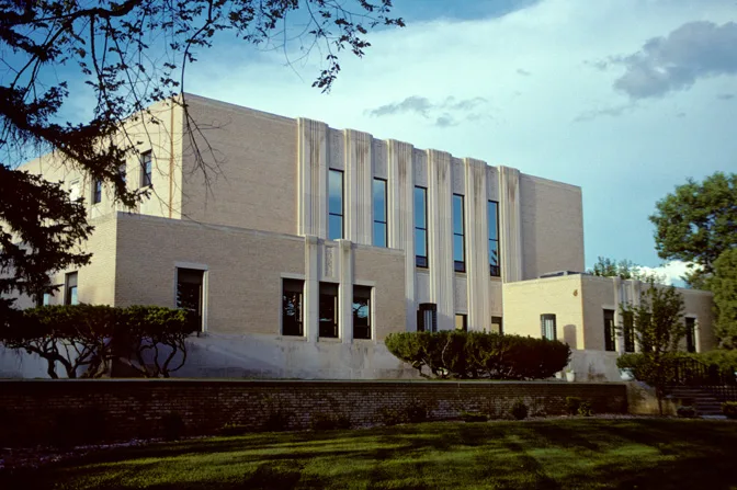
Stark County Courthouse0.2 mi
Office buildings nearby
Life Building0.3 mi
Parks nearby
Pleasant Valley Park0.2 mi
Pine Tree Park0.3 mi
Hospital Park0.3 mi
Places of worship nearby
Saint Johns Episcopal Church0.3 mi
Shopping malls nearby
St. Joe's Plaza0.3 mi
Social facilities nearby
Benedict Court0.2 mi
Public transit map Dickinson Legend
| Railway | |
| Bus | |
| Streetcar |
Bicycle map Dickinson Legend
| Bike path | |
| Bike lane on roadway | |
| Cycling allowed on bus lane | |
| Bicycle street | |
| Open to cyclists | |
| Open to cyclists, good path | |
| Cycling prohibited | |
| Cobblestone |
| Long-distance bike route | (depending on scale) | |
| Long-distance bike route |
Pedestrian map Dickinson Legend
| Path |
| Long-distance hiking trail | (depending on scale) | |
| Long-distance hiking trail | ||
| Pedestrians prohibited |