
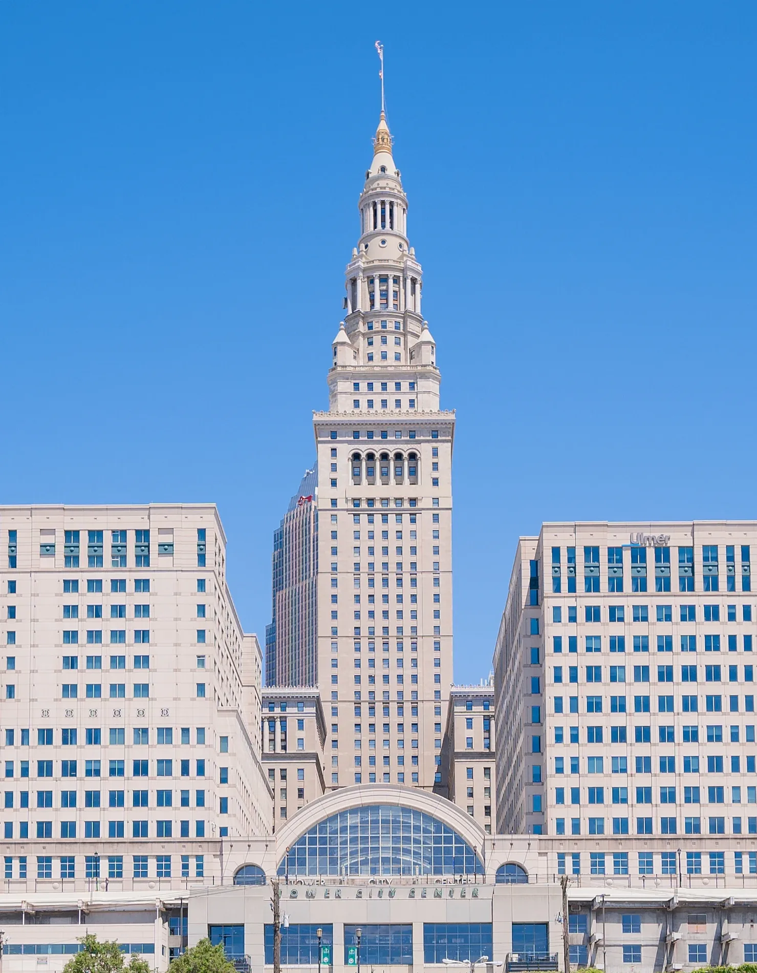
Terminal Tower in Cleveland
Terminal Tower in Cleveland is a commercial building, Public Square 50. Terminal Tower is built in the Beaux-Arts style. Ⓦ.
- House Number
- 50
- Street
- Public Square
- Building Type
- commercial building
- Website
- https://www.towercitycenter.com/
Image
Streets nearby
South RoadwayUnited States Post Office - Tower City, The Cookie Store, Citizens Bank, Darlafoxx, Moses Cleaveland, Mortar Practice, The Advanced Guard
300 ft
Prospect Avenue EastWahlburger's, City Tap, Red, Mr. Albert's Men's World, Read's Jewelry and Loan, Zanzibar, Bank of America, Ohio Desk Company, Domino's, Gateway Church Downtown Cleveland
450 ft
West Prospect AvenueTower City, A Dollar, Hyde Park Chophouse, 360 Clothing Studios, Playball, DTLR, KeyBank, The Feet Geeks, Faces by LaChaé, The Gold Station, Exclusive Jewelry, Unscript'd Boutique, Creative Tees, Mi'Amour, Apple Jax Toys, Dunkin', Turn Bar + Kitchen
450 ft
East 1st StreetDollar Bank
500 ft
RTA WalkwayRainbow, Charleys Philly Steaks, It's Greek To Me, Kelly's Cajun Grill, Auntie Anne's, Mixed Greens, Shanghai Joe's
550 ft
Superior AvenueSuperior Av & East Roadway, Saint Francis Catholic Church, Kingdom Hall of Jehovahs Witnesses, Saint Thomas Aquinas School, Deons, Spin cycle, Tones Wireless, Kiss Beauty Supply, Ohio Gas, Moe's Tire and Auto Service, Food Center, Sunoco, Cleveland, Public Square & East Roadway, The Color Guard, Calvary Church of God in Christ, Malik's Beauty Supplies Outlet, Freck's Lounge, hp, E&T Market
0.1 mi
West RoadwayPNC Bank, Designer Perfumes, Gateway Newsstand, Boost Mobile, Maker
0.2 mi
Rockwell AvenueViscaya Cannon, Pho Thang Cafe, Dunkin', Tom L. Johnson, Emperor's Palace, Camp Kiddos, Old Chinatown, The Teacher's Lounge, Reading a Garden, Abraham Lincoln, E. 3rd & Rockwell, Nine-Twelve District
0.2 mi
Frankfort AvenueFahrenheit, Johnny's Little Bar, Johnny's Downtown, Taza Lebanese Grill
0.2 mi
West 2nd StreetSouper Market, Simply Fresh Market, Morton's The Steakhouse, Maria's
0.2 mi
East RoadwayAt Short Range
0.2 mi
Canal Road0.2 mi
East 3rd Street0.2 mi
West Superior Avenue79 A/B 51A/B/C 22 26
0.2 mi
Ontario StreetJake's, Mr. Hero, Downtown Convenience, The Spread, Starbucks
0.2 mi
West Mall DriveThe Burnham, Fountain of Eternal Life
0.3 mi
Apartment buildings nearby
W. T. Grant Lofts0.1 mi
Attractions nearby
Huntington Convention Center of Cleveland0.3 mi
Buildings nearby
JACK Cleveland Casino250 ft
Landmark Office Towers400 ft
Lausche State Office Building0.2 mi
Global Center for Health Innovation0.3 mi
Justice Center0.3 mi
Buildings under construction nearby
Sherwin-Williams Pavilion0.1 mi
Sherwin-Williams Tower0.2 mi
Commercial buildings nearby
Park Building500 ft
May Company Building0.1 mi
75 Public Square0.2 mi
Society for Savings Building0.2 mi
United States Post Office Building0.2 mi
55 Public Square0.2 mi
Key Tower0.2 mi
200 Public Square0.2 mi
Standard Building0.2 mi
Rockefeller Building0.2 mi
Gilman Building0.2 mi
Courthouses nearby
Howard M. Metzenbaum United States Courthouse0.2 mi
Grasslands nearby
George Gund Foundation Green0.1 mi
Overlook Hill0.1 mi
Concert Hill0.2 mi
Hotels nearby
Hotel Cleveland, Autograph Collection350 ft
Cleveland Marriott Downtown at Key Tower0.2 mi
Parking lots nearby
Ontario Street Parking Garage500 ft
Parks nearby
Public Square0.1 mi
Places of worship nearby
Old Stone Church0.2 mi
Police stations nearby
Cleveland Police Department Headquarters0.2 mi
Restaurants nearby
REBOL400 ft
Shopping malls nearby
Tower City Center300 ft
Stations nearby
Public Square / Tower City350 ft
| Year built | 1928 |
|---|---|
| Official opening | 1930 |
| Architectural style | Beaux-Arts |
| Height | 215.8 m |
| Area | 53605 m² |
| Owned by | Forest City Realty Trust |
| Located in | Cleveland |
| Located on street | Public Square |
| Postal code | 44113 |
| Country | United States |
| Native name | Terminal Tower |
| Location | Downtown Cleveland |
| Part of | Tower City Center |
 Public transit map Cleveland Legend
| Railway | |
| Bus | |
| Streetcar |
 Bicycle map Cleveland Legend
| Bike path | |
| Bike lane on roadway | |
| Cycling allowed on bus lane | |
| Bicycle street | |
| Open to cyclists | |
| Open to cyclists, good path | |
| Cycling prohibited | |
| Cobblestone |
| Long-distance bike route | (depending on scale) | |
| Long-distance bike route |
 Pedestrian map Cleveland Legend
| Path |
| Long-distance hiking trail | (depending on scale) | |
| Long-distance hiking trail | ||
| Pedestrians prohibited |