
Cuyahoga River in Independence, Ohio
Cuyahoga River in Independence is a river. Cuyahoga River is also known as Crooked River. Cuyahoga River also exists in Brecksville. Ⓦ.
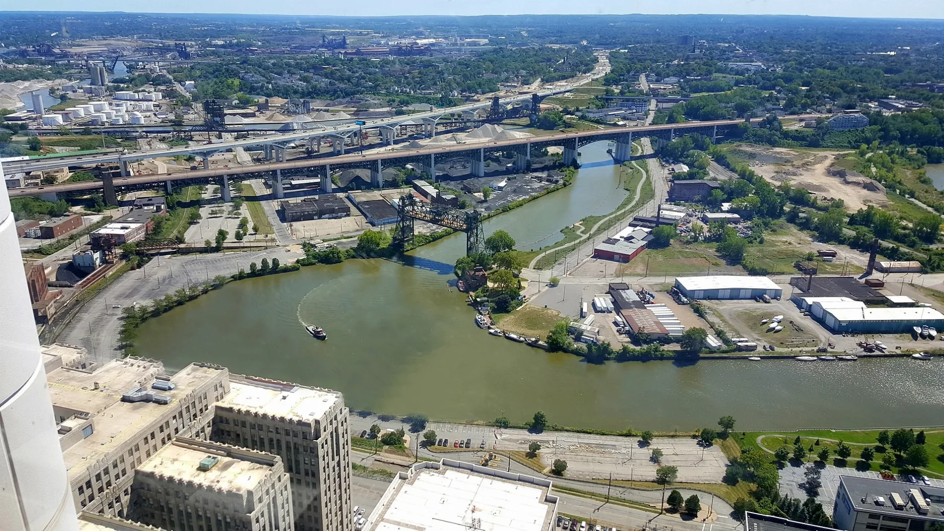
- Waterway Type
- river
Restaurants
Pharmacies
Rental services
Cafes
Cell phone stores
Hotels
Gift shops
Platforms
Beauty salons
Fast food restaurants
Gas stations
Post offices
Stations
Streets nearby
Ohio & Erie Canal Reservation All Purpose Trail0.1 mi
Canal Road0.2 mi
Warner Road0.2 mi
Granger RoadShell, Big Boy, Subway
0.2 mi
Schaaf Road0.2 mi
Brecksville Road0.2 mi
Old Brecksville Road0.3 mi
Fuhrmeyer Road0.4 mi
East 71st StreetCuyahoga Heights, Cuyahoga Heights High School, Remodeling Fx
0.4 mi
Bacci Park All Purpose Trail0.4 mi
Cloverleaf Parkway0.4 mi
Old Granger Road0.4 mi
Willowbrook Drive0.5 mi
Outerbelt South Freeway0.6 mi
Bletch Court0.6 mi
East 72nd Place0.6 mi
Marcelline Court0.6 mi
Kleber Court0.7 mi
Dressler CourtCuyahoga Heights Public Hall
0.7 mi
East Schaaf Road0.7 mi
Willow FreewayMarcy
0.7 mi
Exchange Road0.7 mi
Doll Drive0.8 mi
Ohio & Erie Canal Towpath TrailMalley's Chocolates, Yours Truly
0.8 mi
West Canal Road0.8 mi
Valley Belt Road0.8 mi
Rockside Woods Bouolevard0.8 mi
Rockside Woods Boulevard North0.8 mi
Wall Street0.9 mi
Longano Drive1.0 mi
West Creek Road1.1 mi
Abandoned railways nearby
Cleveland Sewage Treatment Plant Spur0.5 mi
Auto repair shops nearby
Hilltop Garage0.6 mi
Bowling alleys nearby
Spin0.4 mi
Canals nearby
Ohio & Erie Canal0.5 mi
Commercial buildings nearby
AAA East Central0.8 mi
AAA east Central Annex0.8 mi
Hotels nearby
Embassy Suites1.0 mi
Industrial areas nearby
Valley Belt Industrial Park0.6 mi
Landfills nearby
Cuyahoga Sanitary District Landfill0.4 mi
Cleveland Land Development Co - Schaaf Road Landfill0.8 mi
Parks nearby
Bacci Park0.2 mi
Pubs nearby
Tavern of Independence0.3 mi
Railways nearby
Willow Industrial Track0.2 mi
Cuyahoga Valley Scenic Railroad0.7 mi
Restaurants nearby
Cozumel0.3 mi
Harry's0.5 mi
Sports centers nearby
Topgolf0.9 mi
Streams nearby
Mill Creek0.4 mi
| Length | 137 |
|---|---|
| Located in | Cuyahoga County, Summit County, Portage County, Geauga County |
| Country | United States |
| Source | East Branch Cuyahoga River, West Branch Cuyahoga River |
| Mouth | St. Lawrence River, Lake Erie |
| Tributary | Brandywine Creek |
| Nickname | Crooked River |
| Native name | Cuyahoga |
 Public transit map Independence Legend
| Railway | |
| Bus | |
| Streetcar |
 Bicycle map Independence Legend
| Bike path | |
| Bike lane on roadway | |
| Cycling allowed on bus lane | |
| Bicycle street | |
| Open to cyclists | |
| Open to cyclists, good path | |
| Cycling prohibited | |
| Cobblestone |
| Long-distance bike route | (depending on scale) | |
| Long-distance bike route |
 Pedestrian map Independence Legend
| Path |
| Long-distance hiking trail | (depending on scale) | |
| Long-distance hiking trail | ||
| Pedestrians prohibited |