
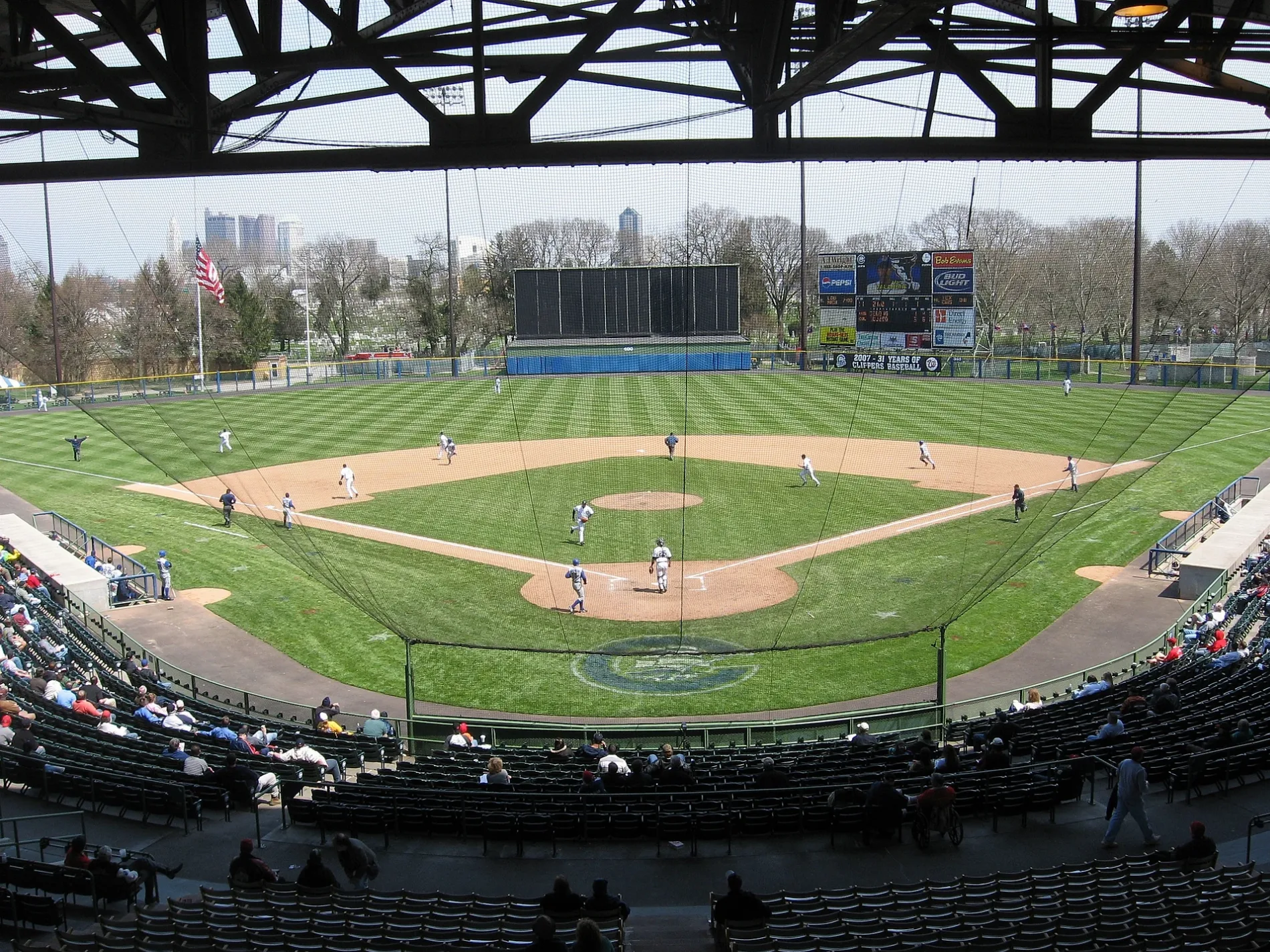
Cooper Stadium in Columbus, Ohio
Cooper Stadium in Columbus is a building. Cooper Stadium is located near South Cypress Avenue. Ⓦ.
- Building Type
- building
Image
Cell phone stores
Banks
Variety stores
Furniture stores
Secondhand stores
Bus stops
Places of worship
Convenience stores
Restaurants
Clothing stores
Tattoo studios
Fast food restaurants
Streets nearby
South Yale AvenueProgressive Holiness Church, All Paws Retreat and Spa, All Paws Retreat
450 ft
Thomas Avenue0.2 mi
South Cypress Avenue0.2 mi
Dakota AvenueFranklinton
0.2 mi
Campbell Avenue0.3 mi
Nace Avenue0.3 mi
Holton Avenue0.3 mi
West Mound StreetW Mound St & Dakota Ave, W Mound St & Mount Calvary Ave, Family Dollar, TNT Fashions, Rent-A-Center, W Mound St & Harrisburg Pike, Huntington Bank, Cricket Wireless, W Mound St & S High St, W Mound St & S Yale Ave, W Mound St & Glenwood Ave, W Mound St & S Princeton Ave, Columbus Temple
0.3 mi
Avondale Avenue0.3 mi
Brehl Avenue0.3 mi
Bellows Avenue0.3 mi
South Princeton Avenue0.3 mi
West Park Avenue0.3 mi
Mount Calvary Avenue0.4 mi
Van Buren Drive0.4 mi
Dana Avenue0.4 mi
Canonby Place0.4 mi
Hawkes Avenue0.4 mi
South Glenwood AvenueFood Mart
0.4 mi
Sullivant AvenueInner City Church, Church of the Redeemed, Saint Matthews Fire Baptized Holiness Church, Resurrection Life Church, United Pentecostal Assembly Church, Hope Christian Assembly Church, Los Primos Food Truck, Pentecostal Sons of God Church, Sullivant Ave & Dexter Ave, Sullivant Ave & S Southampton Ave, Sullivant Ave & S Sylvan Ave, Sullivant Ave & S Brinker Ave, Wendy’s, 3850 Sullivant Ave, Sullivant Ave & Holly Hill Dr, Sullivant Ave & N Wilson Rd, Pentecostal Saints of God Church, Boss Battle Tattoo Studio, Iglesia Chistina Vida Nueva, Sullivant Ave & Demorest Rd, Sullivant Ave & Kingsford Rd, Sullivant Ave & Derrer Rd, Sullivant Ave & Wedgewood Dr, Sullivant Ave & Exchange Dr, Sullivant Ave & Georgesville Rd
0.4 mi
Buchanan Drive0.5 mi
West FreewayS Souder Ave & W Mound St
0.5 mi
Martin AvenueFranklinton Cycle Works
0.5 mi
West Rich StreetSí Señor, Bicentenial Park Fountain, Stag, W Rich St & Starling St, W Rich St & S Green St, W Rich St & S Skidmore St, The Goat at RiverSouth, W Rich St & Lucas St, One Line Coffee, W Rich St & McDowell St
0.5 mi
Cemeteries nearby
Lullaby Land0.2 mi
1060.2 mi
Baby Rest0.2 mi
300.2 mi
1130.3 mi
1080.3 mi
S0.3 mi
1190.3 mi
1140.3 mi
1270.3 mi
740.3 mi
1230.3 mi
10.3 mi
490.3 mi
T0.3 mi
1260.3 mi
105 (Military)0.3 mi
Mount Calvary Cemetery0.4 mi
Fast food restaurants nearby
Rally's0.3 mi
Gas stations nearby
Sunoco0.1 mi
Places of worship nearby
First Pentecostal Gospel Church0.3 mi
Bellows Avenue Church of the Nazarene0.4 mi
Triumphant Christian Center Church0.4 mi
Railways nearby
Midland Subdivision0.5 mi
Supermarkets nearby
ALDI0.3 mi
| Year built | 1932 |
|---|---|
| Official opening | 1932 |
| Operator | Franklin County |
| Owned by | Franklin County |
| Located in | Columbus |
| Country | United States |
 Public transit map Columbus Legend
 | Railway | |
| Bus | |
| Streetcar |
 Bicycle map Columbus Legend
 | Bike path | |
| Bike lane on roadway | |
| Cycling allowed on bus lane | |
| Bicycle street | |
| Open to cyclists | |
| Open to cyclists, good path | |
| Cycling prohibited | |
| Cobblestone |
| Long-distance bike route | (depending on scale) | |
| Long-distance bike route |
 Pedestrian map Columbus Legend
 | Path |
| Long-distance hiking trail | (depending on scale) | |
| Long-distance hiking trail | ||
| Pedestrians prohibited |