
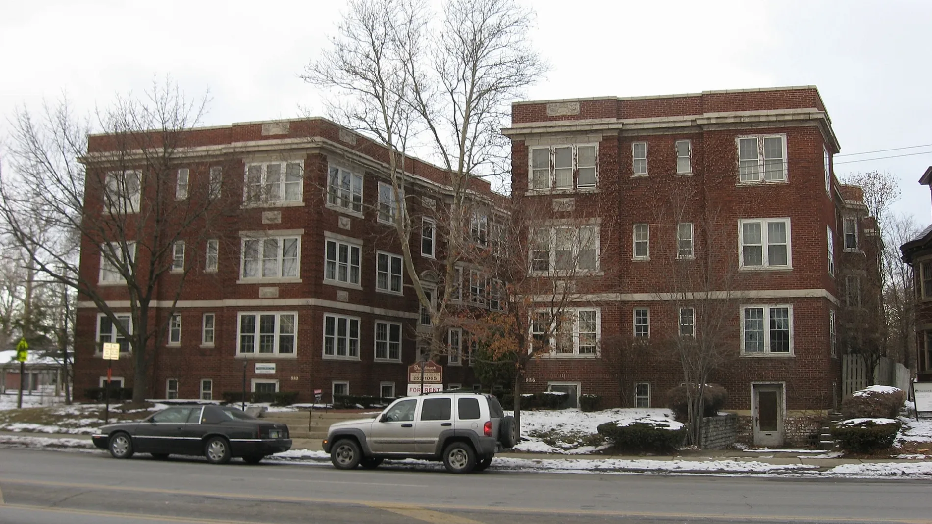
South Garfield Avenue in Columbus, Ohio
South Garfield Avenue in Columbus is a two-lane, asphalted residential street. The street has sidewalks. It runs in a north-south direction starting from East Broad Street and crosses East Capital Street and Agate Alley and ends at Oak Street. South Garfield Avenue also exists in Huron County.
- Road Type
- residential street
- Lanes
- 2
- Speed Limit
- 25 mph
- Route
- north-south
Image
Bars
Bike rentals
Candle shops
Ice cream shops
Bus stops
Beer gardens
Florists
Tattoo studios
Art galleries
Restaurants
Hair salons
Liquor stores
Cafes
Tea shops
Streets nearby
Agate Alley50 ft
Hamilton Park450 ft
East Broad StreetUnited States Postal Service Mailbox, Northeast Cannon, These Are My Jewels, Lest We Forget, Northwest Cannon, E Broad St & N High St, E Broad St & S High St, Credit Union of Ohio ATM, E Broad St & S 4th St, E Broad St & N Grant Ave, E Broad St & S Grant Ave, E Broad St & N Nelson Rd, E Broad St & Monypenny Ave, E Broad St & Taylor Station Rd, E Broad St & N 3rd St, E Broad St & S 3rd St, E Broad St & S 5th St, E Broad St & N 5th St, E Broad St & N 4th St, Discovery District, Cup O Joe, Broad Street United Methodist Church, E Broad St & N Washington Ave, E Broad St & S Washington Ave, E Broad St & Jefferson Ave, E Broad St & Winner Ave, E Broad St & Wilson Ave, E Broad St & Hamilton Park, E Broad St & Parsons Ave, E Broad St & Cardinal Park Dr, E Broad St & N Ohio Ave, E Broad St & S Ohio Ave, E Broad St & N 17th St, E Broad St & S James Rd, KeyBank, E Broad St & Reynolds Crossing Dr, E Broad St & Bannockburn Blvd, Speedway, E Broad St & Waggoner Rd, E Broad St & Meijer Dr, E Broad St & Cedar Cliff, 8400 E Broad St, E Broad St & the Limited, 3675 E Broad St, Walgreens, E Broad St & S Napoleon Ave, E Broad St & N Weyant Ave, Grandma's Pizza & Pasta, Snap & Crack Locksmith, Buckeye Pets, Impress Beauty Outlet, Synergi Salon, The Vaper Shop, Z's Asian Bistro, E Broad St & N Hampton Rd, E Broad St & S Hampton Rd, E Broad St & N Ashburton Rd, E Broad St & Lowell Rd, E Broad St & Kellner Rd, E Broad St & N Harding Rd, E Broad St & S Harding Rd, E Broad St & N Broadleigh Rd, E Broad St & S Broadleigh Rd, E Broad St & Brunson Ave, E Broad St & Franklin Park Con, E Broad St & Woodland Ave, E Broad St & Parkwood Ave, E Broad St & Franklin Pk W, E Broad St & Latta Ave, E Broad St & Governor Pl, E Broad St & S Champion Ave, Near East Side, E Broad St & N 20th St, E Broad St & Hoffman Ave, E Broad St & S Douglas St, E Broad St & Mcnaughten Rd, Chick-fil-A, E Broad St & Outerbelt St, E Broad St & Brice Rd, E Broad St & N Brice Rd, E Broad St & Broad Pointe Pl, E Broad St & Eastpointe Ridge Dr, Turkey Hill, E Broad St & Blacklick Xing, E Broad St & Reynoldsburg New Albany, E Broad St & Lancaster Ave
500 ft
East Capital StreetPNC Bank
500 ft
South Monroe Avenue0.1 mi
North Garfield Avenue0.1 mi
Gustavus LaneOld Familiar Barber Shop
0.1 mi
Douglass Street0.1 mi
Avon Place0.1 mi
Glover Alley0.2 mi
East Innerbelt0.2 mi
East Chapel Street0.2 mi
Hamilton Park East Service0.2 mi
South 17th Street0.2 mi
Oak StreetColumbus Windows and Siding Company, The Olde Towne Tavern, Yellow Brick Pizza, Arcade SuperAwesome, The Olde Oak, CoGo Parsons Ave and Oak St, Gemüt Biergarten, Local Cantina, Koso, Taste of Greece & Morocco Street Food, The Plant Gays, Winston's Coffee & Waffles, Just Chicken, The Bearded Baker, NOLA Daq Shack, Saba Middle Eastern Grill, Masa Mexican Grill, Monster Baby Donuts, The Railhouse, Switch, Michi Patterns, Corner Stone Craft Beer & Wine, Hangover Easy
0.2 mi
Bryden RoadDada Matcha Bar
0.2 mi
Willow Street0.2 mi
Elliott Alley0.2 mi
Franklin AvenueOlde Towne East
0.2 mi
Jefferson AvenueEleventh Avenue School, Academy For Leadership
0.2 mi
Bryden AlleyOld First Presbyterian Church
0.3 mi
Lester Drive0.3 mi
I 710.3 mi
South Everett Alley0.3 mi
Allen Avenue0.3 mi
East Cherry StreetMount Olivet Baptist Church, 16 Bit Bar, Main Street
0.4 mi
Galloway Alley0.4 mi
East Town StreetHeritage Museum of Kappa Kappa Gamma, CoGo Topiary Park - Town St, Subway, UPS Drop Box
0.4 mi
East Walnut Street0.4 mi
South Eleventh Street0.4 mi
East Rich StreetCoGo Columbus Commons - Rich St, Holtzman-Main, Holy Cross School, Psychic Gallery, FlixBus Columbus (Downtown)
0.4 mi
East Main StreetE Main St & S High St, E Main St & S 5th St, E Main St & S Grant Ave, Tim Hortons, Dogtopia, Verizon, E Main St & Brookside Dr, The UPS Store, E Main St & Eastmoor Blvd, E Main St & Noe Bixby Rd, E Main St & Enfield Rd, Subway, Papa John's, E Main St & S Chesterfield Rd, E Main St & S Broadleigh Rd, E Main St & Kenwick Rd, Speedway, Mr. Tire, KeyBank, Theatre Street Dance Academy, E Main St & Rhoads Ave, E Main St & Bulen Ave, E Main St & Fairwood Ave, E Main St & Seymour Ave, E Main St & Kelton Ave, E Main St & Miller Ave, E Main St & Kimball Pl, E Main St & Kendall Pl, E Main St & Wilson Ave, E Main St & S Champion Ave, CoGo Champion Ave and Main St, E Main St & S Ohio Ave, E Main St & Gilbert St, E Main St & Carpenter St, Feed Me! Sandwich Kings!, E Main St & Holtzman Ave, Southern Theatre, Red Brick District, E Main St & Allen Ave, E Main St & S Washington Ave, Apostolic Church of Christ, Grace Bethany Church, E Main St & Barnett Rd, E Main St & Ruby Ave, E Main St & S Weyant Rd, E Main St & McNaughten Rd, E Main St & S Monroe Ave, E Main St & Parsons Ave, E Main St & S James Rd, E Main St & Value City, E Main St & Main 270 Center, Donatos Pizza, E Main St & S 4th St
0.4 mi
Main- Rich Street Connector0.4 mi
Parsons AvenueParsons Ave & Ashwood Rd, Parsons Ave & Elsmere St, Parsons North Brewing Company, Parsons Ave & Columbus St, Parsons Ave & Zimpfer St, Parsons Ave & Thurman Ave, Parsons Ave & E Welch Ave, Awol Bar, Olde Towne Flowers and Gifts, Parsons Ave & Groveport Rd, Parsons Ave & Dering Ave, Parsons Ave & Frebis Ave, Parsons Ave & E Alcott Rd, Parsons Avenue Church of Christ, Parson's Avenue Church of God, Parsons Ave & Williams Rd, Parsons Ave & Rumsey Rd, Parsons Ave & Hilock Ave, Far South Columbus, The Mercury Diner, WingStreet, Parsons Ave & E Whittier St, Strut The Salon, Alchemy Cafe, Headies Hideout, 39 Below FroYo, Upper Cup Coffee, Royal Tresses Hair Salon, Cap City Tattoo Co., The Candle Booth, Steelton, Parsons Ave & E Barthman Ave, Parsons Ave & E Innis Ave, Parsons Ave & Southwood Ave, Parsons Ave & Sheldon Ave, Parsons Ave & E Gates St, Chef Hiro, Parsons Ave & Corr Rd, Parsons Ave & Ziegler Ave, Parsons Ave & Harland Dr, Parsons Ave & Indian Mound Park, Parsons Baptist Church
0.4 mi
Allotment gardens nearby
OTE Community Garden300 ft
Apartment buildings nearby
The Frisble Apartments0.1 mi
Buildings nearby
Gittes Law Group400 ft
Davis Discovery Center0.3 mi
Townley Court0.3 mi
Commercial buildings nearby
Columbus Music Hall300 ft
Community centers nearby
Kaleidoscope Youth Center0.3 mi
Convenience stores nearby
Duchess Shoppe0.1 mi
Gas stations nearby
BP0.1 mi
Museums nearby
Kelton House Museum0.3 mi
Places of worship nearby
Shiloh Christian Center350 ft
Broad Street Presbyterian Church450 ft
Public buildings nearby
Columbus Public Health0.3 mi
Restaurants nearby
Dragon One400 ft
Theaters nearby
The Bluestone0.3 mi
 Public transit map Columbus Legend
| Railway | |
| Bus | |
| Streetcar |
 Bicycle map Columbus Legend
| Bike path | |
| Bike lane on roadway | |
| Cycling allowed on bus lane | |
| Bicycle street | |
| Open to cyclists | |
| Open to cyclists, good path | |
| Cycling prohibited | |
| Cobblestone |
| Long-distance bike route | (depending on scale) | |
| Long-distance bike route |
 Pedestrian map Columbus Legend
| Path |
| Long-distance hiking trail | (depending on scale) | |
| Long-distance hiking trail | ||
| Pedestrians prohibited |