
Station 67 in Columbus, Ohio
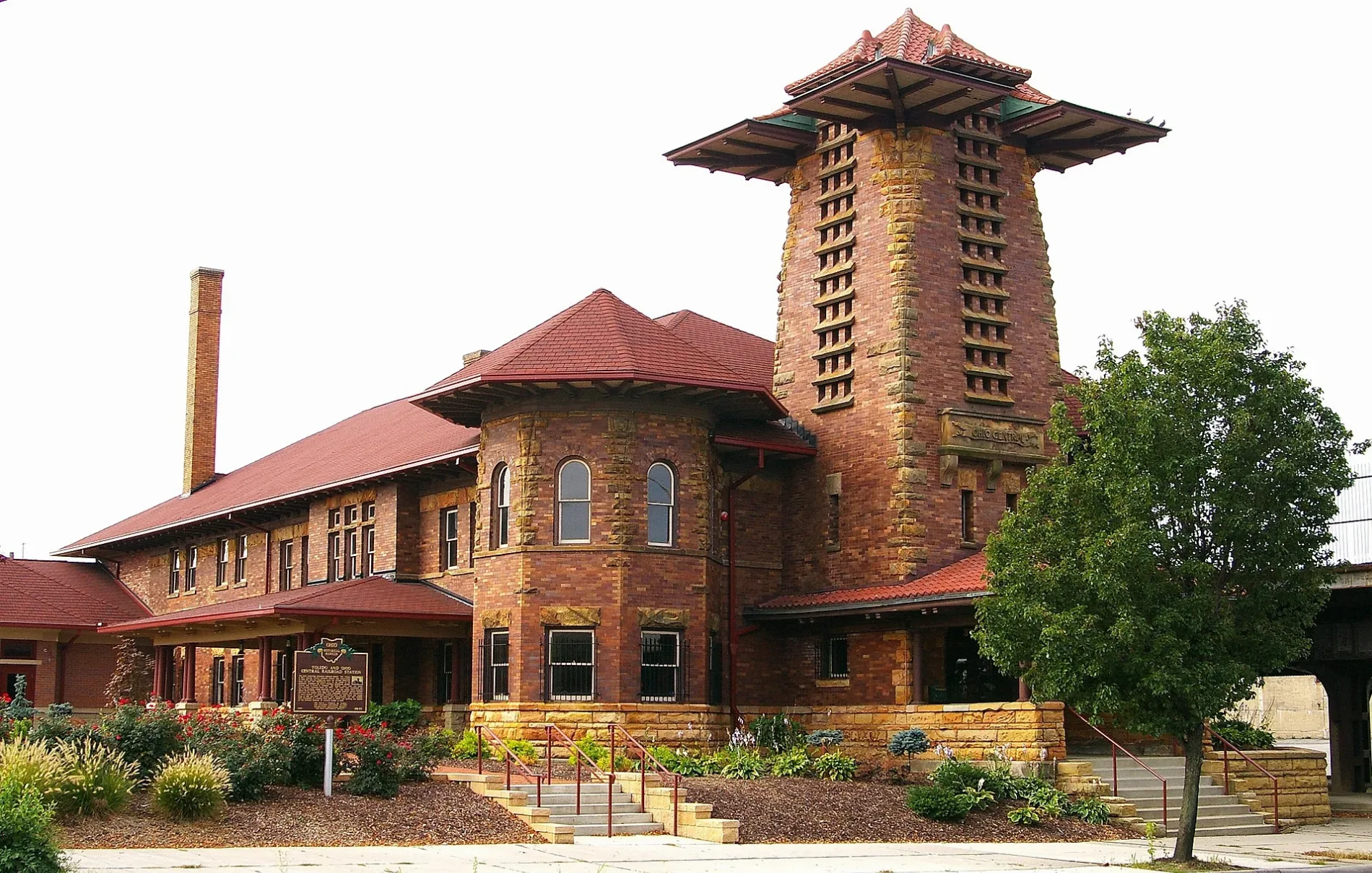
Station 67 in Columbus is a historic object. Station 67 is also known as Toledo and Ohio Central Railroad Station. Station 67 is located near West Capital Street. Ⓦ.
- Alternate Name
- Toledo and Ohio Central Railroad Station
- Building Type
- building
Image
Cafes
Restaurants
Candy stores
Tourist information centers
Bus stops
Parking lots
Event venues
Arts centers
Places of worship
Bike rentals
Fast food restaurants
Bars
Schools
Streets nearby
West Capital StreetGods Glory Temple, Hilltop Evangelical Lutheran Church, Hilltop Lutheran Church, Saint Sebastian Church, Saint Aloysius Roman Catholic Church, Saint Thomas Baptist Church
350 ft
Rush AlleyMaudine's
500 ft
High Water Alley550 ft
Belle StreetPeninsula Garage
550 ft
Starling Street0.1 mi
North May Avenue0.2 mi
McDowell StreetGlobal Bible Way Church
0.2 mi
South May Avenue0.2 mi
City View Walk0.2 mi
Lucas Street400 West Rich Arts Incubator
0.2 mi
West Chapel Street0.2 mi
West Broad StreetWest Broad Street Church of Christ, W Broad St & N Davis Ave, W Broad St & S Davis Ave, W Broad St & S Front St, W Broad St & Marconi Blvd, W Broad St & S Southampton Ave, 3440 W Broad St, W Broad St & Rhodes Park, W Broad St & Glenwood Park, Columbus, CoGo High St and Broad St, W Broad St & S Roys Ave, Enterprise, W Broad St & N Brinker Ave, W Broad St & S Algonquin Ave, Hillcrest Baptist Church, Mobile, W Broad St & S Burgess Ave, FedEx Drop Box, United Parcel Service Drop Box, United States Postal Service Mailbox, World Outreach for Christ Tabernacle of Truth, W Broad St & Midland Ave, W Broad St & Whitethorne Ave, W Broad St & N Hartford Ave, W Broad St & Hawkes Ave, Sunoco, W Broad St & Stevens Ave, Amazing Grace Baptist Church, CoGo, Gravity Event Center, W Broad St & Belle St, U-Haul, W Broad St & N Central Ave, W Broad St & Lechner Ave, W Broad St & S Central Ave, W Broad St & S Cypress Ave, West Broad Street Missionary Chapel, W Broad St & Chicago Ave, W Broad St & W Park Ave, W Broad St & S Skidmore St, W Broad St & N May Ave, W Broad St & N Skidmore St, Starbucks, W Broad St & N Sylvan Ave, Hilltop Branch Public Library, W Broad St & Haldy Ave, W Broad St & N Hague Ave, W Broad St & S Hague Ave, W Broad St & N Ogden Ave, W Broad St & S Warren Ave, W Broad St & N Oakley Ave, W Broad St & S Highland Ave, Master Commission New Covenant Church, W Broad St & N Eureka Ave, W Broad St & S Wayne Ave, Bottoms Up Coffee, W Broad St & Rodgers Ave, W Broad St & S May Ave, W Broad St & N Westmoor Ave, W Broad St & S Westgate Ave, Franklinton Community of Hope Church, W Broad St & N Yale Ave
0.2 mi
West State StreetStauf's Cofee, Federal Express Drop Box, UPS Drop-Box, Subway, Heartland Bank, Ho Toy, Little West Tavern, Little West Poutine, Scioto Peninsula
0.2 mi
Broderick Street0.2 mi
West Town StreetCoGo Lucas St and Town St, Strongwater Food & Spirits, W Rich St & S Davis Ave, Westside Baptist Church, Central Christian Academy, Central Avenue Church of Christ
0.2 mi
Neil AvenueNeil Ave & W 10th Ave, Archer House, Mack Hall, Joshua Schottenstein Pottery, Mirror Lake Eatery, Tuttle Park, Neil Ave & W 7th Ave, CoGo Neil Ave and King Ave, Neil Ave & Spruce St, Neil Ave & Vine St, Neil Ave & W 1st Ave, Neil Ave & Collins Ave, Flytown, Neil Ave & W 5th Ave, Neil Ave & 4th Ave, Neil Ave & W 3rd Ave, Neil Ave & W 2nd Ave, Neil Ave & Hubbard Ave, Neil Ave & W Goodale St, Neil Ave & Broadbelt Ln, Be Kind, Neil Ave & W 11th Ave, Neil Ave & W 8th Ave
0.3 mi
Apartment buildings nearby
Gravity Building A0.1 mi
Franklinton Apartments at State and May0.2 mi
Franklin Station0.2 mi
Bars nearby
Land Grant Brewing Company0.2 mi
Rehab Tavern0.2 mi
Buildings nearby
Gravity Building0.2 mi
Strongwater0.2 mi
North Bank Park Pavilion0.3 mi
Construction sites nearby
The Macklin0.1 mi
Scioto Peninsula Phase II0.2 mi
GreenHouse Gravity0.2 mi
Hackerspaces nearby
Columbus Idea Foundry0.2 mi
Hotels nearby
The Junto0.1 mi
Museums nearby
National Veterans Memorial and Museum0.1 mi
COSI0.2 mi
Parking lots nearby
Parking Garage 20.1 mi
Parking0.1 mi
Parking Garage 10.2 mi
Gravity Apartments parking garage0.2 mi
Parks nearby
Dorrian Green0.2 mi
West Bank Park0.2 mi
Memorial Grove0.2 mi
Places of worship nearby
Agora Christian Fellowship Church300 ft
Police stations nearby
Columbus Police Substation Precincts 8 & 160.2 mi
Railways nearby
Auburn Connecting Track0.1 mi
Dayton District0.1 mi
Scioto Connection0.1 mi
CSX Columbus Subdivision0.2 mi
Western Branch0.2 mi
Residential areas nearby
ONE at the Peninsula0.2 mi
Row houses nearby
Gravity Building E0.1 mi
Swimming pools nearby
Gravity Building D Pool0.2 mi
Other nearby
Franklinton Flood Wall0.2 mi
| Heritage designation | National Register of Historic Places listed place |
|---|---|
| Located in | Columbus |
| Country | United States |
 Public transit map Columbus Legend
| Railway | |
| Bus | |
| Streetcar |
 Bicycle map Columbus Legend
| Bike path | |
| Bike lane on roadway | |
| Cycling allowed on bus lane | |
| Bicycle street | |
| Open to cyclists | |
| Open to cyclists, good path | |
| Cycling prohibited | |
| Cobblestone |
| Long-distance bike route | (depending on scale) | |
| Long-distance bike route |
 Pedestrian map Columbus Legend
| Path |
| Long-distance hiking trail | (depending on scale) | |
| Long-distance hiking trail | ||
| Pedestrians prohibited |