
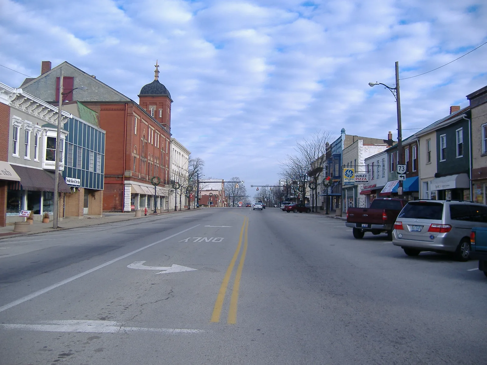
West South Street in Hillsboro, Ohio
West South Street in Hillsboro is an asphalted secondary road (Road number SR 138). It runs in an east-west direction starting from Danville Pike and crosses Oak Street, Vine Street, South Elm Street, South West Street, Ash Street and South High Street and ends at East South Street. This street is part of the highway "138". West South Street also exists in Warren County, Clermont County, Greene County, Franklin County and Fairfield County.
- Road Type
- secondary road
- Route
- east-west
Image
Coffee shops
Schools
Thrift stores
Electronics stores
Banks
Vape shops
Restaurants
Fast food restaurants
Cafes
Courthouses
Ice cream shops
Clothing stores
Florists
Hair salons
Gift shops
Libraries
Laundries
Streets nearby
West Walnut StreetLittle Lamb Christian Pre-School
500 ft
West Pleasant Street550 ft
Ash Street0.1 mi
South Elm Street0.1 mi
West Main StreetMain St. Apparel & Tux, Momma's West Main Street Cafe, Sonner's Barber Shop, White's Bakery
0.2 mi
South High StreetHoltfield Coffee, Hillsboro Historic Business District, Collins Appliance Store, Common Thread Collective
0.2 mi
Governor Foraker Place0.2 mi
Governor Trimble PlaceHighland County Courthouse, Highland County Law Library
0.3 mi
West Beech Street0.3 mi
East Main StreetEast Main Street Historic District, Merchants National Bank
0.3 mi
West North StreetUnited Dairy Farmers, Papa John's
0.4 mi
Antique stores nearby
Rusty Hill Antiques0.2 mi
Bakeries nearby
White's Bakery0.2 mi
Banks nearby
National Cooperative Bank0.2 mi
Merchants National Bank0.3 mi
Boutiques nearby
Scarletts Boutique0.2 mi
Buildings nearby
Brackett's Automotive0.2 mi
Fallon House0.2 mi
Buckeye Family Eye Clinic0.2 mi
Highland County Republican Party0.2 mi
24 Deli & Pizza0.2 mi
Van Zant Law Office0.3 mi
Crowe Financial Group0.3 mi
City of Hillsboro0.3 mi
Highland Co. Hearing Aid Center0.4 mi
Nationwide0.4 mi
Donald E. Fender Inc. Realtors0.4 mi
Clinics nearby
Urgent Care0.2 mi
Clothing stores nearby
Janie's Closet0.3 mi
Coffee shops nearby
5 Beans Coffee & Cream0.3 mi
Commercial buildings nearby
The Highland County Press0.2 mi
Community centers nearby
Eagles Lodge0.3 mi
Cosmetics stores nearby
Merle Norman0.2 mi
Event venues nearby
Hillsboro Orpheum0.3 mi
Fast food restaurants nearby
Domino's0.2 mi
Gas stations nearby
Speedway0.2 mi
Pawn shops nearby
Hillsboro Pawn & Jewelry0.3 mi
Places of worship nearby
Hillsboro First Baptist Church0.1 mi
Wayman's Chapel AME Church0.1 mi
Church of Christ0.1 mi
Cornerstone Family Worship Center0.2 mi
Saint Mary Catholic Church0.2 mi
Police stations nearby
Hillsboro Police0.2 mi
Pubs nearby
The Patriot Public House0.2 mi
Restaurants nearby
Pizza Hut0.2 mi
Schools nearby
St. Mary Catholic School & Parish Center0.2 mi
Stationery stores nearby
Single Office Stop0.3 mi
Supermarkets nearby
Community Markets0.2 mi
Variety stores nearby
Family Dollar0.2 mi
Public transit map Hillsboro Legend
| Railway | |
| Bus | |
| Streetcar |
Bicycle map Hillsboro Legend
| Bike path | |
| Bike lane on roadway | |
| Cycling allowed on bus lane | |
| Bicycle street | |
| Open to cyclists | |
| Open to cyclists, good path | |
| Cycling prohibited | |
| Cobblestone |
| Long-distance bike route | (depending on scale) | |
| Long-distance bike route |
Pedestrian map Hillsboro Legend
| Path |
| Long-distance hiking trail | (depending on scale) | |
| Long-distance hiking trail | ||
| Pedestrians prohibited |