
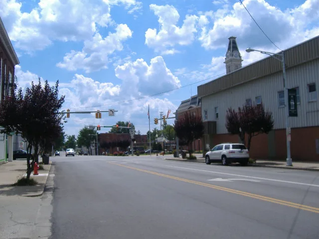
North Washington Street in Greenfield, Ohio
North Washington Street in Greenfield is a secondary road (Road number SR 41;SR 753). It runs in a southeast-northwest direction starting from Industrial Park Drive and crosses North 5th Street, North 4th Street, Chestnut Street, Mill Street, Massie Street, Ludlow Avenue, Spring Street, McClain Avenue, North Street and Lafayette Street and ends at Jefferson Street. This street is part of the highways 41 and 753.
- Road Type
- secondary road
- Route
- southeast-northwest
Places of worship
Clinics
Fast food restaurants
Police stations
Courthouses
Restaurants
Streets nearby
McClain Avenue100 ft
Spring Street350 ft
Boyd Avenue450 ft
Ludlow Avenue0.1 mi
Lafayette Street0.2 mi
North 4th Street0.2 mi
Massie Street0.2 mi
Evans Street0.2 mi
Jefferson StreetGreenfield City Hall, Greenfield Police Department, Highland County Court, Taco Bell, Subway, Greenfield
0.2 mi
North 5th StreetGospel Lighthouse Church
0.3 mi
Fayette Street0.3 mi
North 6th Street0.3 mi
Antique stores nearby
Rusty Relics Vintage Market0.2 mi
Banks nearby
Southern Hills Community Bank0.2 mi
Community Savings Bank0.2 mi
Buildings nearby
Hardy Memorials0.1 mi
Paint Creek Joint EMS/Fire Dst0.2 mi
Wright Mausoleum0.2 mi
Highland Family Eye Care0.2 mi
Judkins & Hayes Attorneys At Law0.2 mi
Sitterle Insurance0.2 mi
Chester Eye Center0.2 mi
Homerun Insurance Services0.3 mi
Churches nearby
Shiloh Baptist Church0.2 mi
Clothing stores nearby
Beautiful Chaos Boutique0.2 mi
Computer stores nearby
Tech Guyz Computer Services0.2 mi
Fast food restaurants nearby
Domino's0.2 mi
Fire stations nearby
Greenfield Fire Department0.2 mi
Fitness centers nearby
Small Town Fitness0.2 mi
Funeral homes nearby
Murray-Fettro Funeral Home0.3 mi
Garages nearby
Bus Garage0.2 mi
Hair salons nearby
C&C Barbershop0.3 mi
Houses nearby
Christopher Lewis & Co.0.3 mi
Seely Portraits0.3 mi
Parks nearby
Imagination Kingdom Park0.3 mi
Places of worship nearby
Church of Christ in Christian Union0.2 mi
First Presbyterian Church0.3 mi
Restaurants nearby
Cici's Snack Shack200 ft
School buildings nearby
Agricultural Building0.2 mi
Schools nearby
Greenfield Exempted Village Schools0.2 mi
Greenfield Elementary School0.3 mi
Greenfield Middle School0.3 mi
McClain High School0.3 mi
Sports fields nearby
McClain Field0.3 mi
Sports halls nearby
Gymnasium0.3 mi
Studios nearby
WVNU0.2 mi
Tattoo studios nearby
Black Cat Tattoo0.3 mi
Tobacco shops nearby
R&B Smoke N Stuff0.1 mi
Variety stores nearby
Family Dollar0.2 mi
Public transit map Greenfield Legend
| Railway | |
| Bus | |
| Streetcar |
Bicycle map Greenfield Legend
| Bike path | |
| Bike lane on roadway | |
| Cycling allowed on bus lane | |
| Bicycle street | |
| Open to cyclists | |
| Open to cyclists, good path | |
| Cycling prohibited | |
| Cobblestone |
| Long-distance bike route | (depending on scale) | |
| Long-distance bike route |
Pedestrian map Greenfield Legend
| Path |
| Long-distance hiking trail | (depending on scale) | |
| Long-distance hiking trail | ||
| Pedestrians prohibited |