
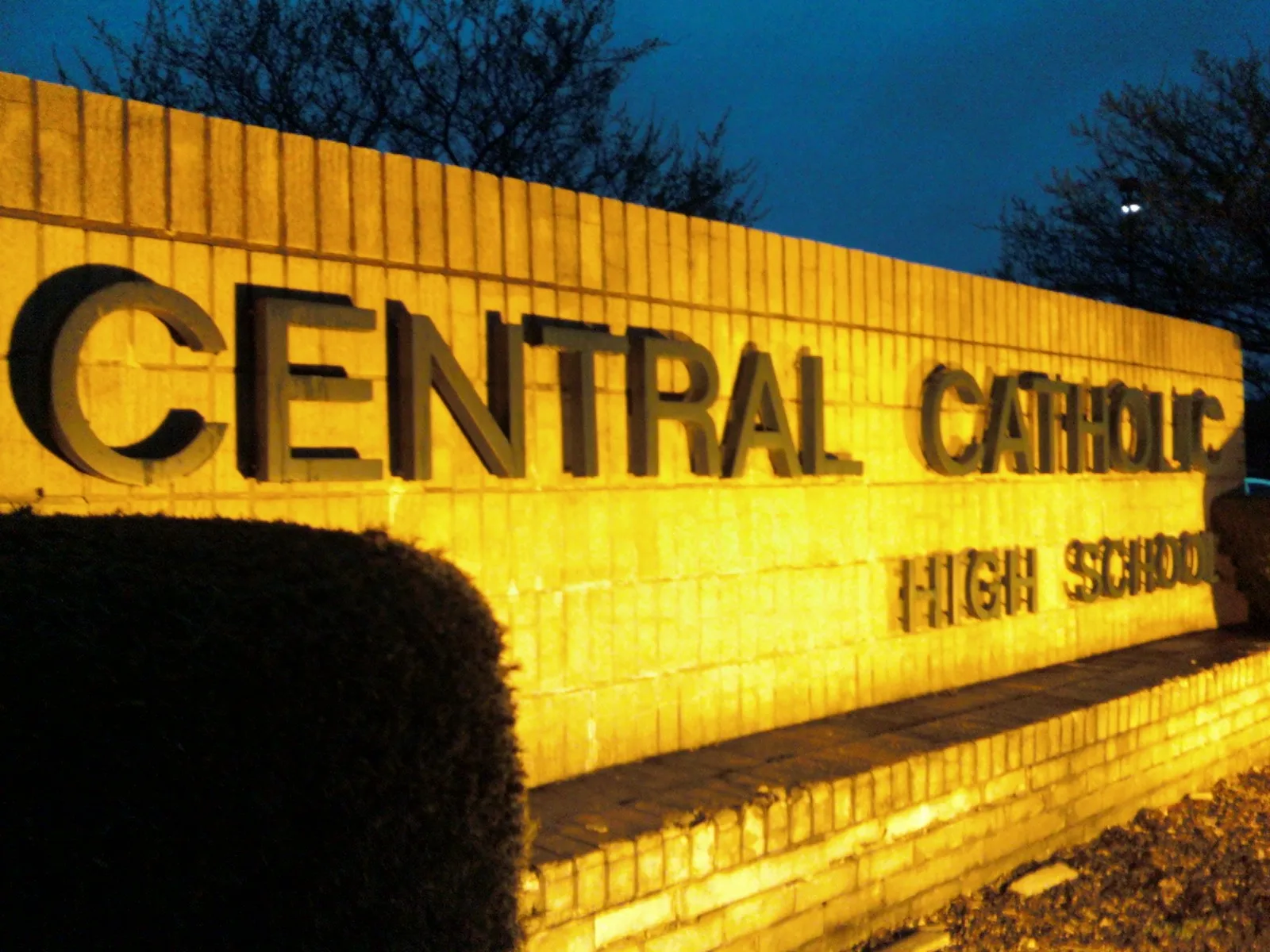
Central Catholic High School in Perry Township
Central Catholic High School in Stark County is a school building, Tuscarawas Street West 4824 (44708). Ⓦ.
- House Number
- 4824
- Street
- Tuscarawas Street West
- Website
- https://www.cchsweb.com/
- Postal Code
- 44708
- Building Type
- school building
Image
Convenience stores
Variety stores
Fast food restaurants
Places of worship
Supermarkets
Beauty salons
Bars
Schools
Gas stations
Thrift stores
Restaurants
- Ichiban - Hibachi Sushi & Boba (Chinese, Japanese, Asian, Sushi, takeout, delivery service, vegetarian options, non-smoking, brewery: various;japanese_beer;saki;sappiro;new_castle_brown_ale;miller_light;hot_and_cold_sake;sake, 50 seats, opening hours: Tue–Sun 11–20) at Tuscarawas Street West 5147 (44708) – approx. 0.6 mi.
Banks
Dentist offices
Streets nearby
Marsden Avenue Southwest500 ft
Woodlawn Avenue Southwest0.2 mi
Western Avenue Southwest0.2 mi
Central Catholic Road0.2 mi
Miles Avenue Southwest0.2 mi
13th Street Southwest0.2 mi
Barrie Street Northwest0.2 mi
Bordner Avenue Southwest0.3 mi
Yukon Street Northwest0.3 mi
Channonbrook Avenue Southwest0.3 mi
Bletzer Avenue Southwest0.3 mi
Ellwood Avenue Southwest0.3 mi
Saratoga Avenue Southwest0.3 mi
Dannemiller Avenue Southwest0.3 mi
Anna Avenue Northwest0.3 mi
Mount Marie Avenue Northwest0.3 mi
Tuscarawas Street WestSunbeam Tanning
0.3 mi
Bergold Avenue Southwest0.3 mi
Arbor Road Southwest0.4 mi
Manor Avenue Southwest0.4 mi
Victoria Avenue Northwest0.4 mi
Cayuga Avenue Northwest0.4 mi
Miles Avenue Northwest0.4 mi
Delaware Avenue Southwest0.4 mi
Brooklyn Avenue Southwest0.4 mi
12th Street SouthwestEdgewood Park
0.4 mi
Aurora Street NorthwestMount Marie Heights, Canton Donor Room, Don Tequila Bar & Grill, Great Clips, Red Wing, Walk In Urgent Care, Jimmy John's, GNC, Pulp Juice and Smoothie Bar, Dollar Tree, Pete's, Lots of Cares Dental Supply, T-Mobile, A Plus Crab, Accurate Medical Supply Inc, Citi Trends
0.4 mi
Perry Drive SouthwestPerry Fuel Mart, Speedway
0.4 mi
Perry Drive Northwest0.4 mi
Tioga Street Northwest0.5 mi
Saratoga Avenue Northwest0.5 mi
Fromm Avenue Northwest0.5 mi
Mohawk Avenue Northwest0.5 mi
Buildings nearby
Duncan Press0.4 mi
Elite Auto Body0.4 mi
Auto Insurance Mart Agency0.4 mi
Cafes nearby
MaryAnn Donuts0.4 mi
Car dealerships nearby
Kelly's Auto Sales0.5 mi
Fast food restaurants nearby
McDonald's0.2 mi
Wendy's0.3 mi
Gas stations nearby
Sheetz0.4 mi
Pet stores nearby
Pet Supplies Plus0.3 mi
Places of worship nearby
St. Joan of Arc Catholic Church0.2 mi
Central Baptist Church0.2 mi
Restaurants nearby
Denny's0.3 mi
Kraus' Pizza0.3 mi
Falcone's Tavern0.3 mi
Retail buildings nearby
Frank's TV Service0.4 mi
School buildings nearby
St. Joan of Arc School0.2 mi
| Year built | 1946 |
|---|---|
| Operator | Diocese of Youngstown |
| Located in | Ohio |
| Country | United States |
Public transit map Perry Township Legend
| Railway | |
| Bus | |
| Streetcar |
Bicycle map Perry Township Legend
| Bike path | |
| Bike lane on roadway | |
| Cycling allowed on bus lane | |
| Bicycle street | |
| Open to cyclists | |
| Open to cyclists, good path | |
| Cycling prohibited | |
| Cobblestone |
| Long-distance bike route | (depending on scale) | |
| Long-distance bike route |
Pedestrian map Perry Township Legend
| Path |
| Long-distance hiking trail | (depending on scale) | |
| Long-distance hiking trail | ||
| Pedestrians prohibited |