
Tibbals Street in Franklin, Ohio
Tibbals Street in Franklin is a residential street. It runs in a northeast-southwest direction starting from West 7th Street and crosses Tibbals Lane and ends at West 8th Street.
- Road Type
- residential street
- Route
- northeast-southwest
Image
Convenience stores
Variety stores
Schools
Pharmacies
Fast food restaurants
Courthouses
Tattoo studios
Weighbridges
Hospitals
Places of worship
Restaurants
Cafes
Post offices
Tobacco shops
Motels
Streets nearby
Tibbals Lane250 ft
West 8th Street450 ft
West 7th Street450 ft
South Main StreetCalypso Cafe
0.1 mi
West 6th Street0.2 mi
East 6th StreetDiamond Tiger Tattoo
0.2 mi
Howard Stamm Lane0.2 mi
West 5th Street0.2 mi
Oxford Road0.3 mi
Farm Avenue0.3 mi
Anderson Street0.3 mi
West 4th Street0.3 mi
East 7th Street0.3 mi
Hudson0.3 mi
South River StreetEighth Street Church of God
0.3 mi
East 4th StreetFranklin City Municipal Court
0.4 mi
South Avenue0.4 mi
East 5th StreetFranklin
0.4 mi
Union Road0.4 mi
East Street0.4 mi
Clark Street0.4 mi
Brown Street0.4 mi
Great Miami River Recreation Trail0.4 mi
Benjamin Franklin Way0.4 mi
Harrison Street0.4 mi
Gessner Lane0.4 mi
West 3rd Street0.4 mi
Roberts Avenue0.4 mi
Elm Street0.4 mi
Miami Avenue0.4 mi
Riley Boulevard0.4 mi
Shaker Road0.4 mi
East 3rd Street0.4 mi
Banks nearby
Huntington Bank0.4 mi
WesBanco0.4 mi
Buildings nearby
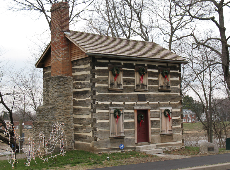
Old Log Post Office0.2 mi
Walter F. Stephens, Jr., Inc.0.4 mi
Community centers nearby
VFW Post0.3 mi
Industrial buildings nearby
Atlas Roofing Corporation0.3 mi
Miami Valley Paper LLC0.3 mi
Landfills nearby
Franklin Solid Waste Disposal Landfill (closed)0.5 mi
Libraries nearby
Franklin-Springboro Public Library0.4 mi
Music stores nearby
DoublePlay Records & Retro0.4 mi
Places of worship nearby
First Church of God of Franklin550 ft
First United Methodist Church of Franklin0.4 mi
Police stations nearby
Franklin Police Department0.4 mi
Railways nearby
Franklin Industrial Track0.2 mi
Restaurants nearby
Pisanello's Pizza0.4 mi
Town halls nearby
Franlin City Hall0.4 mi
Public transit map Franklin Legend
| Railway | |
| Bus | |
| Streetcar |
Bicycle map Franklin Legend
| Bike path | |
| Bike lane on roadway | |
| Cycling allowed on bus lane | |
| Bicycle street | |
| Open to cyclists | |
| Open to cyclists, good path | |
| Cycling prohibited | |
| Cobblestone |
| Long-distance bike route | (depending on scale) | |
| Long-distance bike route |
Pedestrian map Franklin Legend
| Path |
| Long-distance hiking trail | (depending on scale) | |
| Long-distance hiking trail | ||
| Pedestrians prohibited |