Cartogiraffe.com

Wood County, Ohio

Wood County Courthouse Jail
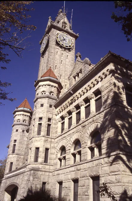
County Courthouse Photos: Wood County Courthouse (Built 1894-1896), Bowling Green, Ohio – Calvin Beale, Public domain – Wikimedia Commons
Wood County is located in Ohio. About 125,488 people live here. Between 2010 and 2020, the population grew from 125,488 to 132,248. The region is divided into 25 Municipalities. The region was founded in 1820. The name originates from Eleazer D. Wood (United States Army officer) The license plate code is 87. Wood County is county in Ohio, United States. More information at www.co.wood.oh.us.
Named after Eleazer D. Wood
Year built 1820
Area 620
Located in Ohio
Country United States
Population 132248
Native name Wood County

Map marker Wood County, Ohio

Public transit map Public transit map Wood County Legend
Railway
Bus
Tram
Bicycle map Bicycle map Wood County Legend
Bike path
Bike lane on roadway
Cycling allowed on bus lane
Bicycle street
Open to cyclists
Open to cyclists, good path
Cycling prohibited
Cobblestone
Long-distance bike route (depending on scale)
Long-distance bike route
Pedestrian map Pedestrian map Wood County Legend
Path
Long-distance hiking trail (depending on scale)
Long-distance hiking trail
Pedestrians prohibited
Wood County
Walbridge
Northwood
Bairdstown
Bloomdale
Bowling Green
Bradner
Custar
Cygnet
Grand Rapids
Haskins
Hoytville
Jerry City
Luckey
Millbury
Milton Center
North Baltimore
Pemberville
Perrysburg
Portage
Risingsun
Rossford
Tontogany
Wayne
West Millgrove
Weston