
Union Station in Oklahoma City
Union Station in Oklahoma City ist ein historisches Objekt. Union Station is also known as Oklahoma City Union Station. Union Station is located near Skydance Bridge. Union Station is built in the Spanish Colonial Revival architecture style. Ⓦ.
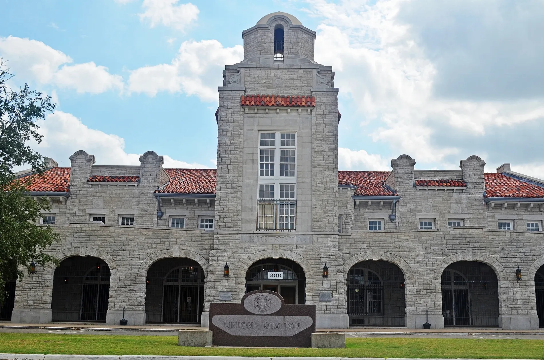
- Building Type
- public building
Streets nearby
Skydance Bridge350 ft
South Hudson AvenueMyriad Gardens, Prairie Birds, Grassland Specialists
450 ft
Southwest 6th StreetSchool Bus Stop for Mustang Public Schools
0.2 mi
Southwest 10th StreetLittle Flower Clinic (formerly school)
0.2 mi
Southwest 7th Street0.2 mi
South Walker AvenueDraper Park Christian Church, Pep Boys, Central Church, Trinity Church of the Nazarene, Capitol Hill Christian Church, South Walker Church of Christ, Harbor of Praise Church, S & B Burgers
0.2 mi
Southwest 11th StreetMay Avenue Church of the Nazarene
0.3 mi
Southwest 12th StreetSouthwestern College of Meat Cutters
0.3 mi
Mick Cornett DrivePark Grounds Coffee, Rare Bird
0.3 mi
South Robinson AvenueThe Cafe, Double Double, Bob’s Steak & Chop House
0.3 mi
The PromenadeLittle Free Library
0.3 mi
South Shields BoulevardShields Boulevard Baptist Church, Shields Church of the Nazarene, Glorieta Baptist Church
0.3 mi
Southeast 9th Street0.3 mi
Southwest 5th StreetMercy Convenient Care - Yukon
0.3 mi
Southwest 13th Street0.4 mi
South Broadway Avenue0.4 mi
South Edward King Gaylord BoulevardOklahoma City Amtrak/Santa Fe Hub, Oklahoma City
0.4 mi
Southwest 4th Street0.4 mi
Crosstown Expressway0.4 mi
South Harvey AvenueCapitol Hill Church of God
0.4 mi
Southeast 4th Street0.4 mi
Southwest 14th Street0.4 mi
South Santa Fe AvenueSpringfield Church of God, Grace Academy
0.4 mi
Songbird Plaza0.5 mi
Auto parts stores nearby
Pull-A-Part Auto Parts Yard0.3 mi
Auto repair shops nearby
Blementhals Service Center0.2 mi
Tenth Street Auto Repair Salvage Yard0.3 mi
A & A Auto Parts and Salvage0.3 mi
A & P Truck Salvage0.3 mi
Tire Town0.5 mi
Bars nearby
Social Capital0.2 mi
Buildings nearby
Sports Pavillion0.1 mi
Commercial areas nearby
Boulevard Place0.3 mi
Conference centers nearby
Oklahoma City Convention Center0.2 mi
Grasslands nearby
Love's Travel Stops Great Lawn0.2 mi
Hotels nearby
Fairfield Inn0.4 mi
Industrial areas nearby
Cusack Wholesale Meat0.3 mi
Ramos Chrome Plating Cruisers0.3 mi
Sooner Rambler Amc Jeep Salvage0.5 mi
Parks nearby
Scissortail Park0.1 mi
PFC Manuel Perez Jr Park0.4 mi
Railways nearby
SLWC Sooner Subdivision0.3 mi
Red Rock Subdivision0.5 mi
Residential areas nearby
Riverside0.2 mi
South Park0.4 mi
Restaurants nearby
Rio Bravo0.2 mi
Shelters nearby
American Fidelity Picnic Grove Trellis0.2 mi
Sports fields nearby
Thunder Community Court0.2 mi
Stages nearby
Love's Travel Stops Stage0.3 mi
| Year built | 1931 |
|---|---|
| Official opening | 1931 |
| Architectural style | Spanish Colonial Revival architecture |
| Owned by | Embark |
| Heritage designation | National Register of Historic Places listed place |
| Located in | Oklahoma City |
| Country | United States |
Public transit map Oklahoma City Legend
| Railway | |
| Bus | |
| Streetcar |
Bicycle map Oklahoma City Legend
| Bike path | |
| Bike lane on roadway | |
| Cycling allowed on bus lane | |
| Bicycle street | |
| Open to cyclists | |
| Open to cyclists, good path | |
| Cycling prohibited | |
| Cobblestone |
| Long-distance bike route | (depending on scale) | |
| Long-distance bike route |
Pedestrian map Oklahoma City Legend
| Path |
| Long-distance hiking trail | (depending on scale) | |
| Long-distance hiking trail | ||
| Pedestrians prohibited |