
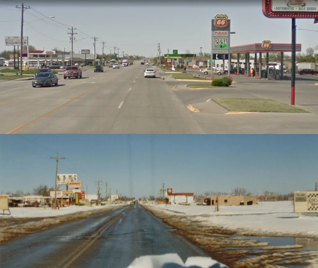
Northeast 9th Street in Newcastle, Oklahoma
Northeast 9th Street in Newcastle is a residential street. It runs in an east-west direction starting from North Main Street and crosses Northeast 9th Place. Northeast 9th Street also exists in Texas County, Cleveland County, Comanche County, Grady County and Haskell County.
- Road Type
- residential street
- Route
- east-west
Image
Restaurants
Dry cleaners
Pet grooming salons
Fast food restaurants
Weighbridges
Cafes
Music schools
Marketplaces
Jewelry stores
Beauty salons
Hair salons
Fabric stores
Antique stores
Self storages
Cannabis dispensaries
Streets nearby
Northeast 9th Place250 ft
Northeast 10th Street0.1 mi
Naomi LaneEmbroidery Etc., Outside the Music Box
0.1 mi
Buckingham Drive0.1 mi
North Main StreetRacer Pit Stop Pizzeria, Kim's Donut, Impact Nutrition, Newcastle Donuts & Bakery, CBD Plus, Newcastle Nails & Spa, Dirty Dogs Grooming, Shear Funk Salon, Ferguson's Jewelry, Dave's Diner, Scott Cleaners, Color Bar Salon, Newcastle Marketplace, Artifacts, Main Street Sweets & Eats, Bryan's Barber Shop
0.2 mi
Wilshire Drive0.2 mi
North Carr Drive0.2 mi
Linda LaneSmoothie Lounge
0.2 mi
Greyhound Lane0.2 mi
Stan Patty Boulevard0.3 mi
Northeast 4th Street0.4 mi
Wright Street0.4 mi
Northeast 4th0.5 mi
Shops nearby
Pioneer Telephone Cooperative0.1 mi
Auto repair shops nearby
Baker's Auto0.1 mi
Banks nearby
Sooner State Bank0.4 mi
Cafes nearby
Salty Frog Snowcones0.5 mi
Car dealerships nearby
Central Oklahoma Auto Remarketing0.2 mi
Car washes nearby
Newcastle Car Wash0.1 mi
Commercial buildings nearby
Newcastle Chamber of Commerce400 ft
AAA Insurance0.4 mi
Harryman Insurance Inc0.5 mi
Convenience stores nearby
RB66 Super Store0.2 mi
Thundermart0.2 mi
Fast food restaurants nearby
Sonic400 ft
Taco Mayo500 ft
Fitness centers nearby
The Body Shop200 ft
Gas stations nearby
Handy's Convenience Store0.2 mi
Phillips 660.2 mi
Hair salons nearby
Tom's Barber Shop0.2 mi
Liquor stores nearby
Island Time Liquor0.2 mi
Parks nearby
Puckett Park0.2 mi
Leesa Cornett Park0.2 mi
Places of worship nearby
The Church at Newcastle0.5 mi
Police stations nearby
Newcastle Police Station0.2 mi
Post offices nearby
Newcastle Post Office0.4 mi
Residential areas nearby
Chickasaw Trails300 ft
Westpointe350 ft
Stonebrooke Apartments500 ft
Tri City Mobile Home Park0.1 mi
Gables Gardens Apartments0.2 mi
Prairieview Apartments0.2 mi
Retail buildings nearby
Moonlight Tinting450 ft
Tactical Pest Solutions500 ft
Flying Java Coffee0.1 mi
Queen of the Tees0.5 mi
School buildings nearby
Newcastle Early Childhood Center0.4 mi
Shelters nearby
Newcastle Storm Shelter0.2 mi
Streams nearby
Marcy Creek0.2 mi
 Public transit map Newcastle Legend
| Railway | |
| Bus | |
| Streetcar |
 Bicycle map Newcastle Legend
| Bike path | |
| Bike lane on roadway | |
| Cycling allowed on bus lane | |
| Bicycle street | |
| Open to cyclists | |
| Open to cyclists, good path | |
| Cycling prohibited | |
| Cobblestone |
| Long-distance bike route | (depending on scale) | |
| Long-distance bike route |
 Pedestrian map Newcastle Legend
| Path |
| Long-distance hiking trail | (depending on scale) | |
| Long-distance hiking trail | ||
| Pedestrians prohibited |