
Southeast Howe Street in Ardenwald, Oregon
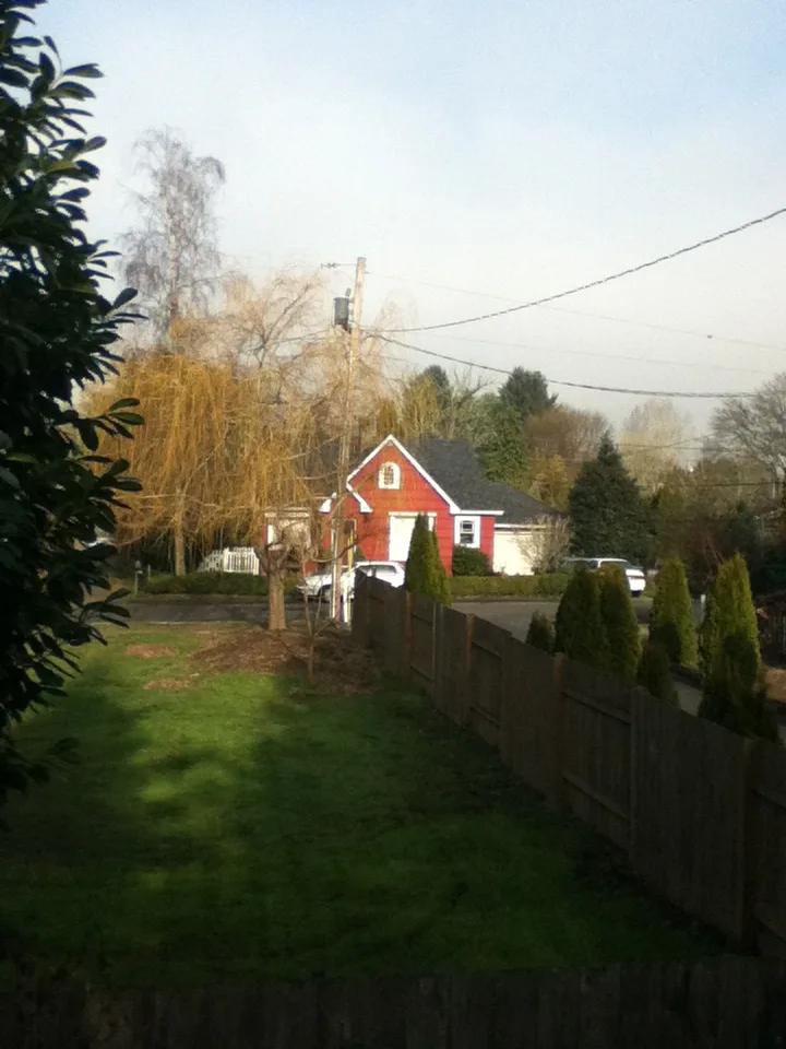
Southeast Howe Street in Ardenwald in Milwaukie is an asphalted residential street. No sidewalks. It runs in a East direction starting from Southeast 40th Avenue and crosses Southeast 42nd Avenue, Southeast 43rd Avenue and Southeast 44th Avenue and continues as Southeast 46th Avenue. It connects Milwaukie and Ardenwald.
- Road Type
- residential street
- Bicycle
- yes
- Route
- east-west
Image
Convenience stores
Restaurants
Bus stops
Clinics
Social facilities
Doctor's offices
Fast food restaurants
Streets nearby
Southeast 43rd Court0.1 mi
Southeast Hazel Street0.1 mi
Southeast 38th Avenue0.1 mi
Southeast 37th Avenue0.2 mi
Southeast Covell Street0.2 mi
Southeast 43rd Avenue0.2 mi
Southeast Melody Lane0.2 mi
Southeast Cottage Lane0.2 mi
Southeast 44th Court0.2 mi
Southeast Drake Street0.2 mi
Southeast 42nd AvenueSoutheast 42nd & Llewellyn
0.2 mi
Southeast Filbert Street0.2 mi
Southeast Rhodesa Street0.3 mi
Southeast Olsen StreetSoutheast 32nd & Olsen, Eric's Market, Milwaukie Cafe and Bottle Shop
0.3 mi
Southeast 41st Court0.3 mi
Southeast Wake Court0.3 mi
Southeast Sherry Lane0.3 mi
Southeast 41st Avenue0.3 mi
Southeast 34th Court0.3 mi
Southeast Rockwood Street0.3 mi
Southeast 36th Avenue0.3 mi
Southeast King RoadSoutheast King & Hollywood, Southeast King & Stanley, Southeast King & 52nd, Southeast King & Home, Southeast King & 47th, Great American Video & Espresso
0.3 mi
Southeast 40th Avenue0.3 mi
Southeast 33rd Avenue0.4 mi
Southeast Wake Street0.4 mi
Southeast Llewellyn Street0.4 mi
Southeast Harvey Street0.4 mi
Southeast Dwyer Drive0.4 mi
Southeast 34th Avenue0.5 mi
Southeast Balfour Street0.5 mi
Southeast 32nd AvenueArdenwald, Southeast 32nd & Van Water, Southeast 32nd & Furat Court, Southeast 32nd & Floss, Southeast 32nd & Malcolm, Southeast 32nd & Olsen, Southeast 32nd & Johnson Creek, Southeast 32nd & Meek, Southeast 32nd & Harvey, Southeast 32nd & Hillside, Esther's Pantry, Tod's Corner, NAMI Clackamas, Northwest ENT and Allergy, 10100 Block Southeast 32nd, Magnolia Thai Restaurant
0.5 mi
Southeast Harrison StreetClackamas Fire District #1, Southeast Harrison & 31st, Kimmy Market & Smoke Shop, Southeast Harrison & 32nd, Domino's, The Office - Coffeehouse & Taproom, Maxem Urgent Care
0.6 mi
Arts centers nearby
Chapel Theatre Annex0.4 mi
Buildings nearby
Edward Jones0.4 mi
Portland Homes and Commercial Properties0.4 mi
Clinics nearby
Healing Place0.5 mi
Convenience stores nearby
7-Eleven0.4 mi
Eric's Market0.4 mi
Doctor's offices nearby
Cedar Chiropractic Physicians0.4 mi
Fitness centers nearby
Snap Fitness0.4 mi
Parks nearby
Water Tower Park300 ft
Balfour Park0.5 mi
Places of worship nearby
World Mission Society Church of God0.4 mi
Post offices nearby
Mail House Plus0.4 mi
Residential areas nearby
Shortstack Milwaukie0.2 mi
Hillside Park0.4 mi
Restaurants nearby
King Curry0.4 mi
Retail areas nearby
King Road Shopping Center0.4 mi
Theaters nearby
Chapel Theatre0.4 mi
Public transit map Ardenwald Legend
| Railway | |
| Bus | |
| Streetcar |
Bicycle map Ardenwald Legend
| Bike path | |
| Bike lane on roadway | |
| Cycling allowed on bus lane | |
| Bicycle street | |
| Open to cyclists | |
| Open to cyclists, good path | |
| Cycling prohibited | |
| Cobblestone |
| Long-distance bike route | (depending on scale) | |
| Long-distance bike route |
Pedestrian map Ardenwald Legend
| Path |
| Long-distance hiking trail | (depending on scale) | |
| Long-distance hiking trail | ||
| Pedestrians prohibited |