
Werneberg Way in Central Lawrenceville, Pittsburgh, Pennsylvania
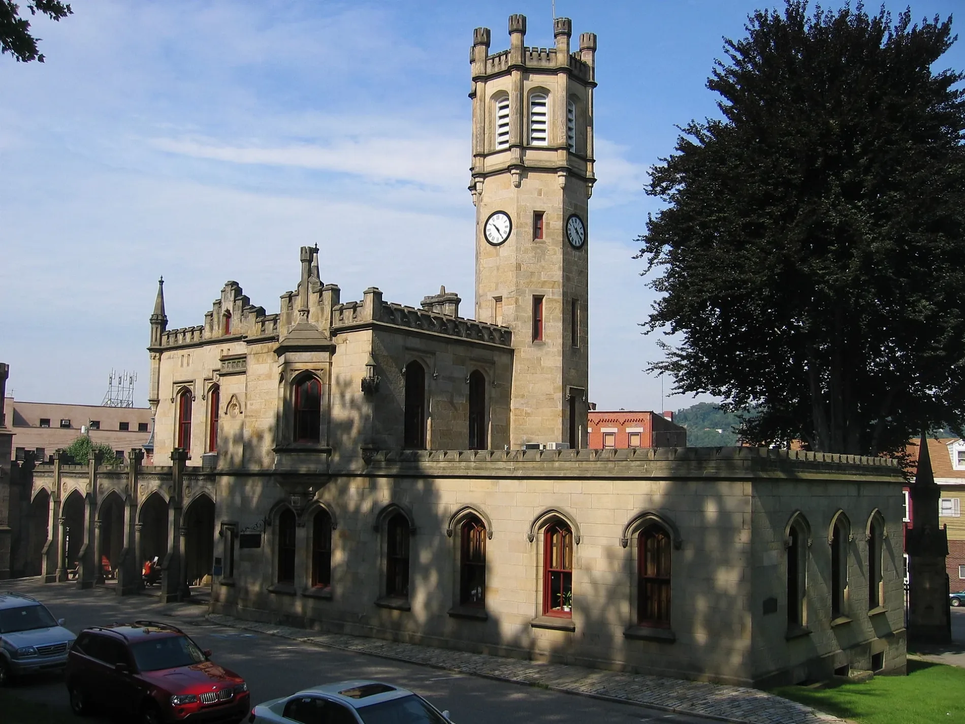
Werneberg Way in Central Lawrenceville in Pittsburgh is a service road. It runs in a southeast-northwest direction and crosses Lawrence Street and ends at Davison Street, while the other end is a cul-de-sac.
- Road Type
- service road
- Route
- southeast-northwest
Image
Funeral homes
Bars
Beauty salons
Places of worship
Restaurants
Bakeries
Furniture stores
Clothing stores
Bus stops
Hair salons
Tattoo studios
Convenience stores
Streets nearby
Lawrence Street50 ft
46th StreetD'Alessandro Funeral Home & Crematory Ltd., No. 14
150 ft
Cessna Way350 ft
Summit Street500 ft
Service Way500 ft
Carlton Street0.1 mi
43rd StreetCondado Tacos, UPMC Greater Pittsburgh Medical Associates, Mr Friez, Cork Harbour Pub
0.1 mi
Percy Way0.1 mi
Bancroft Street0.2 mi
Arsenal Way0.2 mi
Bessemer Street0.2 mi
Urbana Way0.2 mi
Hugo Way0.2 mi
Davison Street0.2 mi
Bruce Street0.2 mi
Sherrod Avenue0.3 mi
Dunkeld Way0.3 mi
42nd StreetPOGOH - 42nd Street & Butler Street, Lawrenceville's Smile Center, FRIO Creamery
0.3 mi
Garwood Way0.3 mi
Government Way0.3 mi
Rosecrans Way0.3 mi
Remus Way0.3 mi
Arsenal Place0.3 mi
Post Street0.3 mi
Geneva Street0.4 mi
Post Way0.4 mi
Keller Street0.4 mi
Siebert Street0.4 mi
Calvin Street0.4 mi
Garden Way0.4 mi
Penn AvenueLos Cabos Mexican Restaurant, Graziano's Pizzeria, Penn Ave at Main St, Juliette A Murcko, DMD, Fazio's Pizza, Penn Ave at 40th St, Penn Ave at 45th St, Penn Ave at Pearl St, Penn Ave Opp Pearl St, Penn Ave at Mathilda St, Tram's Kitchen, Constellation Coffee, Sunoco, Gypsy Tattoo Parlor, Moonlite Express, Hairsmith, M K Motor Mart, Songbird Artistry, Penn Ave opp 44th St (Childrens Hospital), Penn Ave at 44th St (Childrens Hospital), Penn Ave at Friendship Ave
0.4 mi
Children's Hospital Drive0.5 mi
Main Street4121 Main, Twisters Ice Cream, B & M Automotive Services, Nice Bikes Motorcycle Company, Bodega Film Lab, COBRA, Main St at Howley St FS, Main St at Penn Ave NS
0.5 mi
Woolslayer WayDaVita Pittsburgh Dialysis, Tina's
0.5 mi
Buildings nearby
Aaron French mausoleum0.3 mi
Cafes nearby
Caffé Mona La Bistro0.5 mi
Community centers nearby
Stephen Foster Community Center0.3 mi
Construction sites nearby
CHP00 Heart Institute0.4 mi
Dance floors nearby
Brillobox0.4 mi
Funeral homes nearby
Zalewski Funeral Home500 ft
Hospitals nearby
Chilren's Hospital of Pittsburgh Administrative Office Building0.4 mi
UPMC Children's Hospital of Pittsburgh0.4 mi
Libraries nearby
Carnegie Library of Pittsburgh - Lawrenceville0.3 mi
Liquor stores nearby
Penn Beer0.4 mi
Parks nearby
Leslie Recreation Center400 ft
Places of worship nearby
Holy Family Church500 ft
Playgrounds nearby
Leslie Playground400 ft
Restaurants nearby
Taste of India0.5 mi
Other nearby
Children's Hospital of Pittsburgh Heliport0.5 mi
Public transit map Central Lawrenceville Legend
| Railway | |
| Bus | |
| Streetcar |
Bicycle map Central Lawrenceville Legend
| Bike path | |
| Bike lane on roadway | |
| Cycling allowed on bus lane | |
| Bicycle street | |
| Open to cyclists | |
| Open to cyclists, good path | |
| Cycling prohibited | |
| Cobblestone |
| Long-distance bike route | (depending on scale) | |
| Long-distance bike route |
Pedestrian map Central Lawrenceville Legend
| Path |
| Long-distance hiking trail | (depending on scale) | |
| Long-distance hiking trail | ||
| Pedestrians prohibited |